Elevation: 5,904 ft
Prominence: 1,124
Climbing and access information for this peak is on Pages 144-145 of the book. Access issues have closed two routes listed in the book (Rocky Canyon and Table Rock). Recent maps show the elevation at 5,904 feet, a slight difference from the book. Livingston Douglas added two photos showing the peak from additional perspectives. Updated November 2023
Shaw Mountain, also known as Lucky Peak, is found in the Boise Mountains within the Boise National Forest. The peak provides the northern backdrop for East Boise, Idaho. It is the southernmost peak of the Boise Mountains. Shaw Mountain has two summits. The East Summit is the official Lucky Peak summit. The [lower] West Summit is 5,835 feet. The saddle between the two summits is about 240 feet below the Lucky Peak summit.
Idaho Fish and Game manages the surrounding land. Wildlife management is the number one priority in this area. Consequently, the area may be closed at times to protect wildlife. Lucky Peak is a great Spring climb with expansive views of the Treasure Valley and the City of Boise. The peak is one of the 4 peaks dubbed the Grand Slam Peaks. The other 3 peaks are Mount Heinen, Cervidae Peak and Kepros Mountain. USGS Lucky Peak
Shaw Mountain
While you are on the summit of Lucky Peak, consider hiking over to Aldape Peak. The entire Lucky Peak Ridge from the Aldape summit to ID-21 offers great opportunities for hiking and steep mountain biking on the many dirt roads in the area. Two roads with public access lead to the summit of Lucky Peak and are the best routes to use. The routes are discussed below.
Recent Developments
- The Table Rock Route: The road from Table Rock crosses private property and is no longer accessible to the public. This is a shame because it is the most scenic of the approaches.
- In 2019, Idaho Fish and Game built an archery range 2 miles from ID-21 on the Highland Valley/Shaw Mountain Road. There is a large parking area and signage. The range does not block the road.
- Boise State University (BSU) Bird Observation Facility: I visited the peak on September 25, 2014, and discovered that BSU has set up a camp on the north side of the summit for studying and viewing raptors. As I was hiking, it seemed that the road from ID-21 was receiving a lot of traffic. Well, when I arrived at the point just east of the summit, where there is a pit toilet and a gate, I found 6 vehicles parked there. Shortly after, I arrived at the camp and saw a dozen or more tents set up.
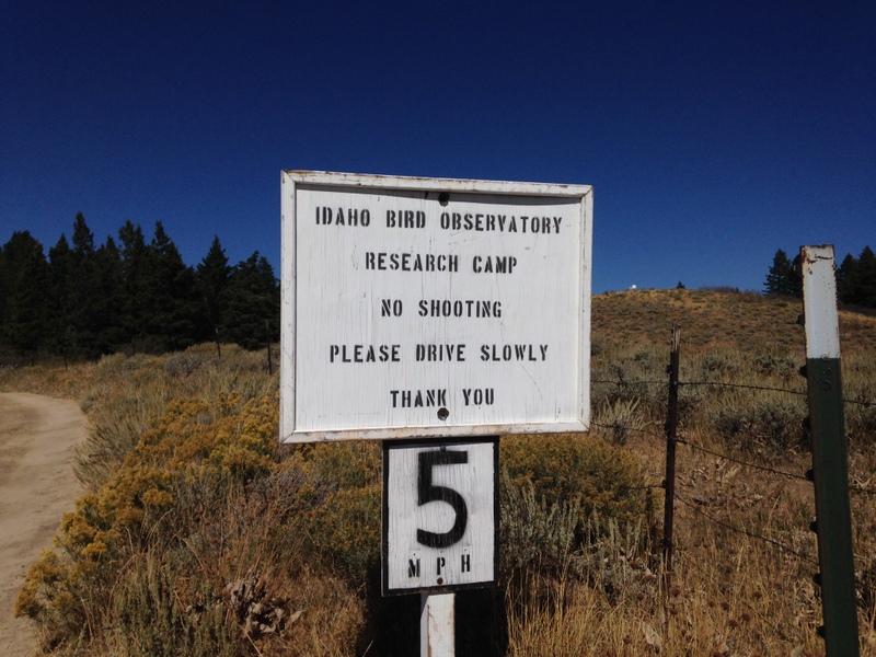
This sign identifies the current use of the summit area.
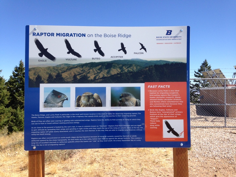
This sign explains why the BSU camp is present. There were bird watchers all around the summit. Several trails have been cut through the brush that lead to the viewing areas.
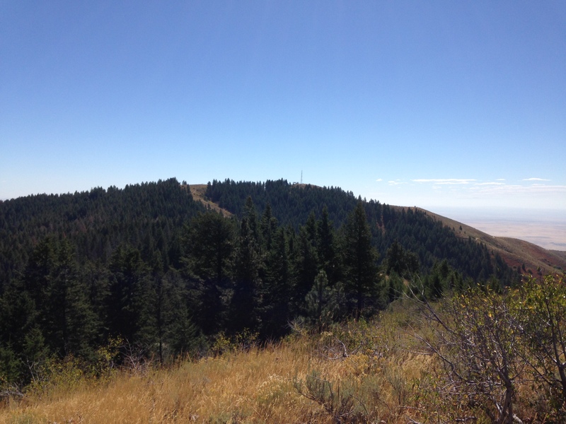
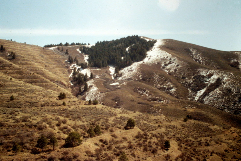
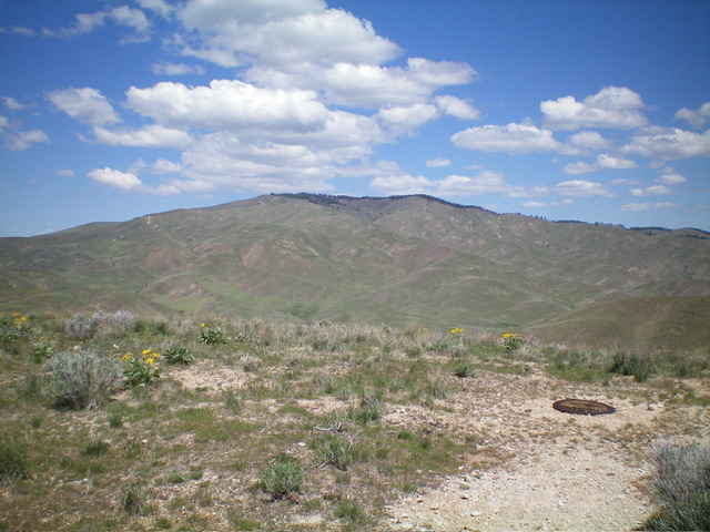
Lucky Peak as viewed from its lower summit.
Routes
Golden Dawn/Northwest Ridge Route, Class 1
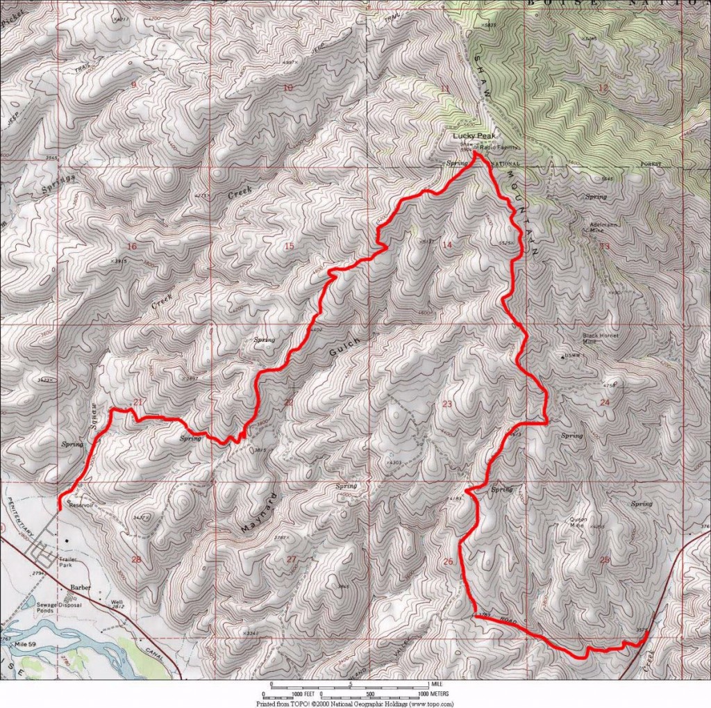
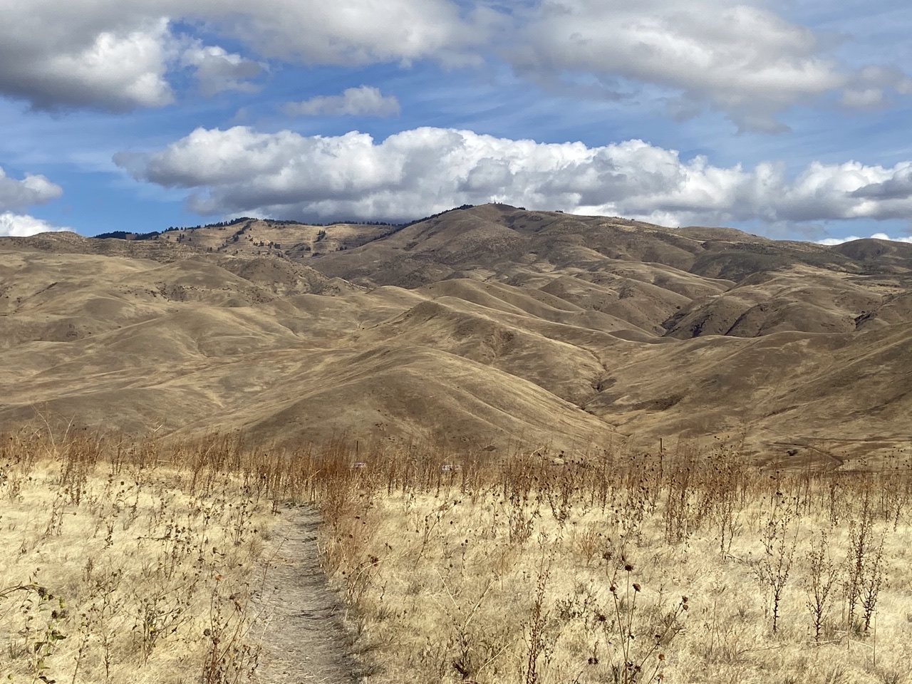
This route begins in East Boise at the end of end of South Council Springs Road (formerly Squaw Creek Road). Access this road from East Park Center Boulevard (formerly Warm Springs Avenue). I named this route “Golden Dawn,” because it begins next to the Golden Dawn Trailer Park. This is the longest route to the summit (10 miles round-trip). The route gains roughly 2,900 feet of elevation from start to finish. The lower part of the route is very busy on sunny Spring weekends. See the route orientation map below.
Park at the end of South Council Springs Road and pass through a gate in the drainage. The road will soon climb a hill, turn right, and then move into the next drainage. The road switchbacks up this drainage and arrives at a junction. Continue uphill to the right. The road is easy to follow from this point. At 5,400 feet, you have following 2 options:
- Stay on the road to the ridge top and then follow the road east along the ridge to the summit. This is the longest option.
- Leave the road and climb directly up the ridge to the summit. This option makes your ascent Class 2 but presents no real obstacles, as the sagebrush slope is easy to navigate.
Highland Valley/Shaw Mountain Road Route, Class 1
This route is accessed from ID-21, approximately 2.4 miles north of Lucky Peak Dam. Keep your eyes peeled for the turnoff on the West Side of the highway, which is signed as the Highland Valley Road. There is room for 5 vehicles to park at the intersection. Fish and Game closes this road to vehicles annually during the Winter. Most years, it reopens April 15th (something to look forward to other than taxes). Pay attention to signs on the gate, as the road may also be closed at times to hikers and mountain bikers. Farther up the road, you will reach a cattle guard and a second parking area. See the route orientation map below.
The Highland Valley/Shaw Mountain Road Route covers roughly 10.0 miles round-trip with 2,300 feet of elevation gain if you start from the highway. When the gate is open, the road is often passable (when dry) for cars over its first 2 miles. If you drive the first 2 miles, you will have an 8.0-mile round-trip adventure with 2,100 feet of elevation gain. The route runs east from the cattle guard to a junction. Go right and follow the road to a second junction. Once again, take the option to your right. The road now starts climbing seriously. You will pass a few other junctions along the way. Stay on the well-worn road. Eventually, the road reaches the summit ridge and passes through a gate. The summit is the high point to the east. The road circles the north side of the peak to one last junction. Go left and the road will take you directly to the summit.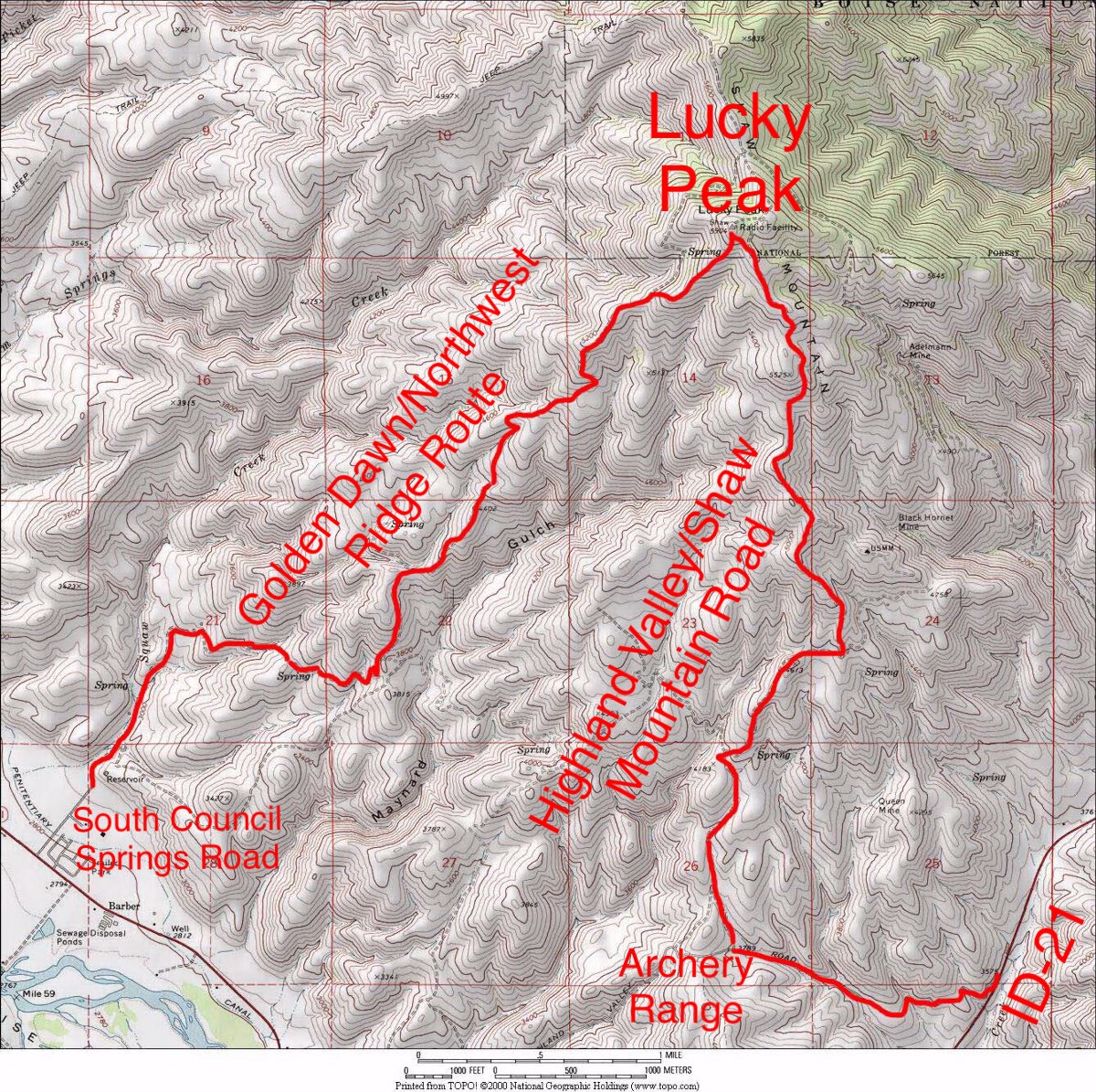
Shaw Mountain viewed from the Table Rock Homers Nipple saddle.
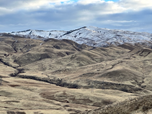
Lucky Peak (the antenna-clad hump in center) as viewed from the north. Livingston Douglas Photo
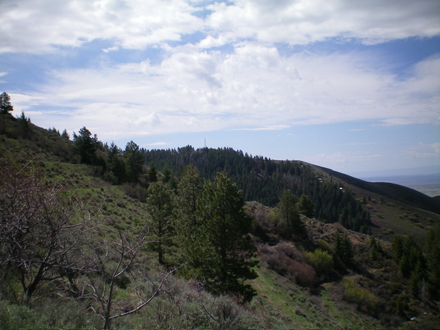
Lucky Peak as viewed from Kodiak Peak to its south. Livingston Douglas Photo
Shaw Mountain viewed from Warm Springs Peak (aka Homers Nipple).
Additional Resources
Regions: Boise Mountains->WESTERN IDAHO
Mountain Range: Boise Mountains
Year Climbed: 1990, 1994, 1995, 1996, 1997, 2000, 2001, 2002, 2004, 2005, 2006, 2007, 2008, 2009, 2010, 2011, 2012, 2013