Elevation: 5,122 ft
Prominence: 382
This peak is not in the book.
One of the shortest of the 47 Idaho peaks with a name containing the word “bald,” this Bald Mountain is much more impressive than it’s 5,122-foot elevation would suggest. The peak rises up quickly from Payette River Canyon to its high point, which offers a stunning view of the surrounding countryside. USGS Garden Valley
During the Summer, you can follow a Forest Service Road to the North Side of the peak and reach the summit with approximately 500 feet of elevation gain, depending upon where you park. The more challenging way to scale the peak is to start at the trailhead directly across from the Garden Valley Ranger Station.
The trailhead and the Station Creek Trail does not show up on the Boise National Forest map. I have only climbed the peak in Winter and cannot comment on the condition of the trails in this area. However, where the snow was thin on the ridge, I spotted a good trail in several places. Tom Cox’s trip report cover his September 2015 ascent and is linked below. I learned about the peak and the ascent line from a trip report prepared by Dave Pahlas. Check out Dave’s trip report.
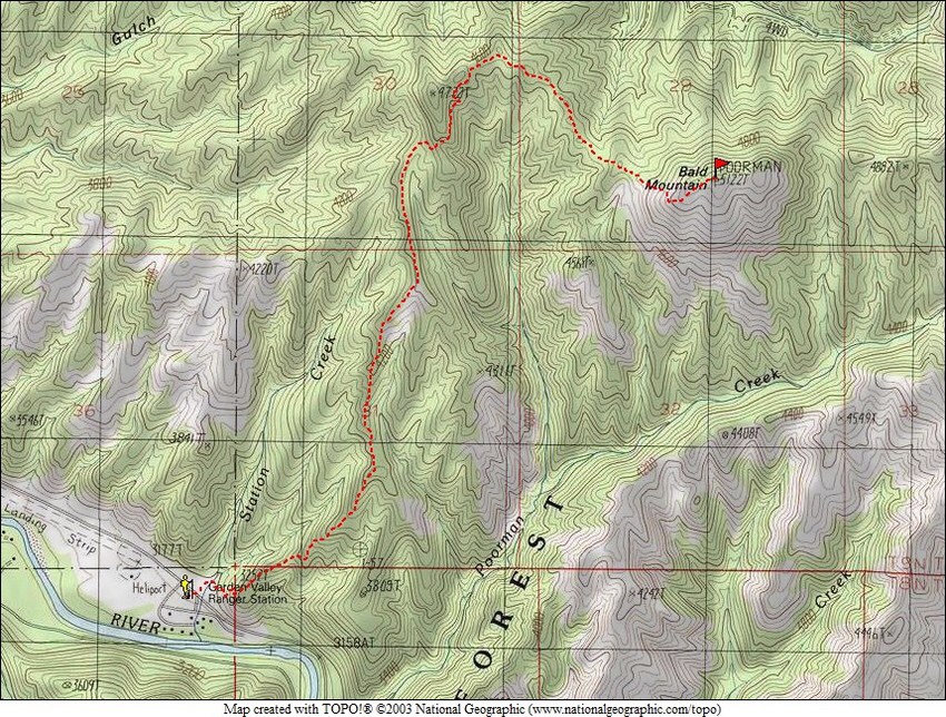
Dave Pahlas’ route to the summit of Bald Mountain.
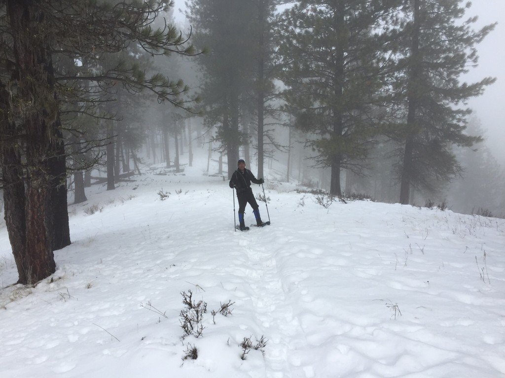
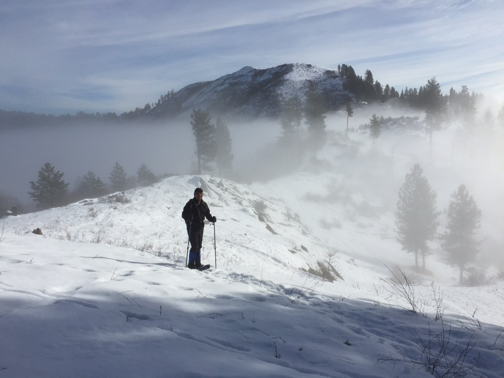
Gilbert Gallegos working up Bald Mountain’s South Ridge on a foggy day. The ridge climbs steeply out of the canyon bottom for the first 900 vertical feet and then stair-steps up after that.
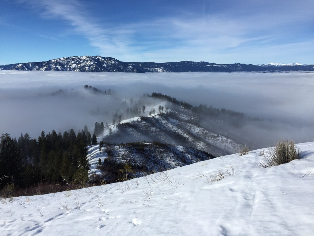
The route skirts around Point 4722 and then reaches this broad saddle. From this point, the route turns due east and works its way up and down toward the summit. Gilbert Gallegos Photo
The summit is about 0.6 miles away.
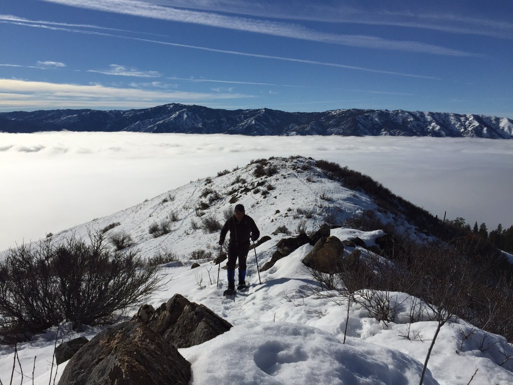
The slope leading to peak’s [lower] West Summit. Gilbert Gallegos Photo
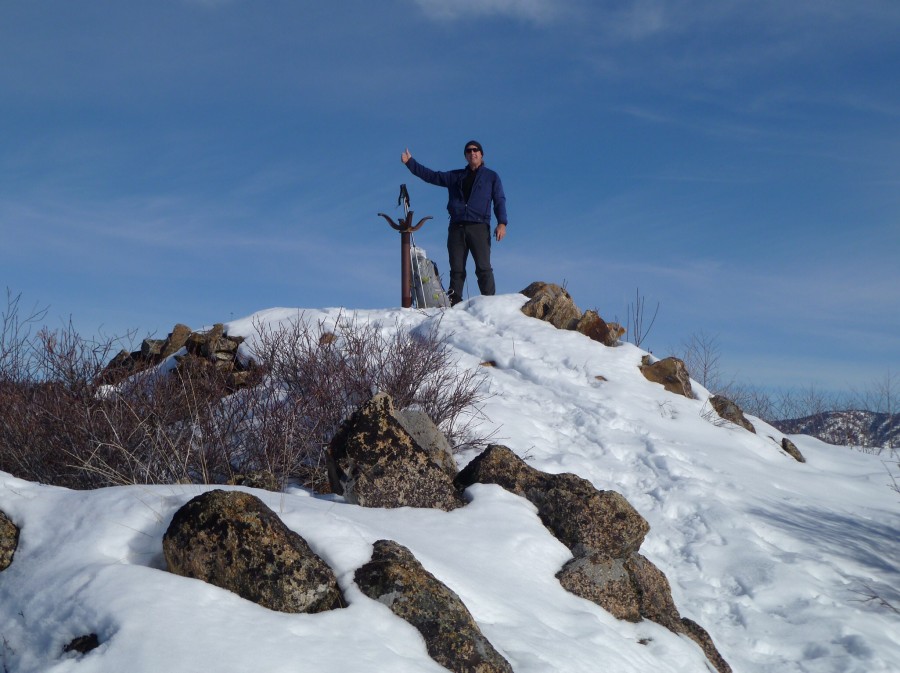
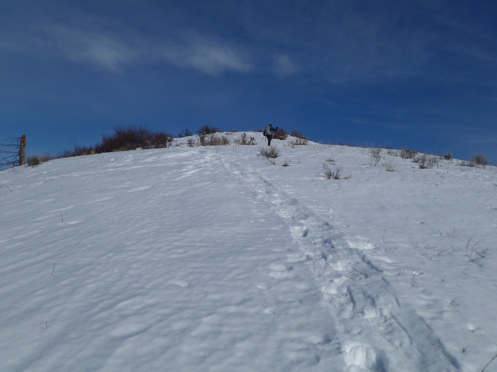
Gilbert Gallegos on the last few feet to the top.
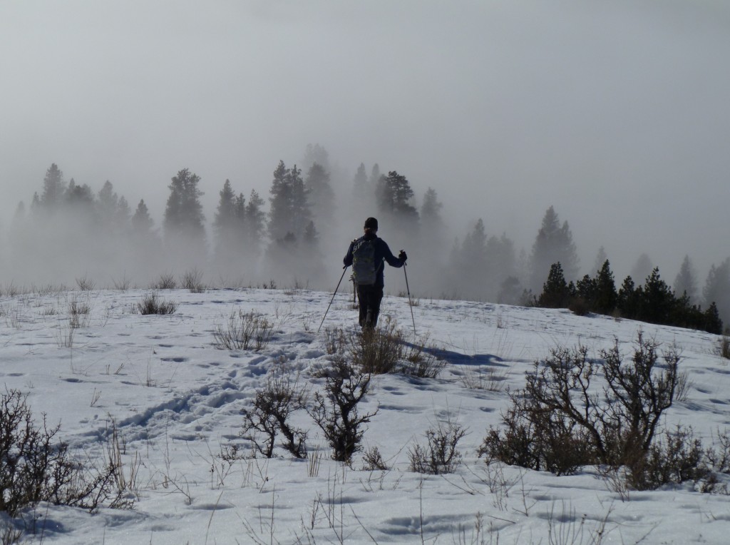
Looking down the West Ridge. The last half-mile is a bit of a roller-coaster ride on snowshoes.
The trip to the top and back was 7.6 miles with total elevation gain of 2,631 feet, which included 2 short detours.
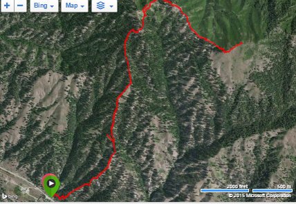
Bald Mountain GPS Track.
Additional Resources
Mountain Range: Western Salmon River Mountains
Year Climbed: 2015
Longitude: -115.88919 Latitude: 44.08149