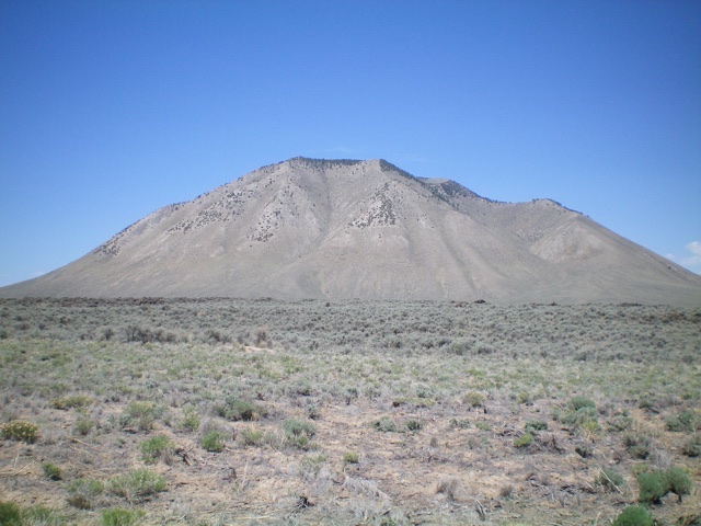
Idaho’s Snake River Plain offers many amazing opportunities for mountain climbers to explore the high desert. While technically not a desert, the Snake River Plain sure feels that way. Over the past six years, I have climbed 124 geographical “features” on the Snake River Plain, probably more than any other climber. Sheldon Bluestein has done extensive exploration of the Snake River Plain and wrote a book about it a few decades ago (“Exploring Idaho’s High Desert,” 2nd edition, 1991). The IACG website provides information for 142 Snake River Plain features, collectively referred to as “buttes.” But are these features all buttes and are they worthy of climbing? Let’s investigate.
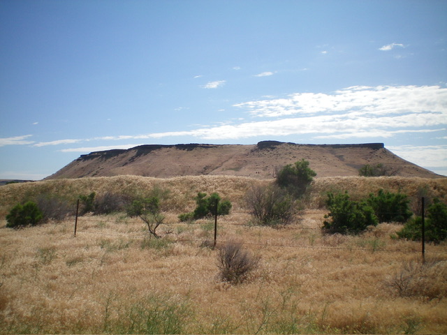
Flatiron Butte (2,839 feet) has the classic SRP butte look when viewed from the west: flat on top with steep sides. Livingston Douglas Photo
The geographical features on the Snake River Plain include mostly named buttes but also include mountains (e.g., Sand Mountain), hills (e.g., Ditto Hill), knolls (e.g., Ninemile Knoll), points (e.g., Initial Point), tables (e.g., Little Blue Table), mesas (e.g., Flint Mesa), cones (e.g., Inferno Cone), ridges (e.g., Sunset Ridge), dunes (e.g., Saint Anthony Sand Dunes), and craters (e.g., North Crater). My exploration of the Snake River Plain began, appropriately, in Craters of the Moon National Monument in May 2019 with Grassy Cone (6,315 feet). Ironically, most of the geographic features in Craters of the Moon are buttes/cones rather than craters. But when do any of the aforementioned features on the Snake River Plain qualify as “peaks” according to LOJ, the respected authority on such matters?
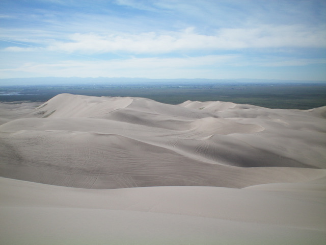
Summit view from the top of Sand Mountain. This mountain is a sea of sandy ridges, dunes, and gullies. Livingston Douglas Photo
Depressions like sand dunes and craters don’t qualify as “peaks,” do they? Well, yes and no. Sand dunes do not. However, the high points in the Saint Anthony Sand Dunes DO qualify (South Junipers HP and North Junipers HP). What about craters? Here is where things get confusing. A crater is a depression in the ground. How could it possibly be considered a “peak”? The post-eruption top of Mount Saint Helens is a massive crater with the high point on its south rim. The summit of Mount Rainier is on the rim of the summit crater. But since these two features are called “mountains,” the issue of crater rims never arises. The same holds true for the Snake River Plain.
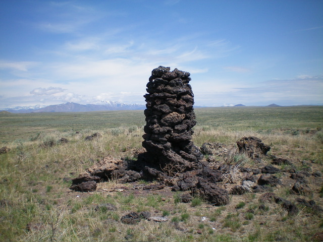
The 7-foot summit cairn atop Potter Butte (5,032 feet). Sometimes you find amazing cairns atop relatively obscure SRP buttes. Livingston Douglas Photo
If a feature is called a butte/knoll/cone (anything BUT a crater), it is included in LOJ’s peak lists even if it is actually the high point on a crater rim. However, if the feature is called a crater, it may or may not be included on LOJ’s extensive lists of peaks. Who determines the map label for a particular geographic feature? The United States Geological Survey (USGS). Okay, that makes sense. But when is a crater a “peak”? When its measured height is based on the high point on the crater rim instead of the bottom of the crater. Most craters are measured based on the low point in the center of the crater and are, consequently, not considered to be “peaks.”
LOJ is inconsistent about its application of crater rims as peaks. For example, North Crater (6,244 feet) is included in LOJ’s peak lists. However, Big Craters (6,295 feet) and Echo Crater (5,847 feet), which are just south of North Crater, are not included in any peak lists. Both of these features are measured by the high point on their crater rims. Both of these peaks are in Craters of the Moon National Monument. The reality is this. Many of the features on the Snake River Plain are rocky outcrops of some sort. Most are called buttes. Some look like the classic butte but many do not. Some are on the edge of crater rims but some are not.
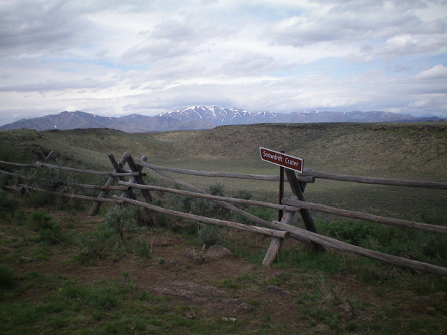
Snowdrift Crater (5,625 feet) as viewed from the southwest corner of the crater rim. Its high point is on the southwest rim so it counts as a “peak” according to LOJ. Livingston Douglas Photo
Don’t get hung up on definitions. Just enjoy exploring the Snake River Plain. Wear your snake gaiters and long pants. Avoid exploring the SRP in mid-Summer when it gets quite hot. Be prepared for some exciting vistas but also for some pretty boring humps/bumps. As a peak climber, you will discover more craters on the SRP than you would expect. A surprising number of the high points of the peaks on the SRP have impressive rock cairns. Most of the SRP peaks are unranked summits with less than 300 feet of prominence. Consequently, the uphill required is often minimal. The SRP offers a break from the steep, forest-and-rock of Idaho’s traditional mountains. The weather is typically warmer and drier than the higher mountains offer. The snow-free season on the SRP is lengthy. Driving the desert roads to get close to the geographic features on the SRP may be your greatest challenge.
