Elevation: 10,735 ft
Prominence: 1,275
Climbing and access information for this peak is on Pages 299-300 of the book. Updated September 2020
Buffalo Skull Peak named after lake at its base is steep sided summit guarded by steep talus and ragged cliffs. Rick Baugher climbed this peak in 1996 via the west ridge and found no evidence of previous ascent. From Buffalo Skull Peak he downclimbed the Class 3 Northwest Ridge and continued on to Mogg Mountain. Rick reports: “Regrettably, the angular talus everywhere below the ridge made for crummy hiking. Built Cairn, left register.” USGS Mogg Mountain
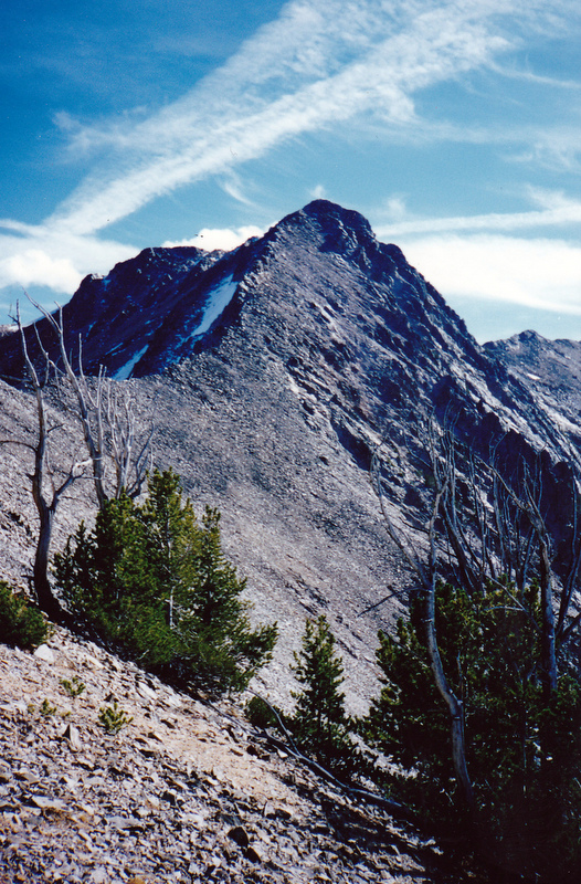
This view is looking down the Lemhi Range Crest from Mogg Mountain to Buffalo Skull Peak. The peak’s Northwest Ridge is an enjoyable Class 3 climb. Rick Baugher Photo and Commentary
Access
Drive to Mill Lake via Mill Creek Road FS-010 and FS 006 [(A)(9.2) Page 315]. The last five miles of this road are narrow, rocky and rough, a high clearance with 4WD Low is recommended]. Google Maps will give you accurate directions. The road to Mill Lake is also on the Avenza app for Forest Service road maps. It will take an hour to negotiate the last five miles.
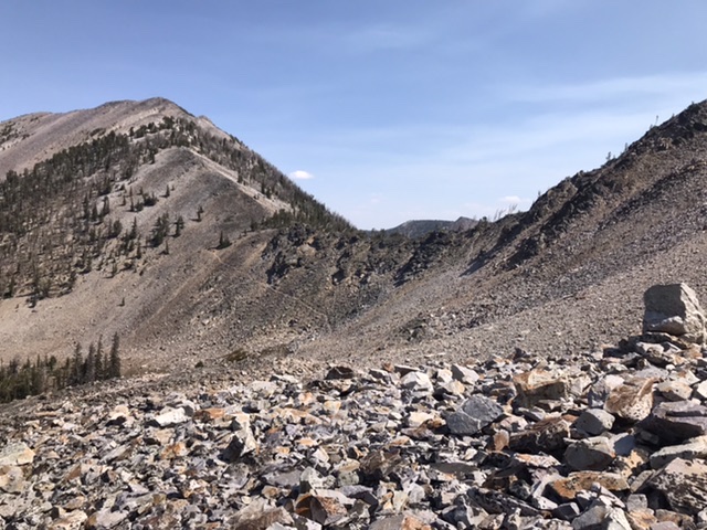
The Mill Creek/East Fork Hayden Creek Col viewed from the northwest. The trail is visible descending from the Col to the point where the route leaves the trail.
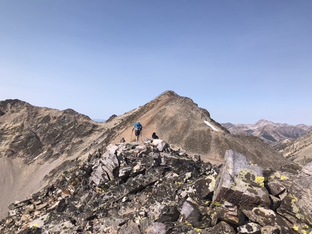
Looking toward the summit Buffalo Skull Peak from the top of the west ridge.
West Ridge, Class 2+
From the north end of the dam, take the Mill Lake/East Fork Hayden Creek Trail, FST-181 [(A)(9.2) Page 315] to the col above the lake in 0.6 miles and 650 feet of elevation gain. This trail was maintained in 2020. From the col follow the trail down to the first switchback. Leave the trail at this point and contour west to the large gully shown on the map below. Climb this loose, talus gully to the top of the west ridge. Follow the ridge to the summit. Round trip is 5.6 miles with just over 2,000 feet of elevation gain.
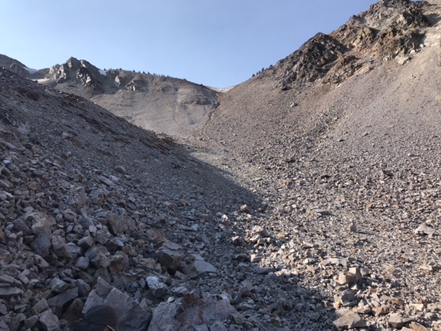
Looking up the ascent gully to the top of the west ridge.
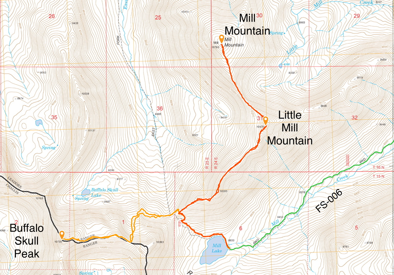
My GPS tracks.
Additional Resources
Regions: EASTERN IDAHO->Lemhi Range
Mountain Range: Lemhi Range
Year Climbed: 2020
First Ascent Information:
- First Ascent Year: 1996
- Season: Summer
- Route: Northwest Ridge.
- Party: Rick Baugher
Longitude: -113.68901 Latitude: 44.65649