Elevation: 7,878 ft
Prominence: 1,128

This peak is not in the book. Published December 2024
Pine Spring Ridge is a lengthy, narrow ridge that is located on the east side of Bear Lake in southeast Idaho. It has an impressive 1,128 feet of prominence. Given the private land ownership in this area, the best public access is from Indian Creek Road to its south. Climb a parallel ridge to its west (Mahogany Ridge) to make the outing more productive. USGS Pegram

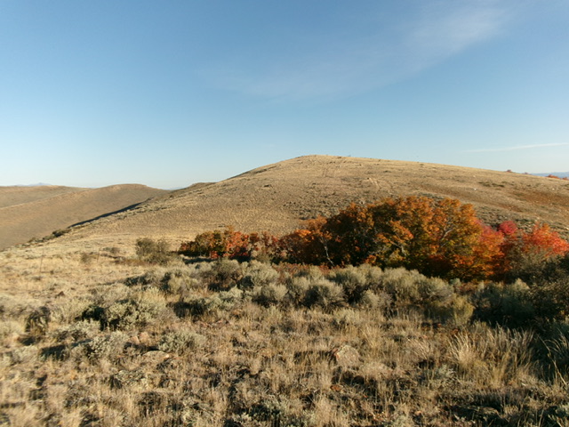
The elongated summit hump (in dead center) of Pine Spring Ridge as viewed from Point 7722. Livingston Douglas Photo
Access
From the stoplight at the south end of Montpelier, drive south on US-30 for 3.3 miles to reach a junction with [signed] Dingle Road. Turn right/west onto Dingle Road and reset your odometer. Dingle Road becomes East Shore Road when it reaches the east side of Bear Lake. At 11.5 miles, reach a signed junction with North Beach Road (right). Continue straight/south on East Shore Road. At 12.6 miles, reach an unsigned junction with Indian Creek Road (left). Turn left/east onto Indian Creek Road and drive 0.8 miles east to a pullout/campsite on the right/south side of the road. Park here (6,305 feet and 42⁰05’44”N, 111⁰14’25”W).
According to LOJ, there is about a ½-mile stretch of the south ridge of Pine Spring Ridge that is on private land. However, I encountered no fencing or signage to prohibit entry. The Baugher route follows a 2-track road up Dry Canyon and then up onto Mahogany Ridge. It crosses a section of private land at Indian Creek Road and may or may not be publicly accessible.
It is probably best driven by ATVs and MCs nowadays, if BLM still allows motorized vehicles. I suspect that MVs are not allowed anymore. You may be able to hike up that old road, which might be a good alternative to my route. This is the first leg of a 2-peak adventure that includes Pine Spring Ridge HP and nearby Mahogany Ridge (6,847 feet). It covers 6.0 miles with 1,875 feet of elevation gain round trip.
South Ridge, Class 2
The Climb
From the pullout/campsite, walk about 50 feet down Indian Creek Road to reach a good entry point (more grass than rock) for the southwest toe of Pine Spring Ridge. Scramble steeply northeast up a shoulder of talus and grass/scrub. Patches of talus/scree become more common as you go higher. Once on the crest of the [flatter] south ridge, head north up easy, short grass/scrub and embedded talus/scree. Cruise up over several ridge humps and do an extra 140 feet of elevation gain on your way to the summit.
The ridge terrain is consistently easy and fast. But the ridge goes on FOREVER. You start to believe that you will never reach the high point. Eventually, reach the summit hump on remnants of an old 2-track ridge road (not shown on maps). The summit of Pine Spring Ridge HP has a USGS benchmark (“Gate”) and a few torn-down triangulation cairns plus a few triangulation posts. There was no summit cairn, so I built one and stuck a triangulation post in it.

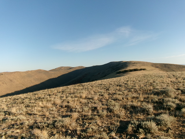
Looking north up Pine Spring Ridge from Point 7525. The ridge crest is right of center. This was the upper part of my ascent route. Livingston Douglas Photo
West Face, Class 2
The Descent
From the summit, head south along the ridge for about 0.3 miles. Leave the ridge and descend southwest through thick-ish sagebrush (with gaps) on the west face to reach the upper end of Mahogany Ridge after crossing the head of a dry gully at 7,400 feet. There is a shoulder (of sorts) about midway down that is easier and faster than the face. It offers more open spots and less-onerous scrub. The north end of [obvious] Mahogany Ridge (at about 7,400 feet) concludes the first leg of today’s 2-peak journey. Mahogany Ridge (6,847 feet) is up next. LOJ does not consider the upper, end of Mahogany Ridge to be its high point. Rather, a lower, rocky bump on the ridge is deemed the high point. Explain that one to me.
Additional Resources
Regions: Bear Lake Plateau->SOUTHERN IDAHO
Mountain Range: Bear Lake Plateau
Longitude: -111.2319 Latitude: 42.1335
