Elevation: 8,330 ft
Prominence: 430
This peak is not in the book. Livingston Douglas added a new access point and approach route, a new descent route, new photos, and additional text to the peak description. Updated November 2024
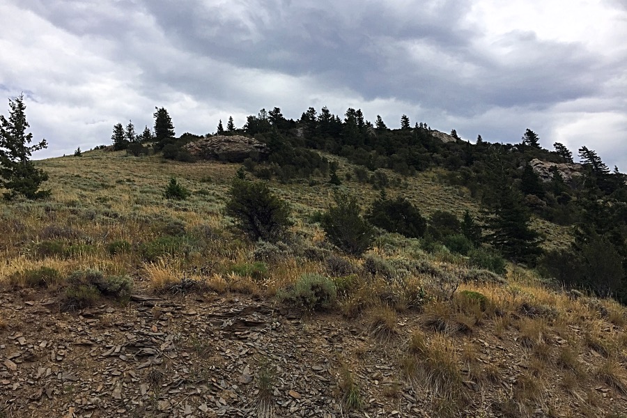
Baldy Mountain sits two miles northwest of Sedgwick Peak. It is a ranked hump on the northwest ridge of Sedgwick Peak. It sits above the headwaters of East Creek and Densmore Creek in the Portneuf Range. The USGS benchmark “Baldy” sits atop Sedgwick Peak, not Baldy Mountain. This area is a mix of private and public land, so be careful. This climb is entirely on State of Idaho land.The road to Sedgwick passes just below the peak’s summit. USGS Sedgwick Peak
Looking up the toward the summit from the road to the south. It’s a short 10-minute walk from the road to the summit.
Access
See the Sedgwick Peak page for the complicated access to this peak. Class 1+.
South Face, Class 2
Park below the summit and ascend the face through scrub.
East Gully/Southwest Face and South Face by Livingston Douglas
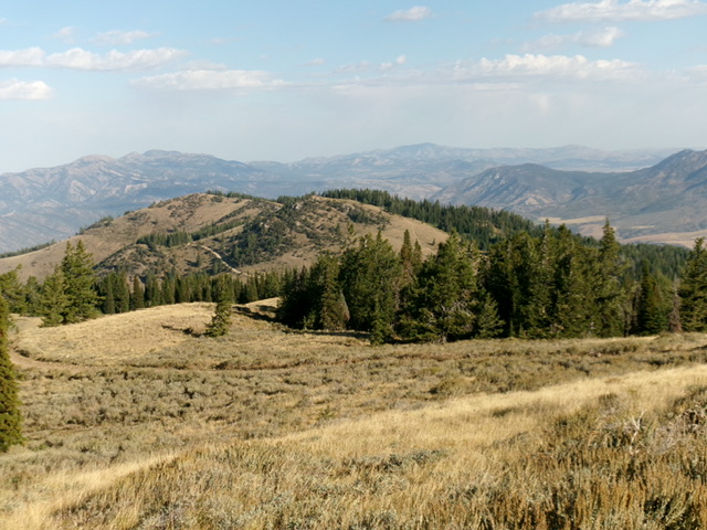
Baldy Mountain (in mid-ground) as viewed from the southeast. Livingston Douglas Photo
Access
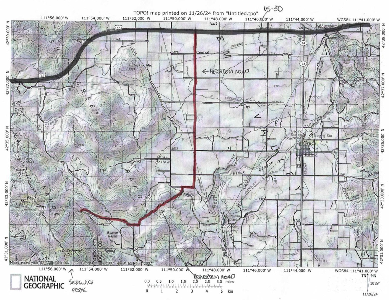
This access route requires a 4WD vehicle but not high clearance. It is a better route for most hikers who lack a 4WD high-clearance vehicle to approach the summit via the Lopez route. This access route has no issues with private landowners. From US-30 at virtual MM381.9, turn south onto [signed] Hegstrom Road. Follow this well-maintained county road for 6.5 miles south to a sharp right/west bend. After another 0.5 miles, reach a signed junction with Gentile Valley Road. Turn left/south onto Gentile Valley Road and follow it for 0.1 miles to a signed junction with Beaver Dam Road.
Turn right onto Beaver Dam Road and reset your odometer. At 2.0 miles, reach a crest in the road. At 3.0 miles, turn right at an unsigned “T” junction. At 3.8 miles, reach an unsigned junction with Fish Creek Road. Continue west on Beaver Dam Road. At 4.3 miles, go right at a signed junction with Earls Way (left). At 12.2 miles, reach a pullout area with a large cattle cistern nearby. The road becomes a steep, badly-rutted ATV trail after this point. Park here (6,735 feet and 42⁰32’22”N, 111⁰54’42”W). The final ½ mile of Beaver Dam Road has some rutting issues. Drive a 4WD vehicle with good tires and medium clearance for this section of the road.
Baldy Peak and Sedgwick Peak Access
This is the first leg of a 2-peak adventure that includes Baldy Mountain and Sedgwick Peak (9,167 feet). It covers 8.5 miles with 3,000 feet of elevation gain round trip.
Map Errors
Maps fail to show a decent jeep road that is on the northeast face of the ridge between Baldy Mountain and Sedgwick Peak. This jeep road intersects the ATV trail heading west up toward Baldy Mountain. This junction is at about 6,950 feet and is only about 1/8 mile west (and up from) an initial unsigned road junction at a side gully that heads north.
East Gully/Southwest Face, Class 2
The Climb
This climb is mostly Class 1. From the pullout/cistern, hike northwest up the severely-rutted (almost impassable) ATV trail/road to quickly reach an unsigned road junction (shown on the USGS topo map) at a side drainage. Go left-ish/west here. Continue northwest up the rugged road briefly to reach a second unsigned road junction (not shown on maps). A decent jeep road heads left/south here. Continue straight/west on the rugged ATV trail as it follows the main drainage, which now has a small stream in it.
The ATV trail crosses the small stream a few times as the rugged road climbs westward. The old road finally leaves the drainage to climb steeply right-ish/northwest up onto a shoulder. It soon bends left/south to cross a meadow that is the 7,900-foot connecting saddle between Baldy Mountain (visible to the northwest) and Sedgwick Peak to the south. Continue on the old road as it descends 50 vertical feet to reach an unsigned “T” junction with the [much better] ridge road. Go right/west then northwest on the ridge road and follow it up to the southwest side of Baldy Mountain at a saddle of sorts. Leave the road here and bushwhack northeast up through thick-ish scrub to reach easier terrain.
Quickly reach the ridge-crest summit of Baldy Mountain and the summit cairn. The east side of the ridge crest here is easy, open grass/scrub. The ridge crest itself is forested. It turns out that there is an old, weak 2-track (not shown on maps) that comes up from the 7,900-foot connecting saddle to near the summit via the rounded, southeast ridge. I did not see this 2-track when I crossed the connecting saddle in a meadow and it is not visible from the summit. But I could see it quite well from the northwest ridge of Sedgwick Peak. It is definitely there. A straight shot up from the connecting saddle would have shortened this hike a bit.
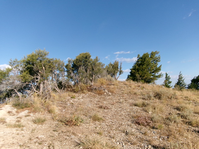
The semi-open summit of Baldy Mountain. Livingston Douglas Photo
South Face, Class 2
The Descent
From the summit, descend south down the scrub and scattered mahogany on the south face to intercept the ridge road. There is a patch of pines to bushwhack through just before reaching the road. Once on the ridge road, follow it southeast then south to a low point on the road in the pine forest. This concludes the first leg of today’s 2-peak journey. Sedgwick Peak is up next.
Additional Resources
Regions: Portneuf Range->SOUTHERN IDAHO
Mountain Range: Portneuf Range
Year Climbed: 2016
Longitude: -111.94579 Latitude: 42.54579