Elevation: 9,525 ft
Prominence: 505
Climbing and access information for this peak is on Page 212 of the book. Published February 2025
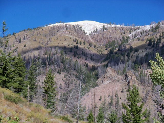
Bear Peak is an impressive massif that separates Thompson Creek from Castle Creek in the Smoky Mountains. It is most easily reached from the south via Barr Gulch Road and Barr Gulch Trail. The south ridge is the cleanest route to the top. USGS Boyle Mountain
Bear Peak. Rick Baugher Photo
Access
Bear Gulch Trail/FST-168 [(A)(7)(a) on Page 214 of the book. This is actually Barr Gulch Trail not Bear Gulch Trail. Please note that the book’s description for Bear Peak (on Page 212) inaccurately refers to Barr Gulch as “Bart Gulch.” This climb covers 8.0 miles with 2,950 feet of elevation gain round trip.
Southeast Ridge, Class 2
The Climb
From the junction of FSR-227/Warm Springs Creek Road and FSR-019/Barr Gulch Road, hike northwest up the old two-track for about a mile and 450 vertical feet to reach the Barr Gulch trailhead (FST-168) at about 7,050 feet. Follow the Barr Gulch Trail for about two miles to 8,040 feet where the trail leaves the south ridge and heads northwest to contour around the west side of the mountain. Scramble north up the narrow then rounded, open ridge of loose talus/scree to the west summit which is the high point. The east summit (Point 9387) is almost 150 feet lower in elevation.
Additional Resources
Regions: Smoky Mountains->WESTERN IDAHO
Mountain Range: Smoky Mountains
Longitude: -114.5892 Latitude: 43.6755