Elevation: 7,486 ft
Prominence: 466

This peak is not in the book. Published November 2024
Birch Creek Mountain is the highest peak in the Wolverine Creek section of the Blackfoot Mountains. Yes, it’s even higher than [popular] Taylor Mountain (7,404 feet) to its northwest. Birch Creek Mountain sits above Double W Divide at the headwaters of Wolverine Creek. It is on private land with some areas of ACCESS YES. USGS Bone

Birch Creek Mountain (ridgeline in distance) as viewed from Peak 7406 to its west. Livingston Douglas Photo
Access
From the south end of Firth on US-91, drive 1.7 miles south on US-91 to [signed] East 600N. This is Wolverine Road, a well-maintained county road. Turn left/east onto paved Wolverine Road and reset your odometer. At 10.2 miles, go straight at a junction with [signed] Blackfoot River Road to stay on Wolverine Road. At 16.6 miles, reach the Taylor Mountain trailhead parking area. Continue northeast then southeast up Wolverine Road for another 2.3 miles to a culvert crossing of Wolverine Creek. There is a split-rail fence gate here and the remains of an old jeep road that heads east then southeast up along Wolverine Creek. Park here near the ACCESS YES sign (6,375 feet and 43⁰17’19”N, 111⁰52’52”W).
Map Errors and Other Updates
There are many more old 2-track roads in this area than are shown on the USGS topo map. Contrary to Rick Baugher’s route comments, there is no longer any public access allowed from the Double W Divide to Birch Creek Mountain. It is clearly posted for “No Trespassing.” That would certainly be the shortest and easiest way to climb the peak.
West Face, Class 2
The Climb
From the split-rail fence gate, hike up an overgrown use trail that is on an old road bed that follows the left/north (then east) side of Wolverine Creek. This foot trail heads up Wolverine Creek all the way to a road junction (unmapped road) of two ATV/Jeep roads. Follow the ATV/Jeep road that continues up Wolverine Creek. This road soon reaches an unsigned “T” junction high up. Go left/northeast here and follow this 2-track road to its end at a cattle fence/gate. Cross the fence and follow another old 2-track northeast on the ridge crest to the gentle, open summit hump of Birch Creek Mountain. There is a small cairn on top. The antenna-clad, [lower] north summit hump is a short distance away.

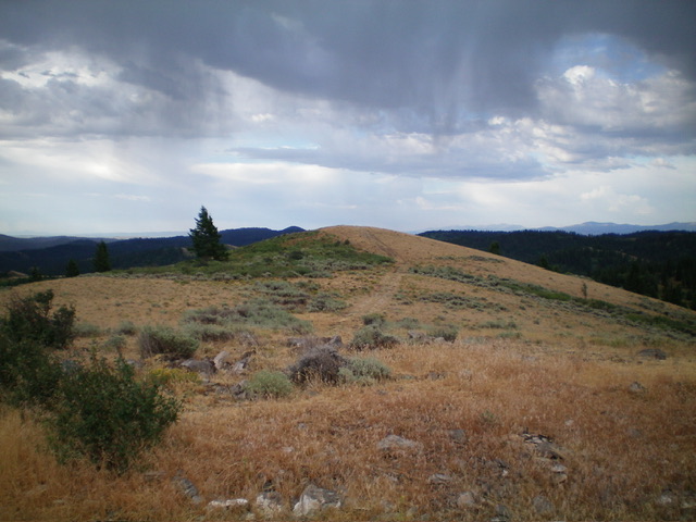
The summit hump of Birch Creek Mountain as viewed from the antenna-clad north summit. Livingston Douglas Photo
North Ridge/West Face, Class 2
The Descent
From the summit, follow the 2-track road south to a minor saddle then head up to the antenna-clad north summit. This summit hump is only five feet lower than the true/south summit, according to my altimeter. From the north summit, follow a decent 2-track service road along the ridge as it heads north then northwest to a fence crossing and a saddle. Do not continue descending the access road from here because it crosses a cattle gate onto unposted private land (this access road is posted for “authorized personnel only” farther down). This saddle sits at the head of a gully on its left/southwest side.
Follow the ridge crest a bit farther northwest to get past the fenced, private ranch property. Once past it, descend west then southwest through thick, steep sagebrush (not fun) to reach the Wolverine Creek drainage and the old foot trail in the road bed. Follow the foot trail northwest then west back to Wolverine Road and your parked vehicle.
Additional Resources
Regions: Blackfoot Mountains->SOUTHERN IDAHO
Mountain Range: Blackfoot Mountains
Longitude: -111.8620 Latitude: 43.2918