Elevation: 9,313 ft
Prominence: 1,933
Climbing and access information for this peak is on Pages 257-258 of the book. The access route described in the book is now closed to the public by a private landowner. Fortunately, Derek Percoski has provided the new access information set out below which is current as of December 2019. Livingston Douglas added photos from 2021 and 2025. He also provided an update on the ever-changing status of access to this big peak. Updated October 2025
Blizzard Mountain is located at the southeast end of the Pioneer Mountains. Access is difficult due to private property blocking the potential access routes. USGS Blizzard Mountain South
Blizzard Mountain is such a broad mass that you
really have to be far away to see its shape. This photo shows both Blizzard Mountain and
Peak 8513 on the left. The highpoint of Blizzard Mountain
cannot be seen in these photos. It is in the middle of a horseshoe-shaped
summit area. Walking the entire summit is more than a mile! Photo and commentary by Derek Percoski
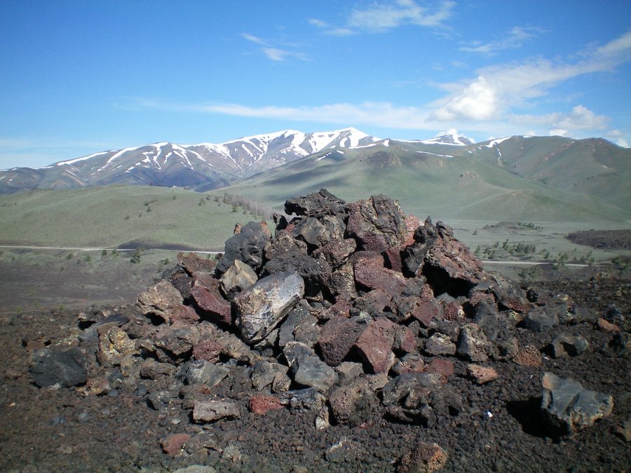
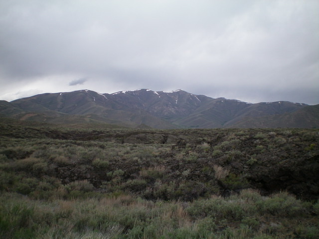
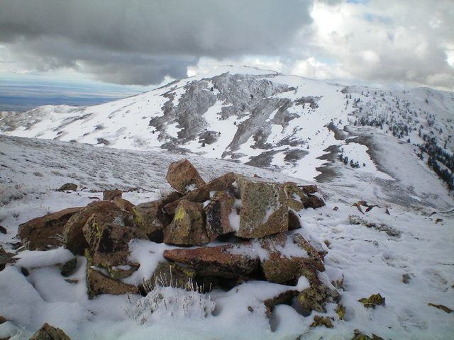
The large summit cairn atop the high point of North Crater in Craters of the Moon National Monument. Snow-clad Blizzard Mountain is in the distance. Livingston Douglas Photo
2025 Access Update by Livingston Douglas
Unfortunately, Percoski’s access route is completely outdated. The East Fork Fish Creek Road is closed early on and cannot even be hiked higher up due to private property. See the BLM easement map photo.
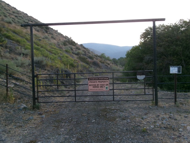
The road closure gate on East Fork Fish Creek Road. Livingston Douglas Photo
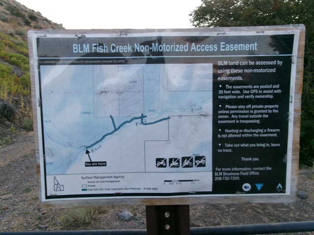
The BLM easement map for East Fork Fish Creek Road from the road closure point. About a mile up from here, the area is private land and is closed to the public. No access to Blizzard Mountain. Livingston Douglas Photo
2023 Updated Access by Derek Percoski (no longer available)
I will leave Derek’s access information on this page in the hopes that this route will reopen in the future.
The East Fork Fish Creek Road is now open to the public. There are no gates. Signs along the way state “Private property. No hunting or camping. Access is allowed.” The attached image confirms that the entire road is on private property. The 4×4 road goes all the way to 6600, where you’ll encounter the remains of an old bridge. At this point you are 2 miles and 2700 vertical from the summit of Blizzard. I did leave a note on my windshield stating that I was day hiking just in case the property owner came by. I don’t have a route to recommend since I went on a split board tour that included Peak 8513, but a climber should have no trouble making their own (steep) Class 2 path to the top.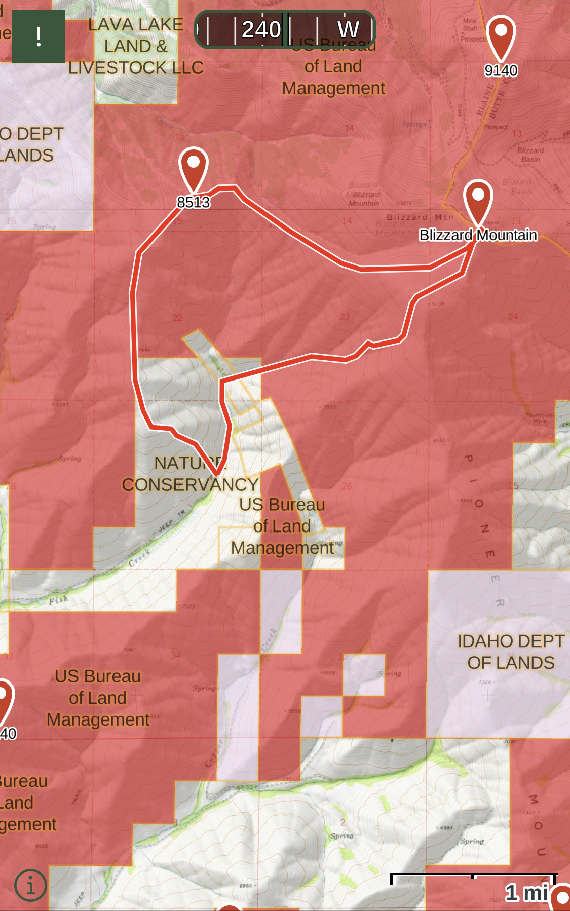
Blizzard Mountain as viewed from Peak 9102 to its north. The summit is well left of center on the high ridge. Livingston Douglas Photo
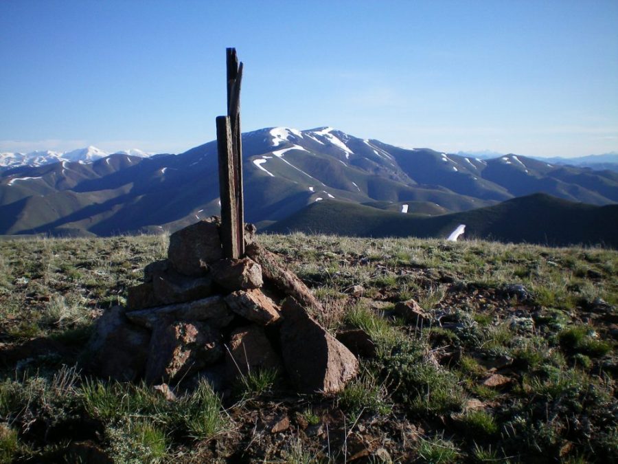
The summit cairn atop Peak 7900 with Blizzard Mountain in the background. The high point on Blizzard Mountain is the rightmost of the two humps. Livingston Douglas Photo
Blizzard Mountain as viewed from US-20 to its southeast. The summit is just right of center. Livingston Douglas Photo
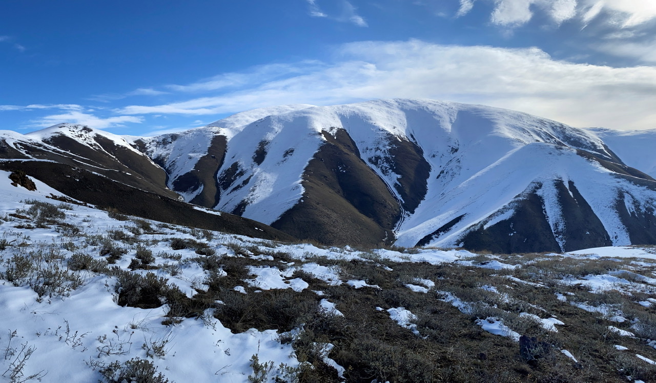
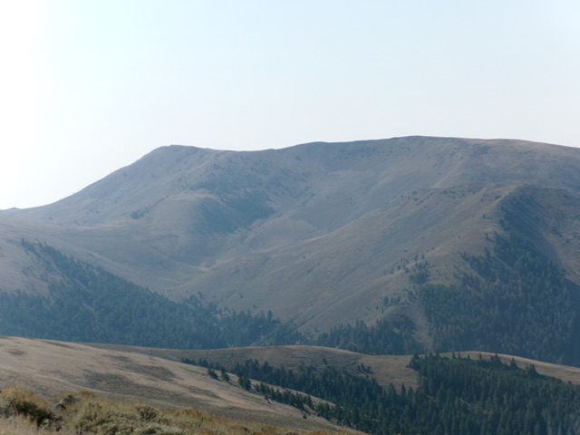
Blizzard Mountain (center) as viewed from the summit of Peak 9140 to its northeast. The mountain earns its name in this photo. It is often snow-covered. Livingston Douglas Photo
Additional Resources
Regions: EASTERN IDAHO->Pioneer Mountains
Mountain Range: Pioneer Mountains
Longitude: -113.66859 Latitude: 43.49839