Elevation: 5,890 ft
Prominence: 120

This peak is not in the book. Published November 2022
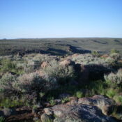
Crows Nest is located due east of Thorn Creek Reservoir in the Bennett Hills. It is a named summit. It is unclear how it got its name. It is overshadowed by its neighbor to the east, the Lincoln County HP (5,950 feet), which is only slightly higher and is almost impossible to determine the high point of. The high point of Crows Nest is much easier to find. The sagebrush in this area is tedious. Thankfully, there are use trails and cattle trails (most of which are not shown on maps) to make the endeavor easier. USGS Thorn Creek Reservoir
Access
Please refer to the Lincoln County High Point page for driving directions to reach Thorn Creek Reservoir. Park in a pullout at the dam wall at the south end of the reservoir (5,495 feet). The outlet creek goes through a culvert underneath an ATV road and the dam wall. Consequently, no creek fording is necessary as some internet postings suggest.
West Face, Class 2
The Climb
From the parking pullout, walk across the top of the dam on a footpath and follow the east side of Thorn Creek Reservoir northeast then north for just over ½ mile to a wide gully that heads right/east. The gully has two branches. You want the left/north one. Find a use trail that heads up through the thick sagebrush in the wide gully. Reach a flat area under, and south of, Point 5782. Leave the use trail and bushwhack northeast. Drop about 25 feet to cross the head of a sagebrush gully to reach the west side of Crows Nest. Angle right/southeast from here and scramble up the west face/ridge to reach the high point. Bash through the sagebrush to find the highest boulder amidst the sagebrush. This is not too difficult because the summit area is relatively confined. There is no summit cairn.
East Face, Class 2
The Descent
From the summit, descend the steep (initially) east face down to a gully (more sagebrush). This is the low point in the traverse to the Lincoln County HP, the next objective of today’s adventure. It concludes the first leg of this 2-peak journey.
Regions: Bennett Mountain Hills->WESTERN IDAHO
Mountain Range: Bennett Mountain Hills
Longitude: 114.5727 Latitude: 43.1994
