Elevation: 10,387 ft
Prominence: 162
This peak is not in the book. Published March 2025
Dyer Mountain is a rugged, rocky hump on the east ridge of Lame Jake Peak (10,817 feet). It is most easily climbed in combination with Lame Jake Peak from the North Fork Pass Creek drainage. USGS Diamond Peak
Access
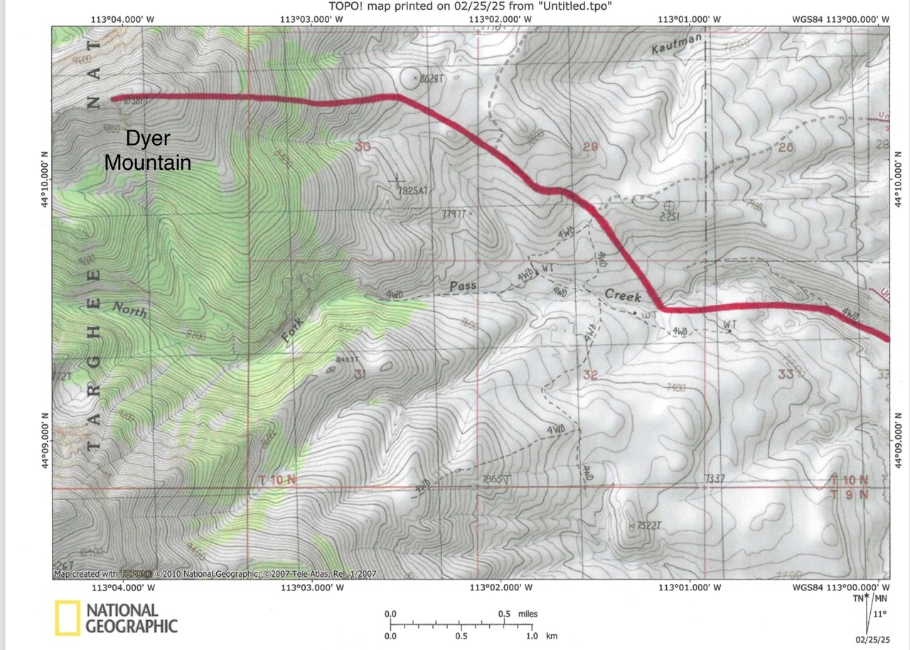
North Fork Pass Creek [(A)(2) on Page 313 of the book]. FSR-181/Pass Creek Road is located along ID-28 exactly 2.3 miles north of the north entrance to BLM’s Birch Creek Campground. The junction is 31.4 miles north of the junction of ID-28 and ID-33 just west of Mud Lake. From ID-28, find a small road sign for Pass Creek Road and reset your odometer. At 1.8 miles, go straight (not right) at a road junction. At 2.9 miles, go straight (not left) at a road junction.
At 3.6 miles, reach a signed road junction at a corral. Rugged FSR-796/North Fork Pass Creek Road goes right/northwest from here. Park at this junction (6,589 feet). Pass Creek Road is a maintained dirt road. A high-clearance vehicle is not necessary. This is the first leg of a 3-peak adventure that includes Dyer Mountain, Lame Jake Peak (10,817 feet), and The Brow (11,015 feet).
 East Face, Class 2
The Climb
From the road junction, hike up North Fork Pass Creek Road to about 6,900 feet. Leave the road and scramble northwest then west through open desert terrain and brush. Descend about 80 feet to cross the North Fork of Pass Creek. Scramble northwest up to the signed junction of FSR-835/FSR-753. Continue northwest up a jeep track then leave it when it bends right/north. Scramble northwest to a flattish area at about 8,000 feet at the base of the east face at a fence row.
Climb west up steep, but easy, desert terrain to reach the forest above. Bushwhack through thick pines and blowdown to reach a good talus field. Scramble west up across the talus field to reach a patch of open pine forest. After bushwhacking through this easy section of pine forest, reach a second talus field and a cliff band. Climb up the talus field and up through the cliff band to reach easy, open terrain. Continue west up through an easy mix of talus and tundra. Reach the summit of Dyer Mountain on easy tundra. The summit of Dyer Mountain is a rocky outcrop with no signs of previous ascent.
West Ridge, Class 2
From the summit, descend rotten, shale outcrops to reach the narrow, 10,220-foot connecting saddle with Lame Jake Peak. This concludes the first leg of today’s 3-peak journey. Lame Jake Peak is up next.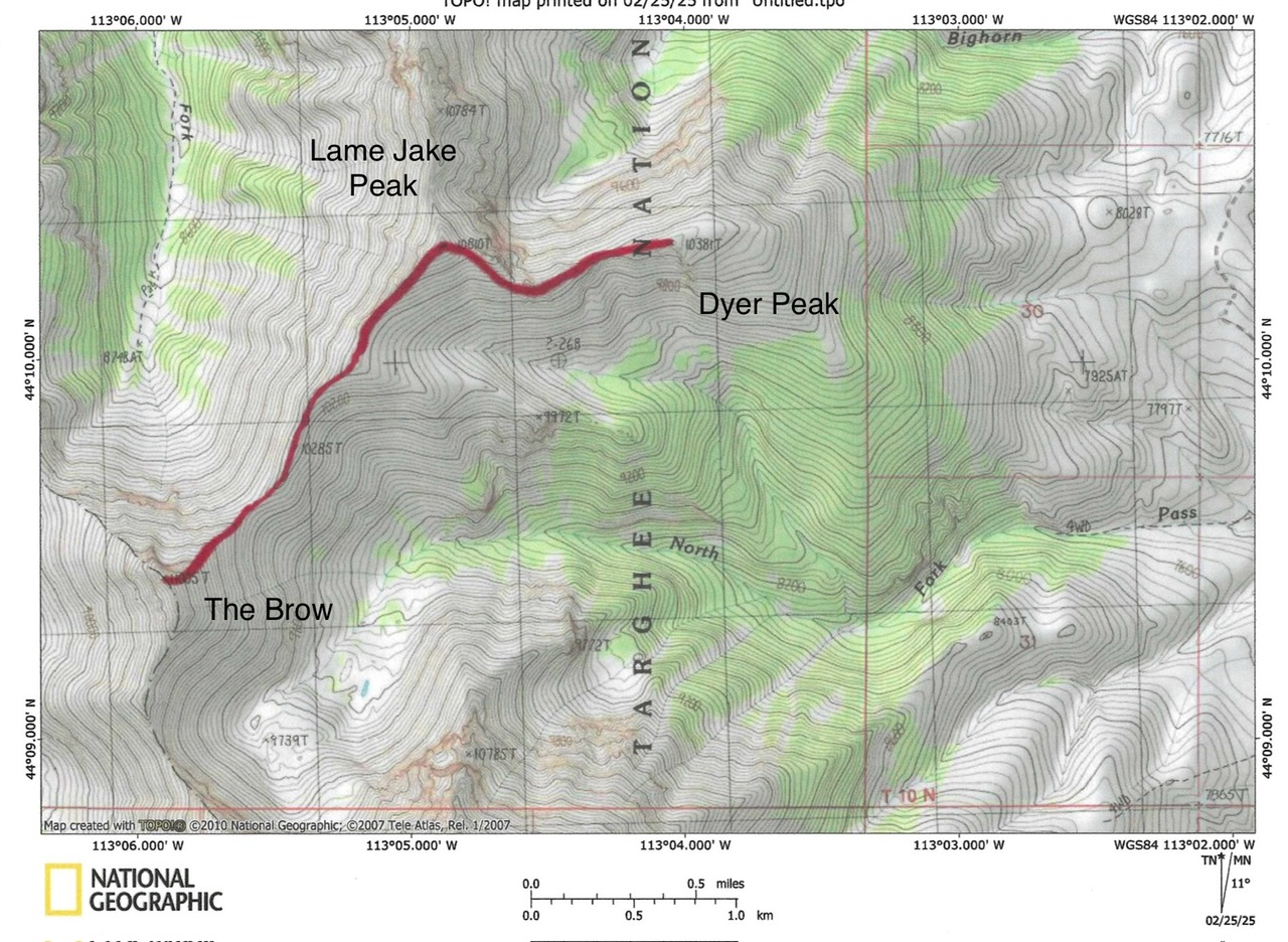
Additional Resources
Regions: EASTERN IDAHO->Lemhi Range
Mountain Range: Lemhi Range
Longitude: -123.06748 Latitude: 44.17177