Elevation: 7,684 ft
Prominence: 544

This peak is not in the book. Published December 2024
Germer Peak is a rocky mix of boulders, blocks, thick brush, and mountain mahogany. Its steep west face is an ominous sight from ID-75. Germer Peak is most easily climbed from its east side. USGS Bradbury Flat
Access
Same as for Peak 8250. This is the second leg of a 2-peak adventure that includes Peak 8250 and Germer Peak (7,684 feet). It covers 10.0 miles with 4,000 feet of elevation gain round trip.
Map Errors
Maps fail to show the full extent of the 2-track road coming up from Bradbury Flat to Bishop Spring and beyond.
Southeast Ridge, Class 3
The Climb
From the 7,140-foot connecting saddle with Peak 8250, Germer Peak is an ominous sight. It is a mess of rocky blocks, thick brush, and mountain mahogany. There is no clear route to the top. Leave the connecting saddle and follow a fence row to its end. Angle right-ish to reach a ridgeline. Scramble up large quartzite boulders/talus and fight with mountain mahogany to advance to the ridge crest. Reach a rocky ridge point and descend its left/south side to advance along the southeast ridge.
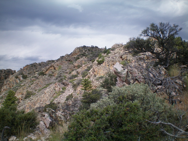
The ridge is an endless mess of disconnected towers, blocks, and humps with mountain mahogany and brush mixed in. It is best to skirt the ridge towers/blocks on the left/south side to get closer to the summit block. The USGS topo map fails to show how choppy the southeast ridge is. There are at least three or four downclimbs necessary to make any progress along the ridge. The mountain mahogany will poke at you and block you in many areas.
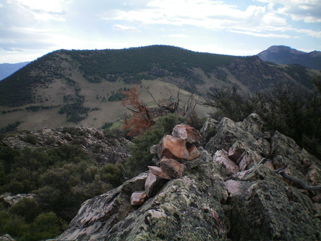
Upon nearing the summit block (which is not easy to identify), scramble up steep blocks/boulders to reach the narrow, ridgeline summit perch. I came up just north of the high point and had to bash my way through thick mountain mahogany and boulders to reach the top. It was not pleasant. I rebuilt the summit cairn atop the highest boulder.

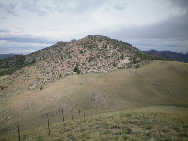
The rocky southeast ridge of Germer Peak. The summit hump is just left of center. Livingston Douglas Photo
Southeast Ridge/Northeast Shoulder, Class 3
The Descent
From the summit, descend the southeast ridge, staying just under the ridge crest on its right/south side and dropping to grassy areas when possible (farther below the ridge crest) to expedite the descent. Just before reaching rocky ridge Point 7480+, leave the southeast ridge at a ridge notch and descend northeast on a shoulder. This was no picnic. Downclimb Class 3 blocks/boulders on the northeast shoulder in a pine forest. Move left/west to get away from the worst of the ridge blocks and bushwhack down through easier pine forest to reach open field grass.
The field grass has embedded talus, which is a bit of a headache, but it sure beats the ridge blocks and boulders. Descend east from a broad, grassy saddle at 7,260 feet. Cruise down through easy field grass to reach the forested Bishop Spring area. Drop into a forested gully, pass Bishop Spring, and follow the remnants of an old 2-track east briefly back to the main 2-track jeep road coming up from Bradbury Flat. Follow the jeep road north-northeast back to Lone Pine Road and your parked vehicle.
Additional Resources
Regions: Boulder Mountains->EASTERN IDAHO
Mountain Range: Boulder Mountains
Longitude: -114.2405 Latitude: 44.3986

