Elevation: 9,752 ft
Prominence: 2,812
Climbing and access information for this peak is on Pages 287-288 of the book. Steve Mandella added photos and a GPS track showing the two routes set out in the book. Livingston Douglas added photos which highlight the beauty of this peak. Updated November 2024
I have climbed Hawley Mountain three times–twice under a full moon in August. It’s a much harder climb than it looks from the base. The peak offers great views from the top. Hawley Mountain is often free of deep snow in early Spring. The two routes in the book (northwest ridge and northeast ridge) are the only routes that I have climbed. While the peak can be climbed from many other directions, these two routes offer the best access. USGS Hawley Mountain
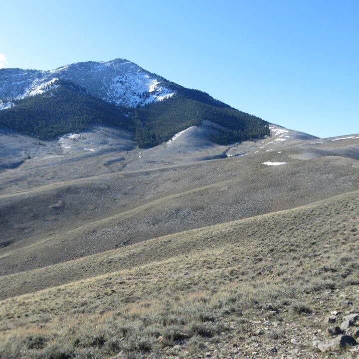
The south side of Hawley Mountain
Livingston Douglas Photos

Hawley Mountain as viewed from Peak 7527 to its south. Livingston Douglas Photo
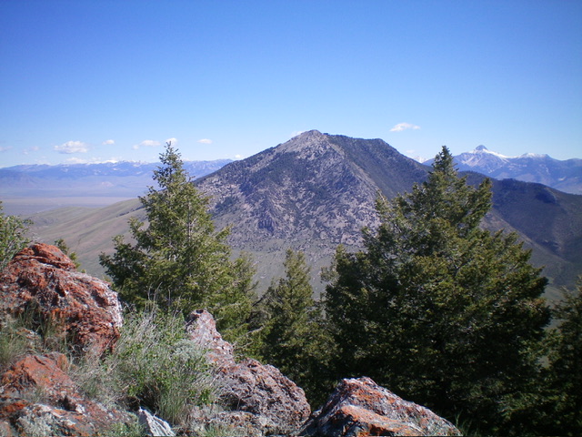
Hawley Mountain as viewed from Peak 8817 to its southwest. Livingston Douglas Photo
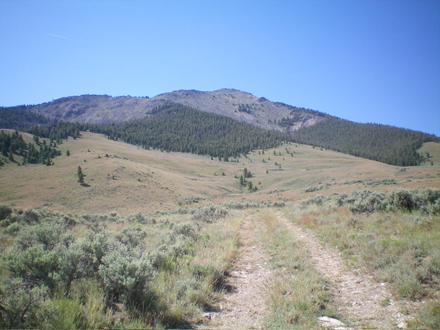
Pic #15: Hawley Mountain as viewed from the northwest. I ascended the forested shoulder in the center diagonally left up onto the north ridge (the skyline left of center). The northwest ridge is the skyline to the right. Livingston Douglas Photo

The USGS benchmark atop Hawley Mountain. Livingston Douglas Photo
Steve Mandella GPS Track and Photos
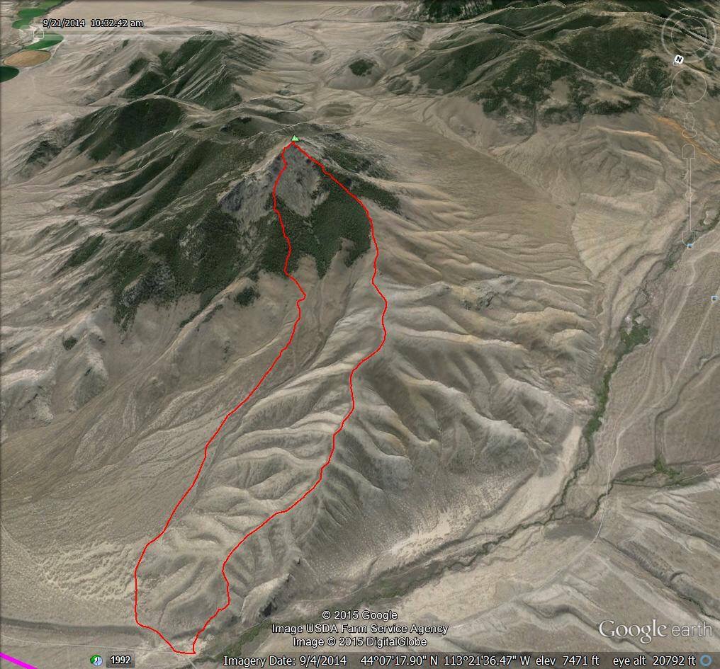
Steve Mandella’s GPS track shows both routes from the book: northeast ridge (left) and northwest ridge (right).
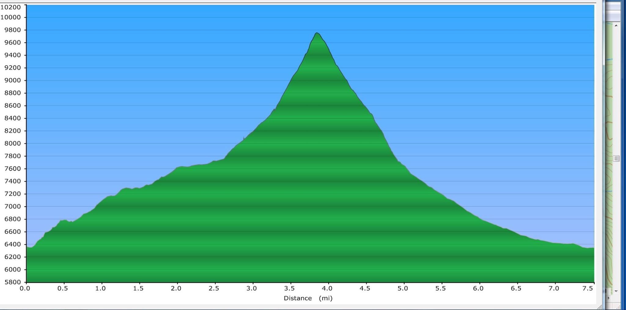
Steve Mandella’s elevation profile for ascending the northwest ridge and descending the northeast ridge.
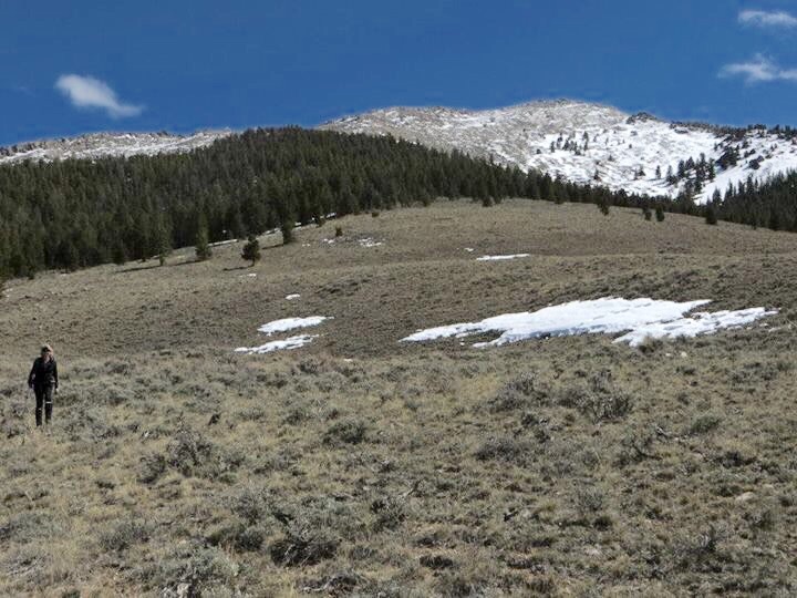
Looking toward the summit and the northeast ridge. Steve Mandella Photo
Margo Mandella descending the northeast ridge. The talus and boulders are a bit of a pain on the upper reaches of the route. Steve Mandella Photo
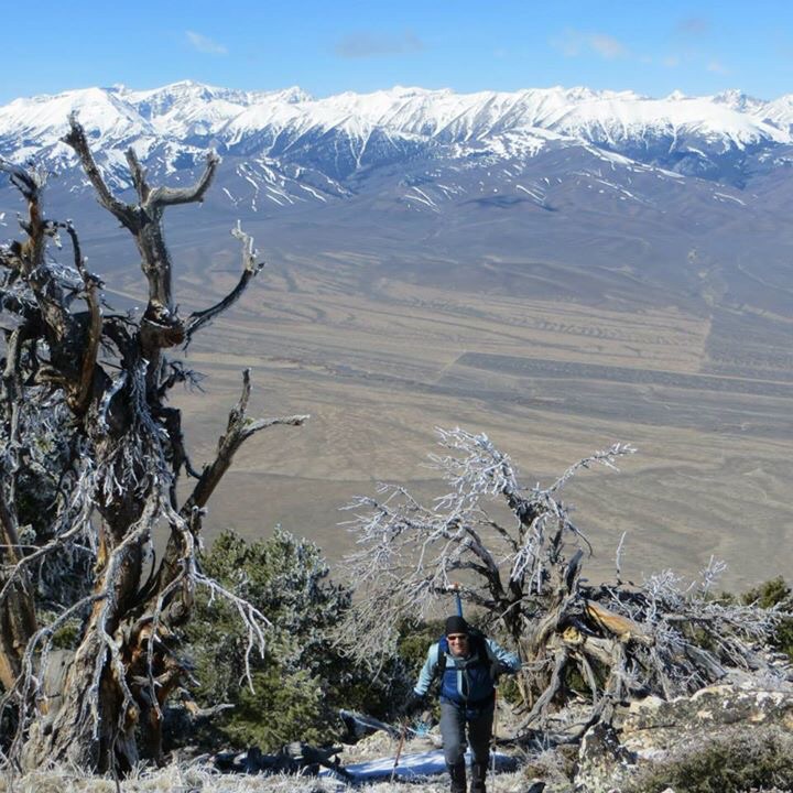
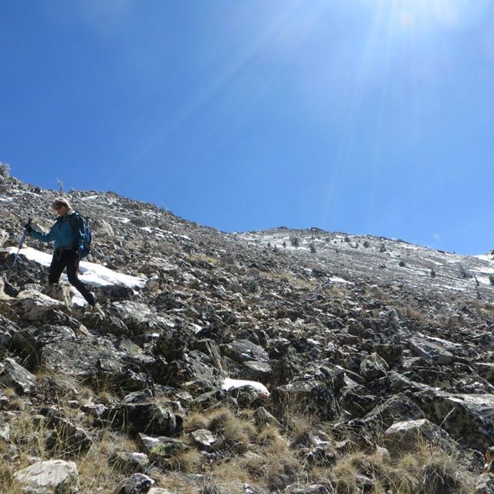
Bruce Dunham ascending the northwest ridge. Steve Mandella Photo
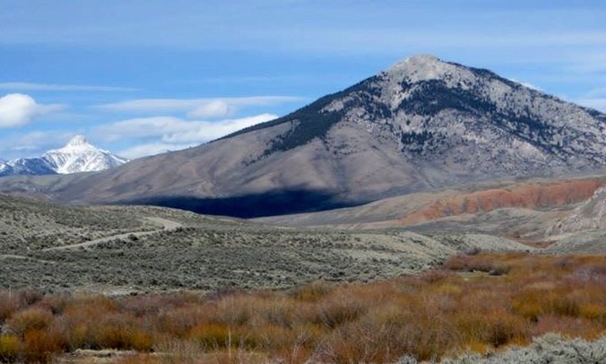
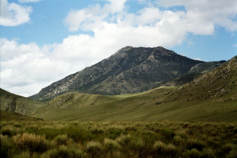
Hawley Mountain as viewed from the west from Pass Creek Road. Steve Mandella Photo
Additional Resources
Regions: EASTERN IDAHO->Hawley Mountains->Lost River Range
Mountain Range: Lost River Range
Year Climbed: 1980, 1981, 1999