Elevation: 9,860 ft
Prominence: 960

Outdated climbing and access information for this peak is on Page 233 of the book. FST-051/Toolbox Creek Trail does NOT go to the summit of Herd Peak as the book and USGS and Forest Service maps indicate. Published November 2024
Herd Peak is the high point on a high ridge that separates the Herd Creek drainages (to the north) from Toolbox Creek and Chicken Creek to the south. It is most easily climbed from the Toolbox Creek Trailhead via a rather long, convoluted route that finishes on its southwest ridge. USGS Herd Peak

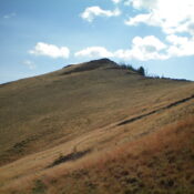
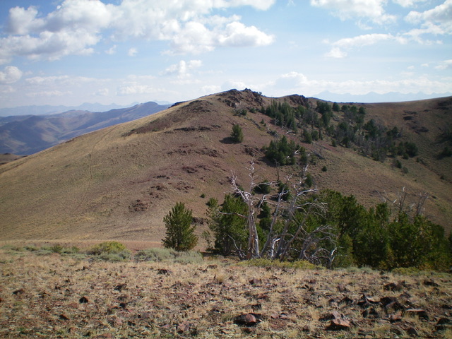
Herd Peak (dead center) as viewed from Point 9843 to its southwest. The southwest ridge is just left of center and was my ascent route. Livingston Douglas Photo
Access
North Fork Big Lost River Road/FSR-128 [(B)(2) on Page 242 of the Book]. From Trail Creek Road, drive 6.4 miles northwest then west up North Fork Big Lost River Road, turn right/north onto the unsigned Toolbox Creek spur road. Drive 0.1 miles to the end of the road and a parking area (7,465 feet and 43⁰56’40”N, 114⁰14’21”W).
Map Errors
Maps fail to show the spur road that leads up to the mouth of Toolbox Canyon. Maps also misposition the Toolbox Creek Trail, which crosses to the left/west side of Toolbox Creek a very short distance above the trailhead, NOT almost ½ mile up the trail at 7,720 feet as the maps show. In addition, maps show the Toolbox Creek Trail climbing directly up to Point 9333 when, in fact, the trail climbs west to a ridge saddle at 8,820 feet. Maps fail to show the other trails on the ridges on the west side of Toolbox Canyon.
Southwest Ridge via Toolbox Creek Trail, Class 2
The Climb
From the parking area at the mouth of Toolbox Canyon, hike north up [unsigned] Toolbox Creek Trail/FST-051. FST-051 is maintained but is narrow and muddy in many spots. The trail quickly crosses to the left/west side of [small] Toolbox Creek. The trail heads north up the west side of Toolbox Creek for about 1.2 miles to a fork in the canyon. The trail bends left/northwest here, NOT right/northeast as maps indicate. It switchbacks its way northwest up a shoulder to a saddle at 8,820 feet. This saddle sits just south of Point 8945 and is at 43⁰57’56”N, 114⁰15’04”W.
The McClure/Jerry Peak Wilderness Boundary is here. There is an unsigned trail junction at this saddle. A ridge trail heads south. Another ridge trail heads north. A third trail heads northeast. The northeast-bound trail heads toward Point 9333. This is the trail that you want. Follow this unofficial foot trail as it skirts the right/southeast side of Point 8945 and reaches an 8,820-foot saddle at the head of the Toolbox Creek drainage. This saddle sits west of, and directly below, Point 9333.
From the saddle, follow a steep use trail east up a ridge then across the northwest face of Point 9333 to reach the 9,220-foot saddle just northeast of Point 9333. Find the old FST-051 ridge trail on the right/east side of the ridge crest at this saddle. The narrow foot trail skirts the right/east side of a ridge hump then descends 110 feet to a gentle, wide, dirt saddle. Continue northeast then north up the narrow trail in open scrub. The trail now climbs up rocky terrain to a gap between two rocky ridge points.
You might think (as I did) that the higher of these two rocky points is Herd Peak, but neither are. From the notch between these two rocky ridge points, the trail bends hard right/east here and drops slightly. The trail skirts the north side of Point 9843 and gets close to a final saddle. Leave the trail here and scramble northeast up easy rock and scree to reach a false summit and, shortly after, the well-cairned high point of Herd Peak. This circuitous ascent route is about 4.0 miles in length.

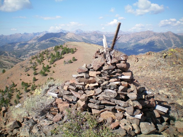
The large summit cairn atop Herd Peak with the lower, southwest summit (Point 9843) behind and to the left of the cairn. Livingston Douglas Photo
Southwest Ridge Direct, Class 2+
The Descent
Let’s descend a more direct line back to Toolbox Creek to reduce the hiking mileage for this journey. From the summit, scramble southwest over the rocky false summit and descend to a minor saddle. Scramble southwest up easy rock and scrub to the open, rocky top of Point 9843 (the southwest summit). From Point 9843, descend south then southwest on loose scree and grass/scrub to intercept the ridge trail (FST-051). Follow the ridge trail back to the small saddle/notch just north of Point 9333.
From this saddle/notch, scramble south up easy rock and scrub to the rocky top of Point 9333. Descend south on a narrow ridge of rocky outcrops and loose, angled scree on its sides. Stay close to the ridge crest on its right/west side (Class 2+ terrain). Reach the top of a nice shoulder (with a rocky ridge point at its terminus) just before the ridge drops southeast to the 8,660-foot connecting saddle with Toolbox Peak. Descend right-ish/south-southwest on this wide shoulder of scree/scrub then grass/scrub then pine forest to reach Toolbox Creek and the Toolbox Creek Trail. Follow the trail back down Toolbox Creek to the trailhead parking area.
Herd Peak can also be climbed via a longer route (9-10 miles round trip) from Horse Creek (the Baugher route), but I am not sure if that trail is maintained anymore or if it even still exists.
Additional Resources
Regions: Boulder Mountains->EASTERN IDAHO
Mountain Range: Boulder Mountains
Longitude: -114.2258 Latitude: 43.9863
