Elevation: 10,817 ft
Prominence: 683

Climbing and access information for this peak is on Page 308 of the book. The book lists two routes for Lame Jake Peak. Rick Baugher climbed the peak twice, once via East Ridge and one via the Southwest Ridge (see the book). Larry Prescott traversed to the summit from The Brow. The elevation and prominence figures are updated and based on LiDAR calculations. Livingston Douglas provides the detailed route information. Updated March 2025
Lame Jake Peak is unofficially named after a Shoban Tribe medicine man who once frequented the Birch Creek Valley. This peak is located east of the main Lemhi Range crest and due north of Diamond Peak. USGS Diamond Peak
Livingston Douglas Update
Access
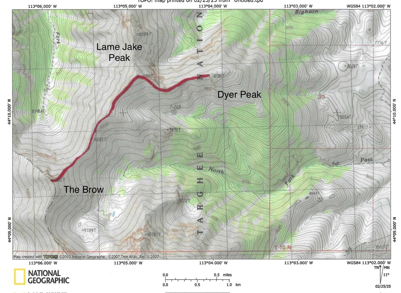
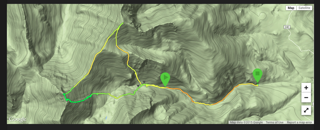
North Fork Pass Creek [(A)(2) on Page 313 of the book]. Same as for Dyer Mountain. This is the second leg of a 3-peak adventure that includes Dyer Mountain (10,387 feet), Lame Jake Peak, and The Brow (11,015 feet).
East Ridge, Class 3
The Climb
From the narrow 10,220-foot connecting saddle with Dyer Mountain, scramble southwest then west up about 110 vertical feet. Skirt the left/south side of some ridge towers/outcrops and drop 60 vertical feet to get past them (Class 3). The ridge now bends right/northwest and becomes much easier. Climb up the ridge crest on broken rock to the small summit of Lame Jake Peak. The peak sits atop the intersection of three ridges. There was no summit cairn so I built a decent one.
Southwest Ridge, Class 2
From the summit, descend southwest on good, broken shale for about 1-1/2 miles to the small connecting saddle with The Brow at 10,140 feet. There are some decent game trails on or near the ridge to expedite this lengthy, narrow ridge descent. The southwest ridge wiggles a bit but generally heads in a southwesterly direction. It presents no problems.
Larry Prescott Updates
See Larry Prescott’s trip report which has great photos of his route from The Brow to Lame Jake Peak. Larry reported:
“The walk to Lame Jake Peak from The Brow is an easy 90-minute stroll along a gentle ridge. One might as well take in Lame Jake Peak in the same trip as The Brow. Besides, if you climbed up from North Fork Pass Creek, you can loop back around and end up back in the canyon.”

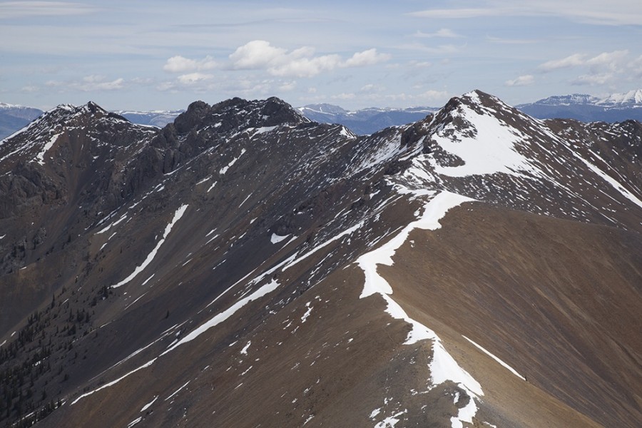
Lame Jake Peak’s three summits as viewed from The Brow. The highest point is right of center. Larry Prescott Photo
Additional Resources
Regions: EASTERN IDAHO->Lemhi Range
Mountain Range: Lemhi Range
Longitude: -113.08119 Latitude: 44.17169

