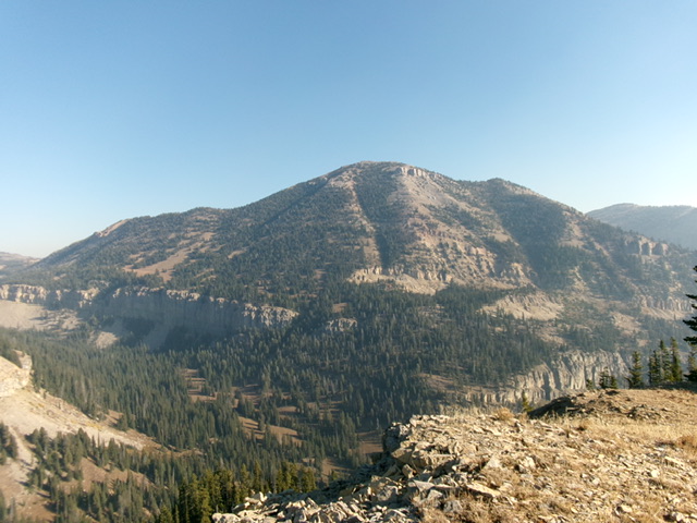
Elevation: 9,574 ft
Prominence: 234

Climbing and access information for this peak is on Page 337 of the book. Published November 2024
Lionhead is a named, unranked bump on the southeast ridge of Bald Peak (10,192 feet) in the Henrys Lake Mountains. It sits on the Continental Divide and on the ID/MT border. Lionhead is most easily climbed from Targhee Pass to its southeast via the CDT but the hike is lengthy. USGS Targhee Pass

Bald Peak (10,192 feet) and Lionhead (the ridge hump right of center) as viewed from Peak 8883 to the south. The southeast ridge of Lionhead is the right skyline. The southeast ridge was my ascent route. Livingston Douglas Photo
Access
Targhee Pass [(B)(2) on Page 337 of the book]. Targhee Pass (7,072 feet) is located along US-20 a few miles west of West Yellowstone, MT. Park near the base of the jeep road on the north side of Targhee Pass. This is the first leg of a 2-peak adventure that includes Lionhead and Bald Peak. It covers 14.5 miles with 4,575 feet of elevation gain round trip.
Map Errors
The USGS and Caribou-Targhee National Forest maps mis-position the CDT after it leaves the snowmobile road.
Southeast Ridge, Class 2
The Climb
From Targhee Pass, hike north up the snowmobile road (closed to cars/trucks at the ½-mile point) for 1-1/2 miles to where the CDT splits from the road (trail sign here). Contrary to maps, the CDT goes hard left/southwest then turns right/northeast up the east side of the Continental Divide to reach the ridge crest. The trail then drops 150 vertical feet north to a ridge saddle in a large, open meadow (at MP712).The 7,980-foot saddle is shown on maps with the mile marker, but the mile marker is no longer there. From the saddle, the CDT leaves the ridge and switchbacks up the forested east side of the ridge crest to regain the ridge crest higher up.
The trail then follows the Continental Divide (staying close to it) all the way to just under the summit of Lionhead. The CDT does some long switchbacks to climb two or three ridge humps along the way. Leave the CDT and scramble directly up the ridge crest (Class 2) over these humps to save on mileage. These humps are all above tree line and are easy to scramble up over. Leave the CDT at a saddle just under Lionhead. Scramble up the south ridge/face to the small, ridgeline summit. The summit had no cairn so I built one on the high point.
Northwest Ridge, Class 2
The Descent
From the summit, descend the easy, open ridge and quickly reach the 9,340-foot connecting saddle with Bald Peak. This concludes the first leg of today’s 2-peak journey. Bald Peak (10,192 feet) is up next.
Additional Resources
Regions: EASTERN IDAHO->Henrys Lake Range
Mountain Range: Henrys Lake Range
Longitude: -111.3231 Latitude: 44.7285