Elevation: 5,849 ft
Prominence: 749

This peak is not in the book.
Little Fiddler is, in my opinion, the most outstanding Danskin Mountains summit because of its isolated position on the crest and its “bell” shape. The peak’s steep East Ridge is Class 2. USGS Danskin Peak
Access
Primary access to the middle section of the Danskin Mountains is from Mountain Home, Idaho. See (D)(1) on Pages 154-155 for the details. Once you reach the high inner valley, you will find a small reservoir on the right-hand side of the road at a major junction 17.0 miles from where you left the highway in Mountain Home. Turn right at this junction onto the Danskin Peak Lookout Road and follow it for 0.75 miles to a junction with a two-track road on your left. This rugged two-track road leads west toward Little Fiddler. You will cross the Cottonwood Creek drainage and then climb up and over into the Pine Creek drainage. This road requires a 4WD and will be very difficult to navigate when wet. Furthermore, the road is mostly used by ATVs and, as a result, it is getting narrow in spots. The road is closed to all but ATVs after it reaches Pine Creek, but a good ATV trail climbs up Pine Creek to Fiddler Summit.
East Ridge, Class 2
The East Ridge can be accessed 2 ways from Pine Creek. The most direct route is to hike the ATV trail that climbs up Pine Creek to Fiddler Summit. On Fiddler Summit, you will find a trail (FST-323) that climbs up the East Ridge to a benchmark. This trail eventually swings south and descends down the peak’s South Ridge which is the alternative access to the East Ridge. From the benchmark, a faint trail climbs up the steep East Ridge to the summit. It is a steep climb but there are no obstacles other than a few clumps of bushes. Be aware that this area sees a lot of ATV and motorcycle use on weekends but is usually vacant on weekdays.
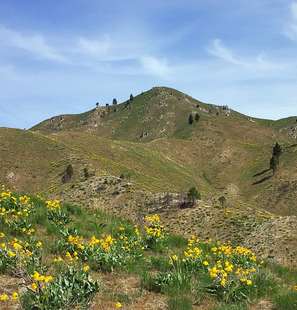
Little Fiddler as viewed from the southeast.
For an alternative (but longer) access route to the East Ridge, follow the Pine Creek Trail from the junction described below to the lower end of FST-323. Take the trail which heads up and then south to the top of the peak’s South Ridge and then follow it north to the benchmark described above.
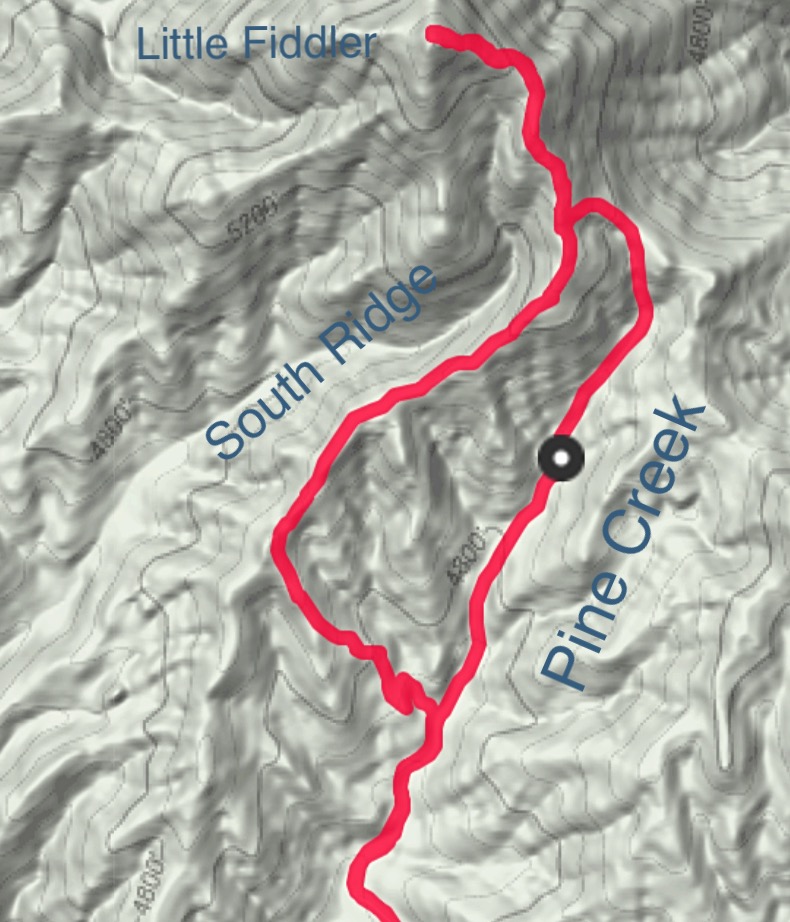
My GPS track. We climbed up the South Ridge using most of FST-323 and descended the ATV trail in Pine Creek. We started at Cottonwood Creek because I did not want to drive across the creek which was still running high. Our total route was 7.0 miles with 1,400 feet of elevation gain. Your results will no doubt vary.
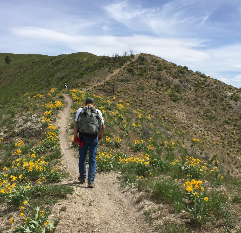
Hiking FST-323 on the South Ridge. Although this route is longer, it is an outstanding ridge walk.
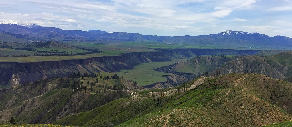
Looking northeast from the summit of Little Fiddler toward Prairie, Idaho with the South Fork Canyon below. The visible trail is FST-323.
Additional Resources
Regions: Boise Mountains->Danskin Mountains->WESTERN IDAHO
Mountain Range: Boise Mountains
Year Climbed: 2016
Longitude: -115.72059 Latitude: 43.48339