Elevation: 11,071 ft

Climbing and access information for this peak is on Page 286 of the book. In addition to the access information given by Livingston Douglas below, Derek Percoski has provided an alternative approach for this peak. See the Mount McCaleb page to read about this access route. Updated October 2018
Little Mac is an impressive peak, but this is not always obvious because it is overshadowed by it towering neighbor, Mount McCaleb. A recent closure of a section of private property along the traditional access route has impacted access to the peak. Livingston Douglas provides updated access and climbing information that will aid you in reaching this summit. USGS Mackay

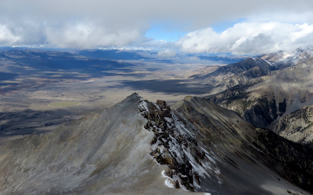
Little Mac as viewed from the summit of Mount McCaleb. Dan Paulson Photo
Dan Paulson trip report follows: “The two known climbing routes I’m aware of run straight up the west ridge line, right out of the trees. I haven’t done this but met two climbers up there who had just done it. I climbed it right up the north ridge line shown in the photo, staying as close as possible to the higher ridge line. It’s easy to pick a route along the ridge.”

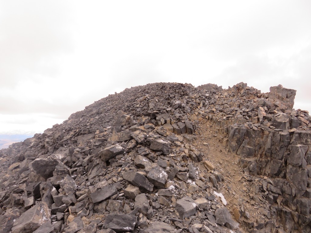
The summit of Little Mac. Dan Paulson Photo

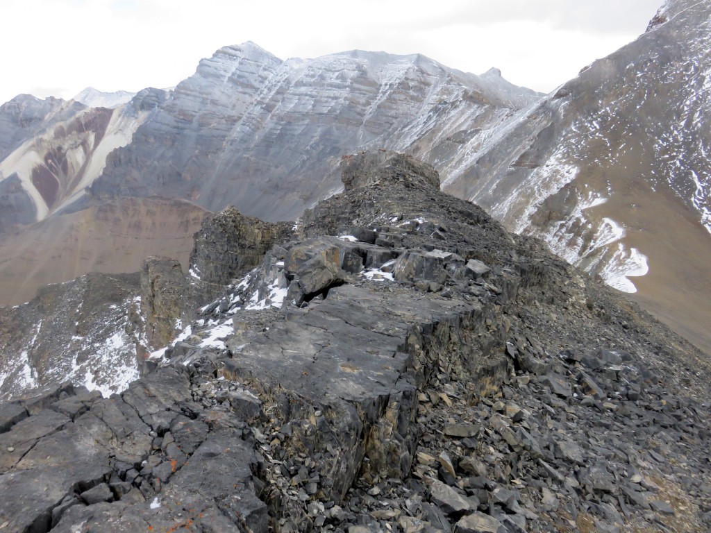
Looking north from the summit of Little Mac. Dan Paulson Photo
South Ridge, Class 3 by Livingston Douglas
Access
Lower Cedar Creek Road [(B)(13)] is the standard approach. However, it is currently closed to the public at 1.2 miles up from the Bench Road, though there is a rough ATV road that goes sharply right at that point to skirt the private property, crosses the bushy Lower Cedar Creek drainage then turns north but ends about a mile before reaching the mouth of Lower Cedar Creek Canyon. For passenger vehicles, you could park at the closure point and hike up the ATV road then bushwhack across Lower Cedar Creek to regain the Lower Cedar Creek Road above the private property closure. Unfortunately, this requires almost 3 miles of hiking to reach the mouth of Lower Cedar Creek Canyon.
Until public access is regained, here is an alternate route that I discovered. It works well for climbing Little Mac, Mount McCaleb, and hikes up the Lower Cedar Creek Canyon (e.g., Limestone Peak). Passenger vehicles can make it to a parking pullout just before Nielsen Ditch; high-clearance vehicles can go just over 1/4 mile farther up the road. By the way, this road is clearly shown on the Mackay quadrangle. It ends on a bench at the mouth of Lower Cedar Creek Canyon on the left/west side of Lower Cedar Creek.
Here are the driving directions for the publicly-accessible alternate route:
From the intersection of Highway 93 and Main Street in Mackay, drive NE on Main Street 0.5 mile to where it intersects the Bench Road. Turn R/SE on the Bench Road and you’ll soon reach the entrance to the Mount McCaleb Cemetery. From the cemetery entrance, drive 0.7 mile SE on the Bench Road to the recycling center (on your left) and cross a cattle guard. Immediately after crossing the cattle guard, turn left/north onto a BLM road; reset your odometer to 0.0 This road aims directly at the mouth of Lower Cedar Creek Canyon. It follows the RHS of the recycling center initially. After passing the recycling center, the road doglegs left then right. At 0.7 mile, go straight at a junction. At 2.4 miles, the road crosses under the power lines and crosses the power line road. At 2.5 miles, the road reaches a cattle gate. At 2.7 miles, the road reaches Nielsen Ditch. Pull off to the right here and park (unless you have a high-clearance vehicle). The elevation here is 6,680 feet. This is where the route begins.
The Climb
Put on your sandals and ford Nielsen Ditch. Don’t worry, it’s not too deep. After fording Nielsen Ditch, stow your sandals (you won’t need them again) and put on your hiking boots. Follow the jeep road north about 3/8 mile to Lower Cedar Creek Ditch. You can cross this one by using the log rails of a cattle fence. Continue up the jeep road 1/4 mile to yet another ditch. You can jump the small stream in this ditch. Immediately after crossing this ditch, turn left/northwest onto a jeep track that follows the northeast side of this ditch. In about 1/2 mile, this jeep track intersects the main jeep road that traverses the base of the mountains. Turn left/west onto this jeep road and follow it just over a mile to a junction with a jeep track that climbs straight up the lower reaches of the South Ridge of Little Mac. This is the standard route used to climb both Little Mac and Mount McCaleb.
Follow this jeep track northward as it climbs steeply up the tundra slope. The jeep track ends at a pullout just below the forest line; there is a campsite here (8,200′). Bushwhack north up the steep slope, almost immediately entering the forest. The South Ridge is not well-defined here but just keep climbing northward. You will reach a flat ridge area on the ridge at 9,180′; this is just below tree line. It’s decision time. If you plan to climb the standard route for Little Mac (East Ridge) and Mount McCaleb (West Ridge), leave the ridge here and do a diagonal traverse rightward into the prominent “north/south” gully that separates Little Mac from Mount McCaleb. If you plan to climb the steep South Ridge of Little Mac, stay on the ridge and continue to grind your way northward.
From the flat area on the ridge (9,180 feet), follow the ridge north. You will quickly reach treeline. It’s been steep, but easy, so far. Unfortunately for you, play time is over. The ridge soon becomes steep, loose scree. You will be on all fours in some sections in order to make any progress. The ridge crest is generally the best place to be, and you’ll be grateful for any rocky outcrops that you find on the ridge crest to help you stand up and stop sliding on the scree. None of the ridge rock is worse than Class 3, and it’s a joy to climb when compared with the dreadfully loose shale. After persevering for a little over an hour, you’ll be standing atop Little Mac. You’ll have a wonderful view of the metropolis of Mackay, Idaho from your summit perch as well as a good look at the West Ridge Route for Mount McCaleb should you decide to climb it as well.
East Ridge, Class 2+ by Livingston Douglas
The Descent
I descended the east ridge of Little Mac en route to a climb of the west ridge of Mount McCaleb. The east ridge is a combination of loose talus/scree and broken slabs/ledges with exposure on the north side of the ridge. This descent brings you down to the Little Mac/Mount McCaleb saddle at 10,660 feet. The descent of the east ridge is quite straightforward and takes less than 15 minutes to complete.
Additional Resources
Regions: EASTERN IDAHO->Lost River Range
Mountain Range: Lost River Range
Longitude: -113.61101 Latitude: 43.99529