Elevation: 6,813 ft
Prominence: 63

This formation is not in the book. Published November 2024
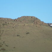
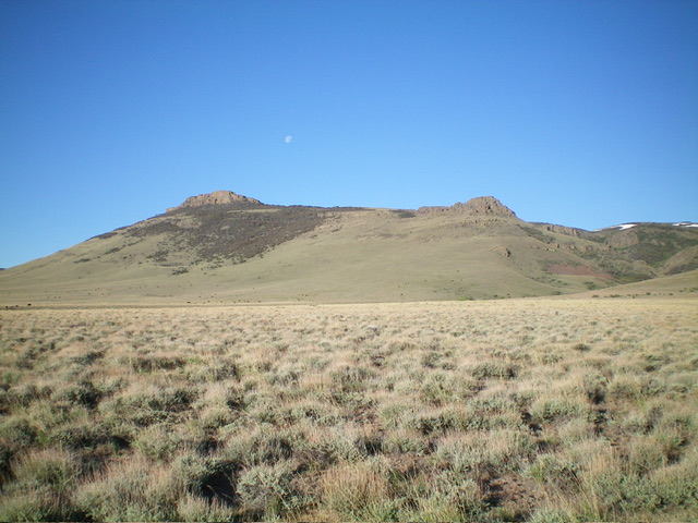
Little Tug is a rugged outcrop located just west of Player Butte in southern Idaho, near the ID/NV border. It is most easily reached from Browns Bench Road to its east. There are currently no recorded ascents of Little Tug. It looks pretty intimidating. USGS Browns Bench South
Access
From US-93 at Rogerson, drive to the center of Rogerson and [signed] 1520N. This is the [paved] Rogerson-Jarbidge highway. Reset your odometer here. Drive 9.3 miles west on the Rogerson-Jarbidge highway to a signed BLM road junction. Go left/south onto this good gravel road (“Browns Bench Road”) and drive about 15 miles south to an unsigned road junction at a creek crossing that is about 0.2 miles north of the Idaho/Nevada border. Park here for a climb of Steamboat and a ridge traverse to Little Tug.
Ridge Traverse from Steamboat (7,098 feet): While the USGS topo map makes this traverse look feasible, visual observation says otherwise. Please refer to the Steamboat page for details on how to reach Steamboat from Browns Bench Road.
Alternate Access
If you plan to climb Little Tug directly from Player Canyon, this is the access route. Consult a land management map because this area is a mix of posted private land and BLM land. From US-93 at Rogerson, drive to the center of Rogerson and [signed] 1520N. This is the [paved] Rogerson-Jarbidge highway. Reset your odometer here. Drive 9.3 miles west on the Rogerson-Jarbidge highway to a signed BLM road junction. Go left/south onto this good gravel road (“Browns Bench Road”) and drive 13.5 miles south to an unsigned road junction.
Turn right/southwest onto a 2-track road and follow it southwest then west for 0.8 miles to a gated road closure/junction at 5,564 feet (map). Go right/north onto a 2-track road that follows a fence row. Reach a fence corner at 0.2 miles. Park here (5,565 feet and 42⁰01’23”N, 114⁰48’40”W) or, if road conditions permit, continue north then west on the 2-track to its end near the mouth of Player Canyon. Contrary to the USGS topo map, the 2-track does NOT go up into Player Canyon. It ends well before reaching the canyon.
Potential Climbing Route (Class 3-4)
From the fence corner, bushwhack west along the right/north side of a fence row that separates BLM land from private ranch land. Reach another fence corner near the foot of the mountains. Head left/south from here on the left/west side of the fence row to reach Player Creek and the mouth of Player Canyon. Bushwhack briefly west up into Player Canyon and find a gully that cuts the north face of Little Tug. Scramble south up this gully to get underneath the summit perch. Climb west up to the small summit.
Additional Resources

