Elevation: 6,847 ft
Prominence: 27

This peak is not in the book. Published December 2024
Mahogany Ridge is a narrow, lengthy ridge that is sandwiched between Pine Spring Ridge to its east and “Dry Canyon Ridge” to its west. It is most easily climbed from Indian Creek Road to its south via an old jeep road that gets you close to its rocky summit. Mahogany Ridge can also be climbed in combination with its big brother (Pine Spring Ridge) to the east. USGS Pegram Creek

Mahogany Ridge HP (according to LOJ) in dead center, as viewed from just north of it. Livingston Douglas Photo
Access
Same as for Pine Spring Ridge HP. This is the second leg of a 2-peak adventure that includes Pine Spring Ridge HP (7,878 feet)and Mahogany Ridge. It covers 6.0 miles with 1,875 feet of elevation gain round trip.
North Face, Class 2
The Climb
From the 7,400-foot merger of the west face/shoulder of Pine Spring Ridge HP and the north end of Mahogany Ridge, follow the rock-and-scrub ridge crest south, using a weak game trail on the right/west side of the ridge to assist. Lower down, use an old 2-track road on the right/west side of the ridge briefly. Leave the 2-track when it descends right/west down into Dry Canyon and heads south to Indian Creek Road.
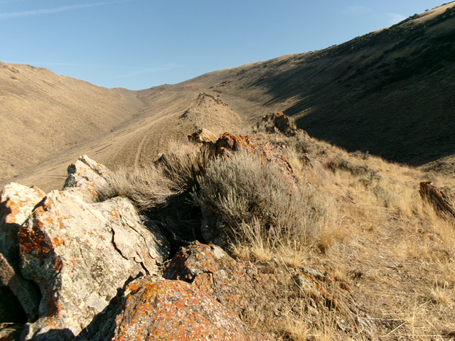
Ironically, Mahogany Ridge has no mountain mahogany on it, just a lot of scrub and narrow ridge rock. The ridge ends at the base of the north face of LOJ’s official high point for Mahogany Ridge—the measured Point 6847 on the USGS topo map. Descend through thick-ish sagebrush to cross a dry gully. Follow a cattle trail briefly up and out of the gully in short scrub to reach the rocky, official summit of Mahogany Ridge. The summit area has two rocky outcrops that vie for the high point. They are not far apart. Stand atop both “just to be sure.” The map is of no help here. The northern outcrop is probably the high point.
The actual high point of Mahogany Ridge is much farther to the north, where the ridge ends (at about 7,400 feet). An insignificant, rocky bump on the lower part of the ridge is deemed the high point of Mahogany Ridge by LOJ for whatever unexplainable reason.

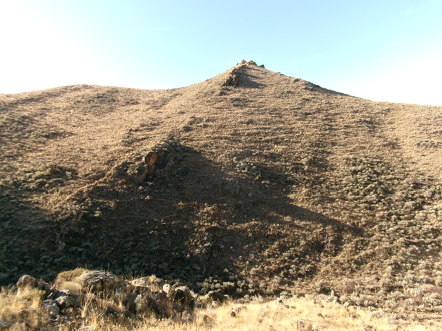
Mahogany Ridge (dead center) as viewed from the 7,400-foot level at its northernmost point. Livingston Douglas Photo
South Face, Class 2
The Descent
From the summit, descend south-southeast through sagebrush and cross a prominent dry gully. Contour south (descending a little as you go) and cross a series of narrow, dry gullies to reach an obvious shoulder crossing (saddle-like) just east of Point 6633. The traverse from Mahogany Ridge is a bit tedious but cattle trails and lanes help in getting through the sagebrush. Once across the shoulder, bushwhack south across easier sagebrush and cross two or three more dry gullies. Reach the final gully that descends to Indian Creek Road just below the pullout/campsite. Stay on an easy sagebrush shoulder on the right/west side of the final gully then drop down to the toe of this shoulder and into the dry gully near its mouth at Indian Creek Road. Cross the road to return to the pullout/campsite and your vehicle.
Additional Resources
Regions: Bear Lake Plateau->SOUTHERN IDAHO
Mountain Range: Bear Lake Plateau
Longitude: -111.2412 Latitude: 42.1088
