Elevation: 7,916 ft
Prominence: 1,256
This peak is not in the book. Published June 2021
Mica Ridge is the high point on a large ridge. There is a named “Mica Ridge” capped off by Indian Mountain located to the west. Thus, calling this peak Mica Ridge is confusing at best. Mica Ridge is a big mountain and should be designated as Mica Peak. It is also one of the most difficult West Mountains peaks to reach. Whether you drive, mountain bike, or hike, the routes are rough with lots of up and down pitches. The view from the summit is amazing. USGS Lone Tree
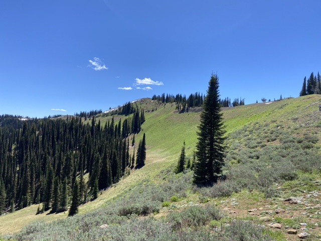
Mica Ridge’s north ridge
Access and Route, Class 1
The most direct route is via West Mountain Jeep Trail/FST-1763. This route is accessed from No Business Saddle. Google Maps provides good directions to No Business Saddle. From the saddle, the road runs south for a rugged 16.0 miles to the 4 Corners Trailhead. At roughly 17.3 miles, this road crosses the top of Mica Ridge. If the word “Jeep” in the road’s name didn’t clue you in, this road is at best a 4WD road and is much better suited for ATVs.
An alternative approach uses FSR-692, which leaves FSR-186 7.3 miles south of No Business Saddle. This road crosses through private property but is still designated as a Forest Service Road. It climbs 2,500 feet over 7.3 rough miles to a junction with the West Mountain Jeep Trail 8.0 miles south of No Business Saddle. From the junction, follow the West Mountain Jeep Trail south to the summit. This is the route I followed and it requires a 4WD. We parked near the FST-1763/FSR-692 junction and walked to the top. Unless you are really into the 4-wheeling experience, I recommend that you park at the junction of FSR-692 and the West Mountain Jeep Trail.
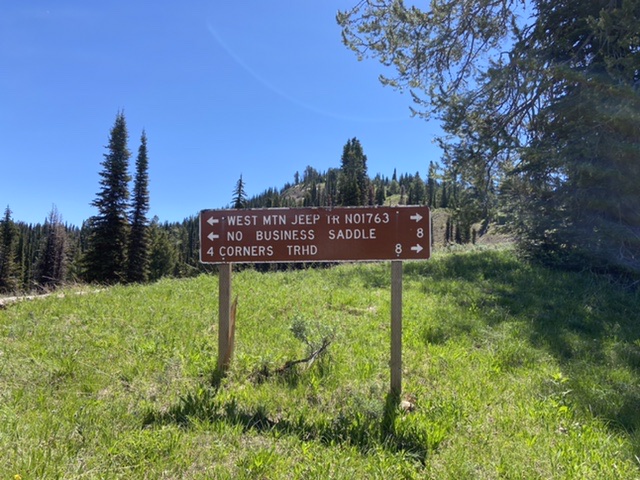
The sign at the junction of FST-1763 and FSR-692.
Although the Payette National Forest lists many ATV trails on its website and has designated the route as the West Mountain Jeep Trail on signs, there is no information about it.
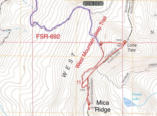
My GPS track for the traverse of Mica Ridge and Lone Tree. (Note: There is a defective straight line in the track near the saddle.) This route covers roughly 2.6 miles and gains just under 600 feet in elevation.
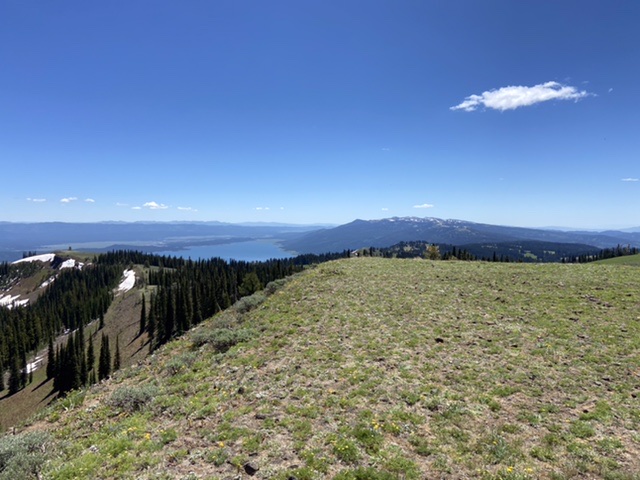
Looking south from the summit–a small tease of the view from the top.
Additional Resources
Regions: West Mountains->WESTERN IDAHO
Mountain Range: West Mountains
Year Climbed: 2921
Longitude: -116.17739 Latitude: 44.64739