Elevation: 6,937 ft
Prominence: 2,397
Climbing, access and historical information for this peak is on Pages 63-64 of the book. The Moose Creek Butte area has been a mythical area from me ever since I learned about the area from Sheldon Bluestein 30 years ago. Mythical because of its Shangri-La type remoteness and reported beauty. A big thanks to Dan Saxton and Daniel Coulter for providing the following trip reports which significantly update the information in the book. USGS Scurvy Mountain
Moose Creek Buttes s the high point of the Moose Mountains subrange of the Clearwater Mountains. USGS Scurvy Mountain
Dan Saxton Trip Report
I climbed the Moose Creek Buttes from the Moose Creek drainage to the north where Road #5440 ends. It is pure bushwhacking up the North Ridge of Point 6415 with some sections brushier and some more open. The ridge of Point 6415 is sharp and needs to be side-hilled on the east side. Then it’s a straight shot up to the summit ridge of the Butte. A simple Class 3 move is required to reach the summit. There are no signs whatsoever of human impact. It’s a very remote summit. Excellent views! You really get a feel for the deep canyons and rugged country of northern Idaho on this peak.
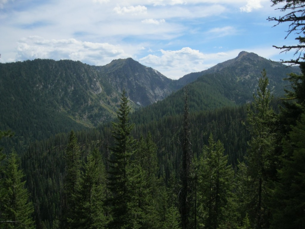
The Buttes as viewed from the Moose Creek Valley. Dan Saxton Photo
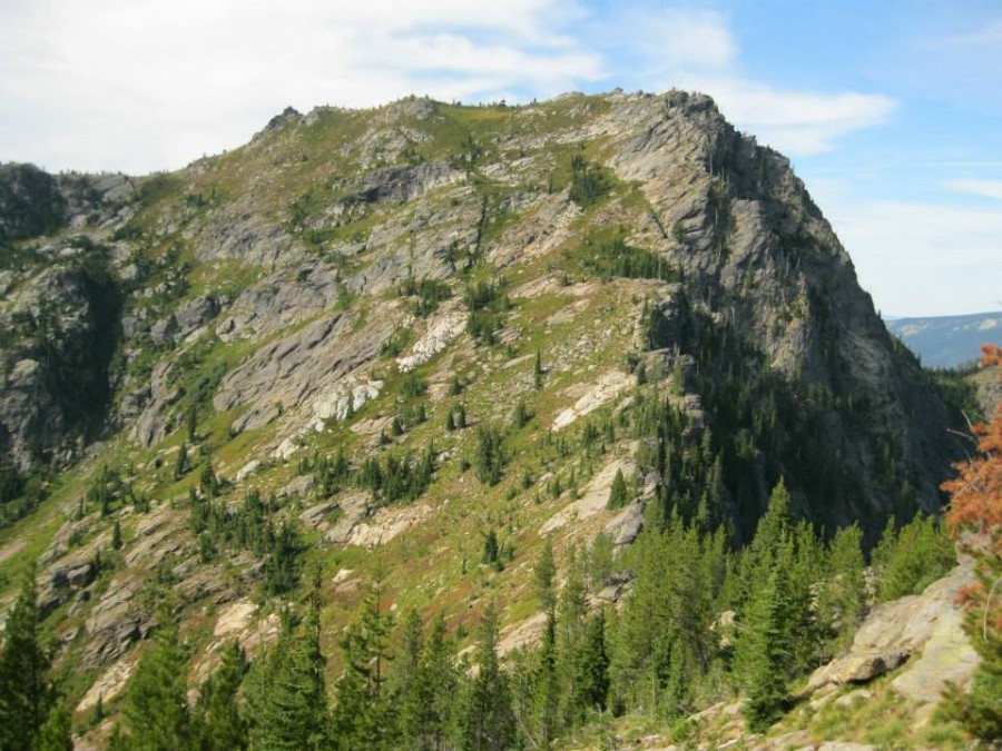
The Moose Creek Buttes main peak as viewed from Point 6415. Dan Saxton Photo
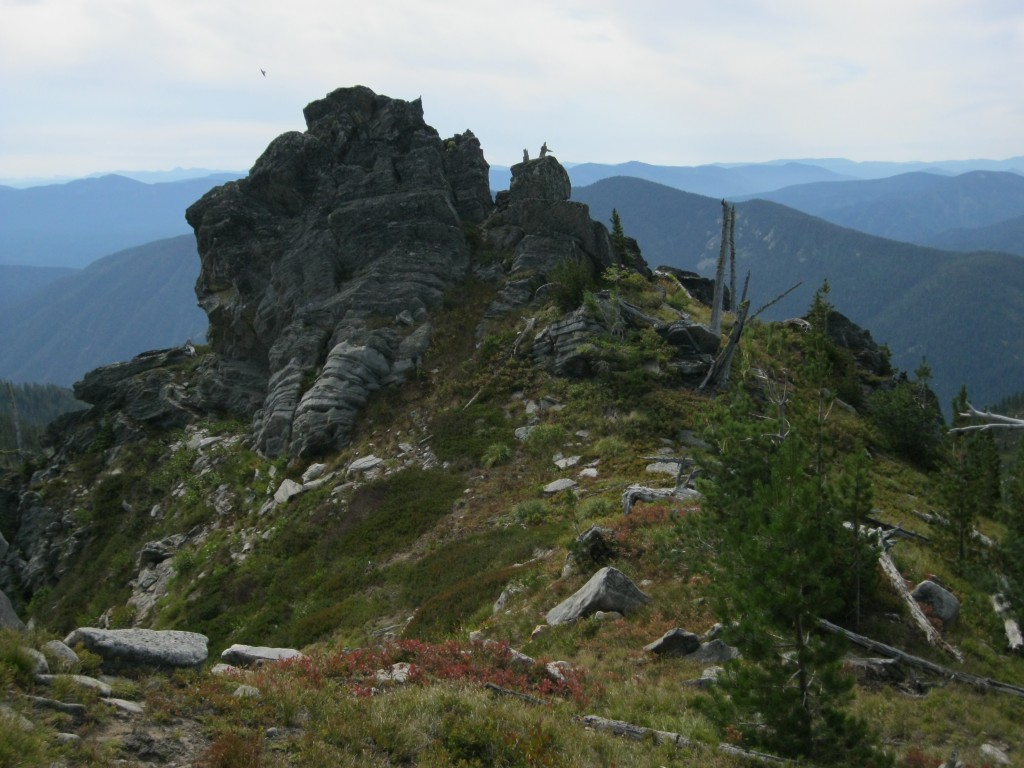
The Class 3 summit block. Dan Saxton Photo
I continued the day by traversing over to the other main peak (Peak 6924) and then went on the crest (relatively open walking, a small Class 3 section off the north side of Point 6745) all the way to Moose Mountain, where I took FST-690 down. The trail is OK high up but it becomes lost in brush on the way down. It’s definitely abandoned. I had to bushwhack down Moose Creek for a mile in heavy brush and grasses.
Please note that due to new mining interests at the end of the Moose Creek Road #5440, starting there is not recommended anymore. Either begin from Deadwood Ridge if you want to do the full traverse of all the peaks (very scenic) or just brave the brushy open south slopes from Kelly Creek, though that way is probably more humdrum.
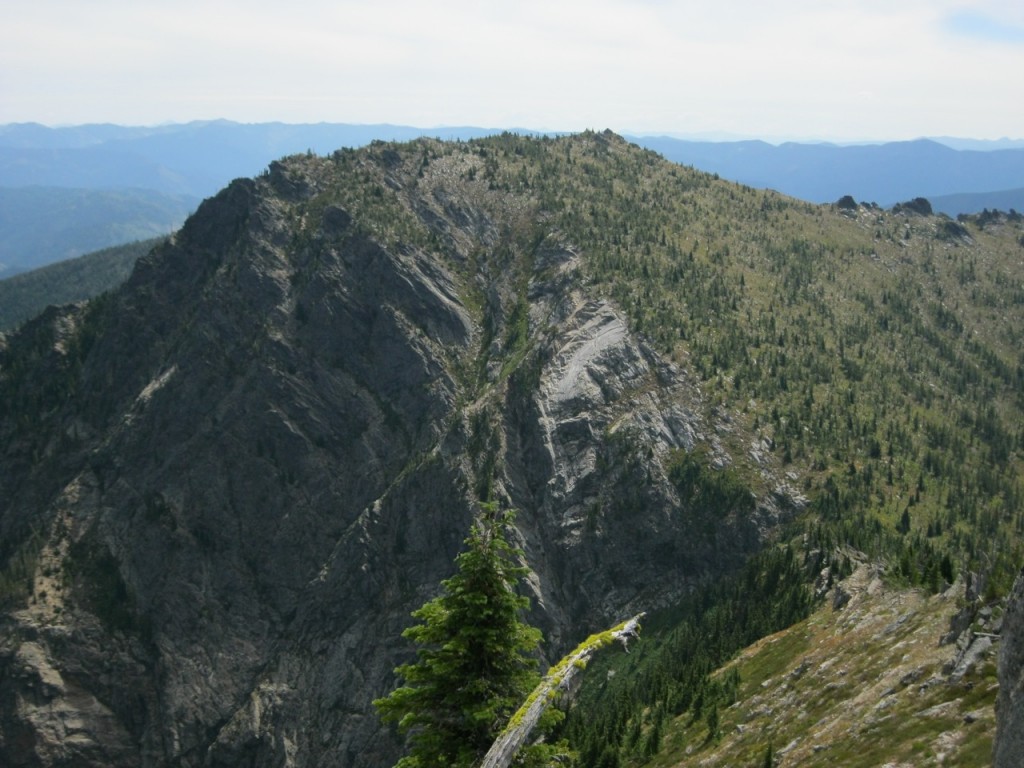
The Moose Creek Buttes high point as viewed from Peak 6924. Dan Saxton Photo
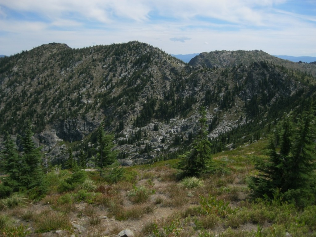
The ridge line of the Moose Creek Buttes. A pleasant walking stretch. Dan Saxton Photo
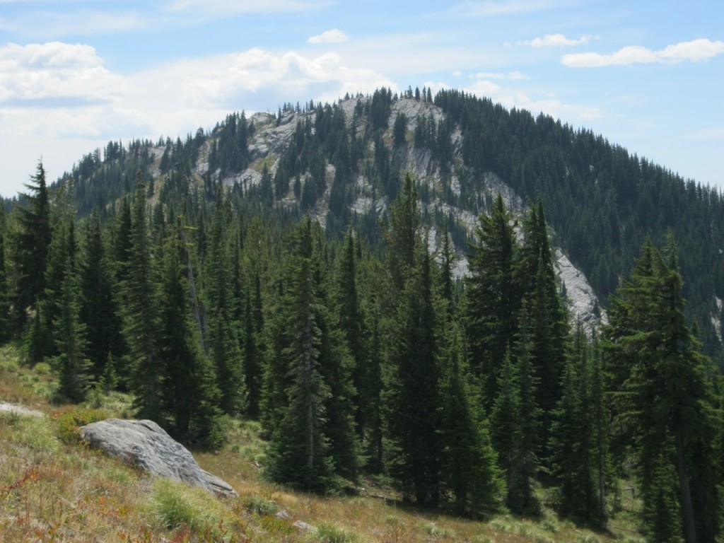
Point 6745 as viewed from the ridge line to Moose Mountain.
Daniel Coulter 2024 Trip Report
Daniel’s original report can be found on peakbagger.com.
Access
I approached Moose Creek Buttes from Superior, MT (my drive out is included in the GPS track). As Ken Jones states, the roads are all great until FR-5440, which requires moderate clearance and is still gated. There is now a parking/turnaround spot just before the gate (despite what a handmade sign along FR-5440 states), but we decided to park a bit lower on the road in an open grassy area (see start of GPS track) to avoid arousing suspicion if anyone drove by. There are a few decent places to camp near the start of FR-5440, which we did the night before our climb.
The Climb
We walked the road to the gate, which was adorned with several no trespassing signs. How exactly we got past the private property is not included in this report, but if we were to have walked through it, we probably would have observed that it is rarely used, but not completely abandoned (as evidenced by some cut trees along the road past the private property). Nevertheless, we observed no other people or vehicles on NF-5440 during our hike or the night before while we were camping along it. The trail is now completely overgrown and did not look like a viable choice anymore. Therefore, at this point, we crossed a log bridge and continued along the road a short while longer to an old mining shack.
Past this shack is where the bushwhacking starts, and it really does not let up until you reach the ridge below point 6415. The bushwhacking is never super challenging, but it is consistently unpleasant and very sustained. There is no clear best route through this section, so just use your best judgement and hope the brush remains tolerable. Do not expect to move at all quickly through this terrain.
We skirted the points 6415 and 6440+ on the southeast side. The terrain here is easier going than lower on the ridge. Once at the saddle between points 6440+ and the summit, we decided on a line to the summit plateau that hugged the rocks on climber’s right. Unfortunately this caused us to miss a game/use trail that we picked up on our descent. Therefore, from the saddle to the summit, I recommend using our descent route to pick up that trail. Once we crested the summit plateau is was a short walk over to the summit block, which required some easy class 3 moves to ascend. We did not locate a register, so Mark left a new one up there (just below and to the northwest of the summit partway up the scramble). Views from the top are quite impressive and we really got a sense of being somewhere very few others have been. Sadly, we did not stay there too long, since we had a long and difficult bushwhack descent to complete, which was just as unpleasant as it was on the ascent.
My Thoughts
This is one of those peaks where the quality of the climbing and the scenery are polar opposites. Once you reach the upper ridge, you get amazing views of the north face of Moose Creek Buttes, which has some really unique geology. Unfortunately, getting there requires one of the most sustained and unpleasant bushwhacks I have had the displeasure of doing. Now that I have completed this peak using Ken’s route, I chuckle at his statement about only coming back in dry conditions. I really cannot imagine any scenario in which I would ever consider braving this peak again. I must also note that this was not my first attempt on this peak. Terri Rowe and I attempted this peak in 2022 from the south (partly due to how bad Ken Jones made his route sound). Needless to say, that was not a successful attempt, due to the most heinous slide alder I have ever encountered blocking us halfway up the south slopes.
Additional Resources
Mountain Range: Central Salmon River Mountains
Longitude: -115.16349 Latitude: 46.74101