Elevation: 10,068 ft
Prominence: 848
Climbing and access information for this peak is on Pages 201-202 of the book. The book covers the route up the peak’s northeast ridge. Judi Steciak and Carl Hamke provided route information and access information for the South Ridge Route. Livingston Douglas provided the route and access information for the peak’s East Ridge Route. Updated November 2022
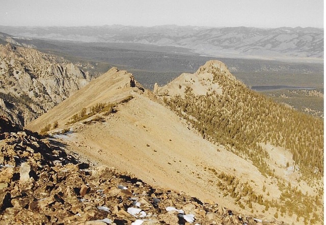
McDonald Peak sits east of the main Sawtooth Crest just southwest of Pettit Lake. It is a peak that can be climbed earlier in the Spring than most Sawtooth Peaks because its slopes melt out earlier than the peaks on the crest. It has also been climbed a number of times in Winter. USGS Snowyside Peak
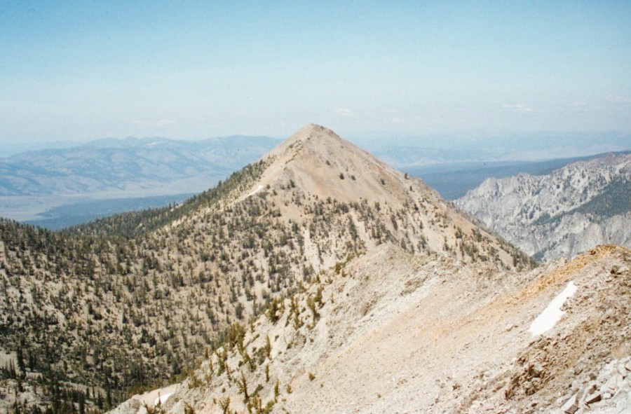
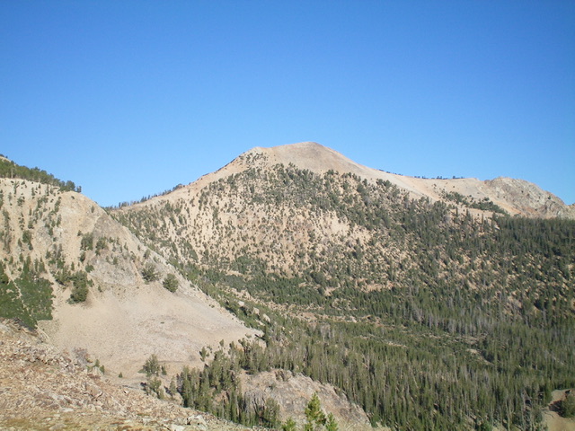
McDonald Peak as viewed from Peak 10027
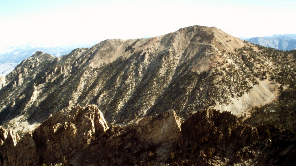
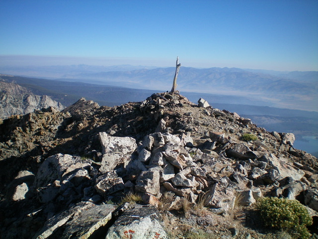
McDonald Peak as viewed from the summit of El Capitan
South Ridge by Judi Steciak and Carl Hamke
Access
Approach update for [(A)(3)(b)] on Page 206: From ID-75, turn west on Cabin Creek Road (FSR-207) about 1.5 miles north of the turnoff for Alturas Lake (FSR-207 is no longer accessible from the Alturas Lake Road). In case the signs are missing: turn left/south at 1.2 miles from ID-75, right/west at about 1.8 miles farther and continue for another 0.2 miles to the Cabin Creek Trailhead.
South Ridge, Class 2
Gain the col between Peak 10027 and Point 9794 from the trail-less lake basin due east of Peak 10027. Either follow the directions on Page 202 for this approach to Peak 10027 or do a short but steep hike over the ridge east of Point 9889 from Lake 9078 in the Cabin Creek drainage [(A)(3)(b) on Page 206]. For the easiest footing, stay on the crest of the ridge as it winds its way up and over Point 9974.
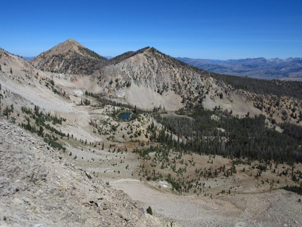
The south ridge of McDonald Peak and Point 9974 as viewed from near Point 9889
East Ridge by Livingston Douglas
McDonald Peak is located northwest of Alturas Lake and south of Pettit Lake on the west side of ID-75 and south of Stanley in the Sawtooth Range. It is a popular peak but, surprisingly, there is no trail to the top. The easiest approach is from the Cabin Creek Trail and its east side.
Access
From ID-75 about 1.5 miles north of Alturas Lake Road, turn left/west onto [signed] Cabin Creek Road/FSR-207. At 1.1 miles, turn left/south at a signed junction to stay on FSR-207. At 2.8 miles, turn right/west onto [signed] FSR-439 for the “Cabin Creek Trailhead.” At 3.1 miles, reach the large trailhead parking lot for the Cabin Creek Trail (7,170 feet).
East Ridge, Class 2
The Climb
From the large trailhead parking area, hike west up the well-beaten Cabin Creek Trail/FST-191 for about 0.4 miles to 7,325 feet. Leave the trail (just before reaching a large gully on the right/north side of the trail) and bushwhack right/north up a steep slope of thick sagebrush to reach the crest of the east ridge. There are scattered pines near the ridge crest here but the ridge itself is mostly open sagebrush and other veg initially.
Once on the ridge, head west through open scrub and soon reach pine forest. You can either bushwhack through the forest near its edge (not too bad) or stay in the open scrub and underlying loose scree/gravel on the left/south side of the ridge. Choose your poison. I chose the forest to avoid the thick scrub and required weaving around to navigate through it. The ridge soon steepens and becomes completely forested. The ridge loses its definition. Just keep climbing west and the ridge crest will reappear and open up a bit.
The slope eases and the forest bushwhack isn’t too bad. Then the ridge bends hard left/southwest at about 8,600 feet and climbs a short, steep section of loose gravel in open terrain (not fun). Thankfully, the forest soon takes over. Climb steeply to a scree hump (Point 9052). The ridge narrows and bends right/west here and is a mix of ridge pines, rocky outcrops/humps, and pure pine forest. There are several ups and downs from Point 9052 to the base of the east face of Point 9794. As you approach Point 9794 (which is at the south end of a major north-south ridgeline that has McDonald Peak at its north end), you can see a line of pine trees ascending diagonally right/north across the east face of Point 9794 at the head of a steep gully (see photo).
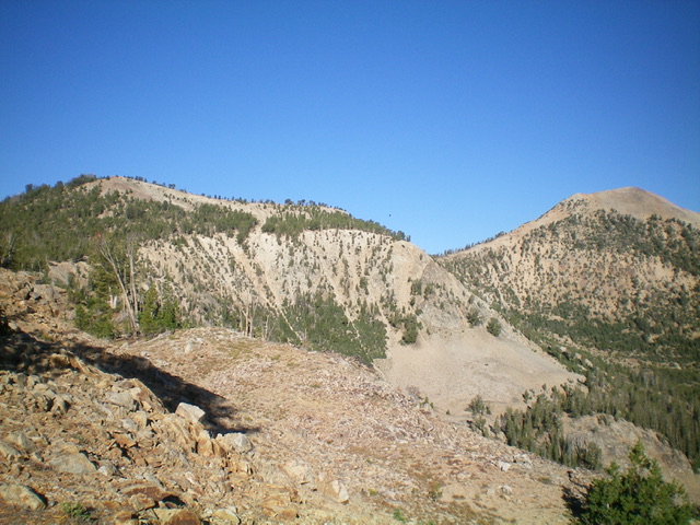
Point 9794 (left) and McDonald Peak (far right) as viewed from high on the east ridge. The diagonal upward traverse (rightward) across the northeast face of Point 9794 follows the line of pine trees in the photo. Livingston Douglas Photo
Follow this line of trees (or just above it) across the east face on surprisingly stable scree/gravel/forest until you must climb left/west up a short section of gravel to reach the ridge crest and avoid the impossible terrain on the east face north of here. Once on the ridge crest north of Point 9794 (at about 9,675 feet), descend the easy, semi-open ridge crest to a gentle saddle at 9,500 feet. From the saddle, scramble northwest then north up the mostly open, rocky ridge crest (with ridge pines to skirt). Find a use trail of sorts on the left/west side of the ridge crest and follow it to reach the first summit hump. Continue north on the easy ridge rock to reach the true summit of McDonald Peak.
The summit had a modest cairn, so I built it up. There is a cairn, post, and survey marker on a slightly lower point to the north on the ridge. When descending the east ridge, be careful to drop right/east through the thick pine forest to find the open, lower section of the east ridge that sits directly above the Cabin Creek Trail. The ridge is ill-defined in this forested section, so it is easy to get off course and end up quite a distance from the trailhead.
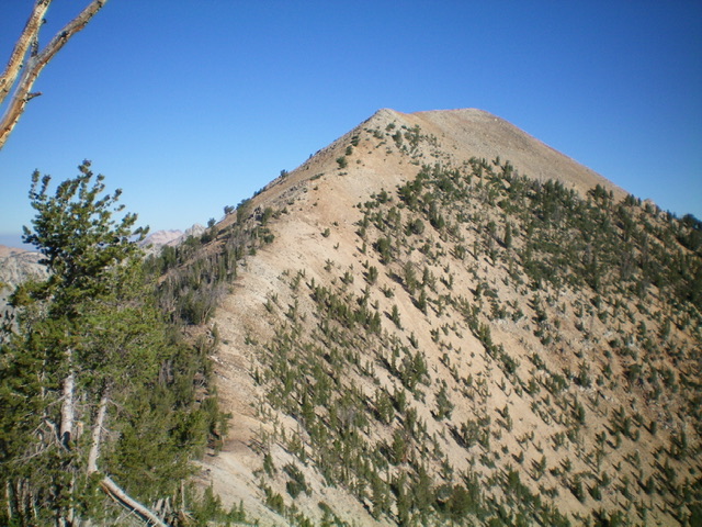
Looking up the south ridge of McDonald Peak. This was the final leg of my ascent route. Livingston Douglas Photo
Additional Resources
Mountain Range: Sawtooth Range
Year Climbed: 1993
