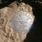
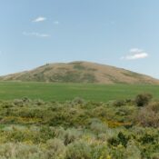
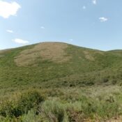
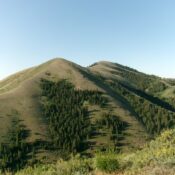
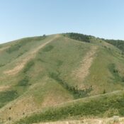
Swan Benchmark by Livingston Douglas

This peak is not in the book. Published December 2024 Swan Benchmark is located on a high ridge just southeast of Malad Summit. This ridge separates Devil Creek from Cherry Creek. Peak 7060 to its south-southeast is the high point on this ridge. This area is a mix of public land and posted, private land so be careful. This climb … Continue reading

Morgan Ridge by Livingston Douglas

This peak is not in the book. The map elevation is 7,718 feet. Published December 2024 Thanks to LiDAR, Morgan Ridge is now a ranked summit. Morgan Ridge is a lengthy ridge that is located on the north side of Maple Creek. It is most easily climbed via its southwest ridge from FST-306. USGS Mapleton Access Maple Creek Road is … Continue reading

Peak 7147 by Livingston Douglas

This peak is not in the book. Published December 2024 Peak 7147 is a minor scrub hump on the east side of Aspen Creek in the Bannock Range south of Downey. It is a ranked bump on the north ridge of Peak 7514. This area is a mix of private and public land. This climb is entirely on BLM land. … Continue reading

Rocky Peak by Livingston Douglas

This peak is not in the book. Published December 2024 Rocky Peak is a misnomer. This peak is not rocky at all. It is entirely on private land. Pacificorp owns most of the land surrounding Oneida Narrows Reservoir and allows hiking on their private land. It is unclear if Rocky Peak is on Pacificorp land or not, but I encountered … Continue reading

Cleveland Hill by Livingston Douglas

This peak is not in the book. Published December 2024 Cleveland Hill is a magnificent hill that oversees the south end of Oneida Narrows Reservoir. Pacificorp owns most of the land surrounding Oneida Narrows Reservoir and allows hiking on their private land. It is unclear if Cleveland Hill is on Pacificorp land or not, but I saw no signage or … Continue reading

Peak 5955 by Livingston Douglas

This peak is not in the book. Published December 2024 Peak 5955 is a gentle elongated hump that sits above Oneida Narrows Reservoir (to its west) and Strawberry Creek and ID-36 (to its east). This area is mostly private land. Pacificorp owns much of the land near Oneida Narrows Reservoir. Hiking is permitted by Pacificorp. It is unclear whether or … Continue reading