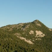
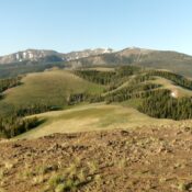
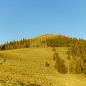
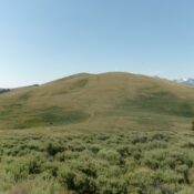
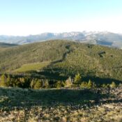
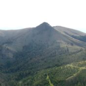
Eagles Nest by Livingston Douglas

This peak is not in the book. Published November 2023 Eagles Nest is a rocky crag located above the confluence of Pine Creek and the Salmon River. It is most easily climbed from its north or northeast sides but the approach could be problematic. The south and west sides of Eagles Nest are rocky and very steep. Extreme caution is … Continue reading

Trapper Ridge by Livingston Douglas

This peak is not in the book. Published November 2023 Trapper Ridge is a ridgeline that is located just west of Jureano Mountain. It sits at the head of Trapper Gulch and Little Jureano Creek deep in the Eastern Salmon River Mountains. Trapper Ridge is most easily reached via FSR-061 which follows the high ridge crest in this area. USGS … Continue reading

Peak 7580 by Livingston Douglas

This peak is not in the book. Published November 2023 Peak 7580 is located deep in the Eastern Salmon River Mountains, just east of East Boulder Meadow on a high ridgeline. It is an easy bushwhack then boulder scramble from nearby FSR-023. The drive to get there will give you more concerns than the climb itself. USGS Napoleon Hill Access … Continue reading

Peak 6795 by Livingston Douglas

This peak is not in the book. Published November 2023 Peak 6795 is located on a ridgeline just west of Napoleon Hill, deep in the Eastern Salmon River Mountains. This area is a mix of live pines and burnt pines. An old jeep track climbs the south ridge of Peak 6795 and then skirts its east side. Only a modest … Continue reading

Napoleon Hill by Livingston Douglas

This hill is not in the book. Published November 2023 Napoleon Hill is located at the north end of a long north-south ridgeline that separates Moose Creek (t the west) from the Salmon River (to the east). Both the north summit and south summit are 85 feet above the saddle at the base of the south ridge, more than the … Continue reading

Peak 7772 by Livingston Douglas

This peak is not in the book. Published November 2023 Peak 7772 is a charred ridge hump that is located just over 1-1/2 miles south of Napoleon Hill. It is a short scramble from FSR-020/Ridge Road in an extensive burn area. There is no clear high point, just a summit cap area. USGS Napoleon Hill Access From the Sinclair Gas … Continue reading