Peak 5895 by Livingston Douglas

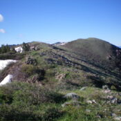
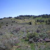
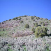
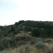
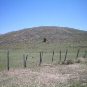
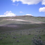
This peak is not in the book. Published November 2024 Peak 5895 is an open ridge hump located southeast of American Falls and just west of Fort Hall Indian Reservation Land. Thanks to LiDAR, this peak recently lost its status as a ranked summit. It is positioned in the land of many windmills and has a service road to near … Continue reading

Peak 6450 by Livingston Douglas

This peak is not in the book. Published November 2024 Peak 6450 is a minor hump located in the southwest corner of the South Hills in the Sawtooth National Forest. It can be most easily reached from roads east of Rogerson near US-93. USGS Hopper Gulch Access From US-93 just north of Rogerson, turn east onto [signed] 1600N and reset … Continue reading

Peak 5613 by Livingston Douglas

This peak is not in the book. Published November 2024 Peak 5613 is a minor hump that sits between Burnett Canyon and Trail Creek, just east of the Malad River in the Bannock Range in the southern reaches of Idaho. It is located along I-15 just north of the ID/UT border. USGS Henderson Creek Access From Exit 3/Woodruff on I-15 … Continue reading

Peak 6896 by Livingston Douglas

This peak is not in the book. This peak has a map elevation of 6,907 feet. Based on LiDAR measurements, the elevation is 6,896 feet. Published November 2024 Thanks to LiDAR, Peak 6896 is now a ranked summit. It sits above Box Canyon and at the head of Valve House Draw in the Bannock Range. Peak 6896 is most easily … Continue reading

Peak 6665 by Livingston Douglas

This peak is not in the book. Published November 2024 Peak 6665 is a pyramidal hump that sits above Lower Valley in the Wooley Range of eastern Idaho. It is entirely on private land.  You must obtain permission before undertaking this climb. USGS Lower Valley Access From ID-34 near the southeast corner of Blackfoot Reservoir, turn right/east onto [signed] Blackfoot … Continue reading