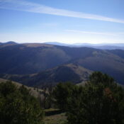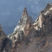
The Heyburn Divide runs east from the main Sawtooth crest at Braxon Peak and encompasses some of the most challenging Sawtooth formations. This divide, its routes, and history are discussed in the book on Pages 171 to 176. The divide was the first to catch the interest of mountaineers following in the footsteps of the Underhills. The West Pinnacle and … Continue reading
Book Updates
Climbing and access information for this peak is on Pages 322-323 of the book. Published November 2023 Skytop Peak is located on the Continental Divide. It sits above both Skytop Lake (MT) and Timberline Lake (MT). Skytop Peak is most easily climbed via the West Fork Wimpey Creek Road and its southwest ridge/southwest face. USGS Goldstone Pass Access From the … Continue reading
This peak is not in the book. Published November 2023 Pass Benchmark is the high point on a ridgeline that sits south of Cruikshank Creek and east of Railroad Canyon in the Beaverhead Mountains. It rises significantly off the valley floor northeast of Leadore and has over 1,000 feet of prominence. USGS Reservoir Creek Access Same as for Peak 9501Peak … Continue reading
This peak is not in the book. Published November 2023 Peak 9501 is the high point on a ridge that separates Frank Hall Creek from Wildcat Creek. Peak 9501 and its neighbor Pass Benchmark (9,567 feet) are unusual in that they are both relatively high peaks that are in the foothills of the Beaverhead Mountains rather than up on the … Continue reading
This peak is not in the book. Published November 2023 Grizzly Hill sits on the Continental Divide in the Beaverhead Mountains north of Leadore. It is most easily reached from Bannock Pass via FSR-012. A forest bushwhack is required to reach the summit. USGS Bannock Pass Access From the signed junction of ID-28 and ID-29 in Leadore, drive northeast on … Continue reading
This peak is not in the book. Published November 2023 Peak 9140 sits on the Continental Divide at the head of both the Short Creek and Poison Creek drainages. It is most easily climbed via its west ridge from Reservoir Creek Road/Trail. The USGS topo map mislabels this peak as Peak 9118 but the contour lines give it an elevation … Continue reading