Elevation: 6,443 ft
Prominence: 343
This peak is not in the book. Published November 2023
Panther Benchmark is the lowest, and farthest southwest, of three ranked summits on a high ridge that separates the Salmon River from Hot Springs Creek. It is most easily approached from FSR-060/Hot Springs Creek Road which was recently regraded extensively. USGS Pine Creek Rapids
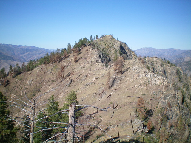
Panther Benchmark as viewed from the northeast. Livingston Douglas Photo
Access
Same as for Peak 6667. This is the third leg of a 3-peak adventure that includes Peak 6667, Peak 6514, and Panther Benchmark (6,443 feet). It covers 8.3 miles with 3,750 feet of elevation gain round trip.
Map Errors
The “pack trail” on the high ridge crest (shown on the USGS topo map) is completely gone. The Forest Service Trail from the Hot Springs to the summit of Panther Benchmark (shown on the Salmon National Forest Map) is mostly gone. FSR-060 was recently completely regraded and is in much better shape than the USGS topo map and the Salmon National Forest Map indicate.
East Ridge, Class 2
The Climb
From the 6,080-foot connecting saddle with Peak 6514, scramble west up a mix of scrub and rock to skirt a saddle on the east ridge. Stay on the left/south side of the ridge crest, finding an old trail to help you finish off this peak. The trail leads to the wreckage atop the small summit of Panther Benchmark. The summit has the remains of an old cabin/lookout strewn about. It also has a USGS benchmark in a ground boulder. There is no summit cairn.
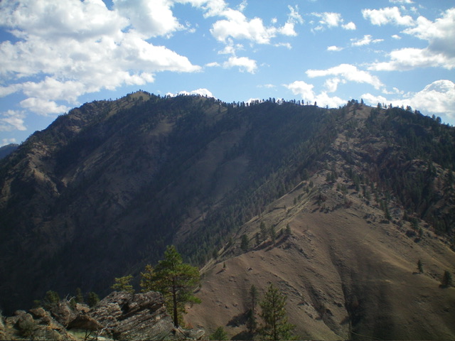
The rocky summit hump of Panther Benchmark as viewed from Point 6258 to its east. Livingston Douglas Photo
East Ridge/South Shoulder, Class 2
The Descent
From the summit, follow the remains of an old trail (shown on the Salmon National Forest map but not on the USGS topo map) back to the 6,080-foot connecting saddle just below Point 6258. The trail dies out before reaching the saddle but the terrain is not difficult. From the saddle, pick up a weak use trail that heads southeast from the saddle to the south shoulder of Point 6258. Once on the shoulder, the trail soon disappears. Follow the easy, semi-forested shoulder south then south-southeast down to 4,800 feet. Leave the shoulder and descend into a dry gully on its left/east side.
Once in the gully, leave it to contour left/east across a few shoulders and minor gullies in easy scrub to then bend left/north when the Hot Springs are below you and to your right/east (you can smell the sulfur). The terrain soon roughens so descend right/east into a forested drainage and cross a small stream that feeds the Hot Springs. Follow a good use trail north along the right/east side of the stream then scramble up steep scrub to reach FSR-060 above you. Hike about 0.6 miles northeast up FSR-060 to return to the road closure gate and your parked vehicle.
The lower portion of the southeast side of the high ridge is riddled with perilous cliff bands. Be very careful of the line that you take to return to FSR-060. It is easy to get into serious problems in rocky, impossibly steep terrain or cliff bands and not be able to reach the road.
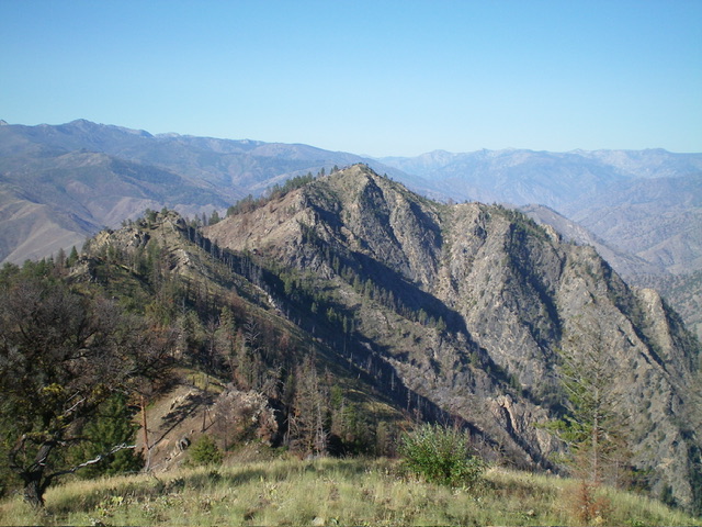
Panther Benchmark (summit is left of center) and its long southwest ridge as viewed from Peak 4618 to its west. Livingston Douglas Photo
Additional Resources
Mountain Range: Eastern Salmon River Mountains
Longitude: -114.3532 Latitude: 45.3195