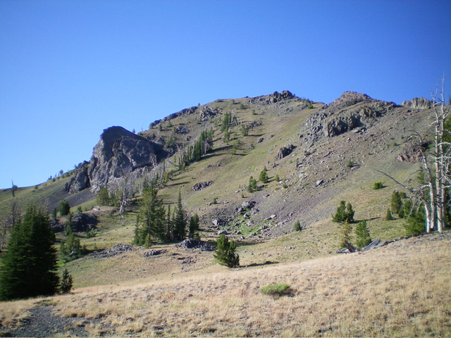
Elevation: 10,096 ft
Prominence: 356
This peak is not in the book. Use the link below to see Dan Robbins’ trip report. Updated November 2024
Peak 10096 is the high point on a north-south ridgeline that separates Copper Creek from the Little Wood River. It is most easily climbed from the Copper Creek Trail to its east. Peak 10096 is overshadowed by its rugged neighbor to the northeast, Glide Mountain (10,256 feet). USGS Star Hope Mine
Access
The Bear Canyon trailhead is located at the back end of the Star Hope Campground. There is a pullout for 3 vehicles. Park here(7,955 feet). The Bear Canyon Trail/FST-062 begins about 50 yards from the parking pullout in an open meadow to the left/south, where it is signed. Star Hope Campground is located 8.0 miles southwest of the Copper Basin Guard Station on the Copper Basin Loop Road/FSR-138 and 9.1 miles south of the north end of the Copper Basin Loop Road/FSR-138 where it has a junction with the Copper Basin Road/FSR-135. This is the first leg of a 2-peak adventure that includes Peak 10096 and Peak 9365. It covers 11.0 miles with 3,175 feet of elevation gain round trip.
Map Errors
The USGS topo map lacks trail numbers for the multiple hiking trails in this area. The trail numbers on the Adventure Maps Trails Map are completely wrong except for the Bear Canyon Trail (FST-062) and White Mountain Trail (FST-043). The USGS topo map fails to show the segment of FST-043 that comes over from the White Mountains up to the pass just east of Peak 9365. This is a major oversight. This critical pass is the low point between Peak 10096 and Peak 9365.
East Ridge, Class 2
The Climb
From the campground/trailhead, hike west up Bear Canyon Trail/FST-062 (with 120 feet of extra uphill round trip) until it drops to cross to the left/south side of Bear Creek. The creek crossing is shallow and not too wide. The trail goes through a patch of willows here. Continue west up the trail. It crosses Copper Creek and heads west up to a signed trail junction. Go left here for the Copper Creek Trail/FST-061 or right continue on the Bear Canyon Trail/FST-062, which leads to the White Mountain Trail/FST-043 in just over a mile. Go left here.
Follow the Copper Creek Trail as it heads southwest then south up the Copper Creek drainage. The trail is poorly maintained. It is weak in meadows and nonexistent in sections higher up. The trail reaches a flat, saddle-like spot and an unsigned trail junction. Continue left/south up Copper Creek on FST-061. The trail crosses to the left/east side of Copper Creek and becomes indistinguishable. Find it again on a shoulder on the east side of the small stream. Higher up, the trail passes a small pond and disappears. Find the trail higher up and follow it upward as it goes through a forested section and heads diagonally right/southwest up to a pass at 9,740 feet.
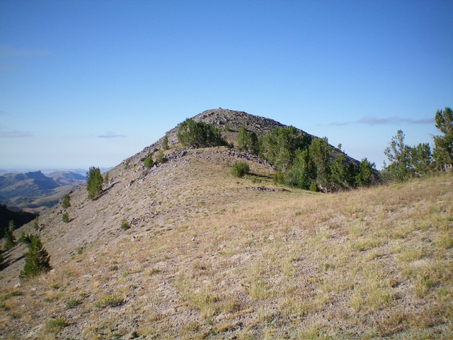
This pass sits underneath Peak 10096 to its west. From the pass, scramble west up a steep ridge of grass/scrub then rocky ridge outcrops and loose scree/gravel. There is a weak, on-and-off, goat/use trail that may help you in the looser sections. Reach a nice knoll of short grass on the north ridge and head left/south to the summit hump in short grass/scrub and some scree/gravel. The summit of Peak 10096 has a decent cairn and nice views of nearby peaks, particularly Glide Mountain.
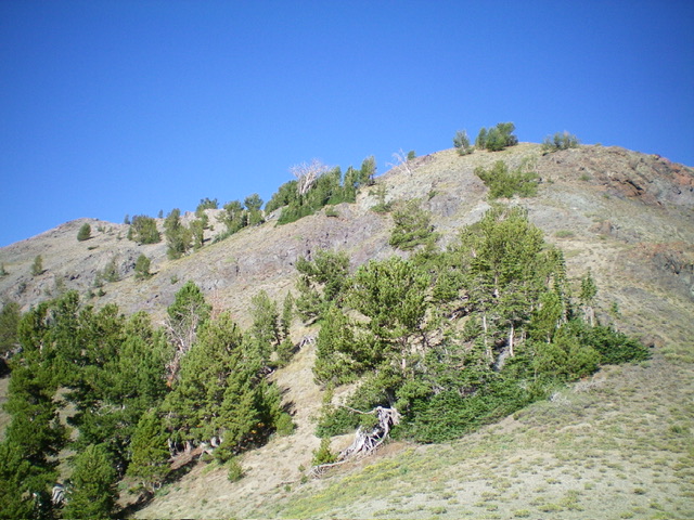
Peak 10096 (summit is at far left) and its east ridge (right of center). This was my ascent route. Livingston Douglas Photo
East Ridge/Lower North Ridge, Class 2
The Descent
From the summit, return to the pass. Follow Copper Creek Trail north-northwest down Copper Creek to the unsigned trail junction previously mentioned. Go left onto FST-327/Skyline Trail and follow this narrow but decent foot trail as it heads northwest then north then northwest to skirt the east side of Point 9881. The trail climbs diagonally left/northwest and rises 75 vertical feet to reach a saddle at 9,260 feet. Leave the trail here and scramble north up a mix of scrub, scree, and scattered pines over two ridge humps. The ridge now bends left/northwest and has much more ridge pines and blowdown to contend with but it is still semi-open.
Climb a final ridge hump and enter a thick pine forest to descend north-northwest to a hidden pass. This bushwhack is a bit tedious (but short) due to dense pines and copious blowdown. The 8,860-foot pass has nice, open field grass with a trail coming up over it (not shown on maps). It is the low point between Peak 10096 and Peak 9365. It concludes the first leg of today’s 2-peak journey. Peak 9365 is up next.
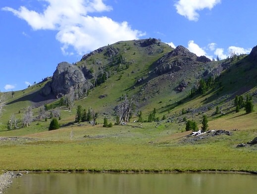
Copper Trail Peak. Dan Robbins Photo
Additional Resources
Regions: EASTERN IDAHO->Pioneer Mountains
Mountain Range: Pioneer Mountains
Longitude: -113.97679 Latitude: 43.71239
