Elevation: 10,102 ft
Prominence: 362
This peak is not in the book. Livingston Douglas added new route information and new photos. Updated November 2024
Peak 10102 is located northwest of Peak 10356. The peak can be approached from the north via the North Fork Big Lost River Road and then either Squib or Miller creeks. It can also be approached from the south via Trail Creek. The Trail Creek approach is undoubtedly the most efficient. You can also climb the peak by traversing the ridge from Peak 10356. USGS Meridian Peak
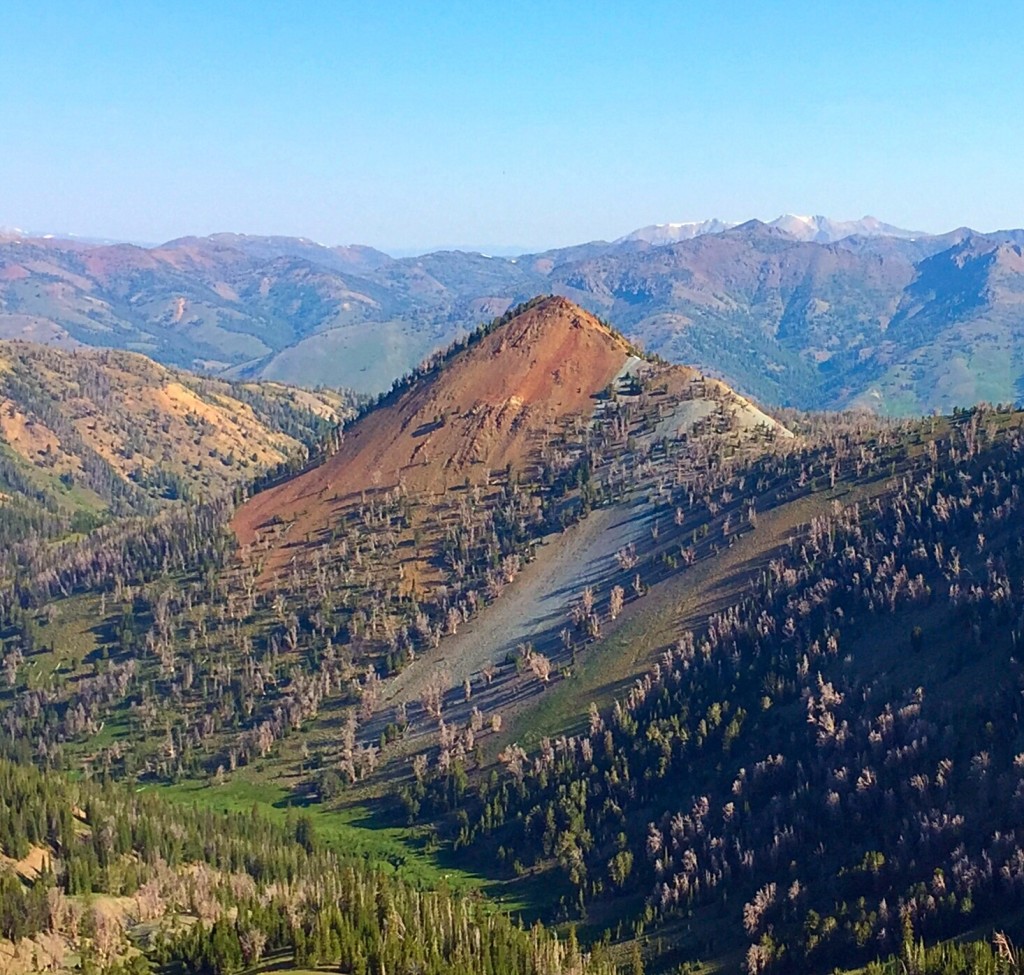
Peak 10102 as viewed from Peak 10340.
West Face and North Ridge/West Face by Livingston Douglas
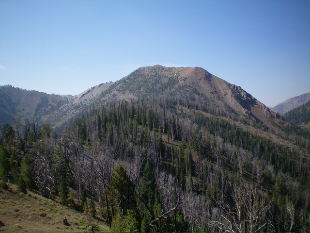
Peak 10102 as viewed from midway up the north ridge. This was my descent route. The summit bump is just left of center. Livingston Douglas Photo
Access
Same as for Ursa Peak (10,284 feet). This is the second leg of a 2-peak adventure that includes Ursa Peak and Peak 10102. It covers 8.5 miles with 3,650 feet of elevation gain round trip.
Map Errors and Other Corrections
The USGS map fails to show the full extent of the frontage road on the south side of the North Fork Big Lost River. This critical (and decent) 2-track leads to the Squib Canyon spur road. The USGS topo map fails to show the full extent of the Squib Canyon Trail. The National Forest map shows the Squib Canyon Trail heading south all the way up to an old mine at 9,200 feet. It ends long before that. The trail never even heads up that gully.
West Face, Class 2+
The Climb
From the 9,260-foot connecting ridge with Ursa Peak, bushwhack east up through a thick but reasonable pine forest to quickly reach steeper terrain. While there is no official ridge here, keep following pine trees on minor ridges first to the right then to the left. Higher up, look for ground rock and scattered pines to make upward progress on the steep scree/gravel base. Use some diagonal game trails to assist you in your upward advance.
The scattered pines go almost all the way to the summit ridge crest. A final push up talus/scree (not as steep) leads to the summit area. Head right/south to the high point a short distance away. The high point is the southern of two rocky humps. The north summit is 3-5 feet lower in elevation. There was a small summit cairn, which I built up considerably.
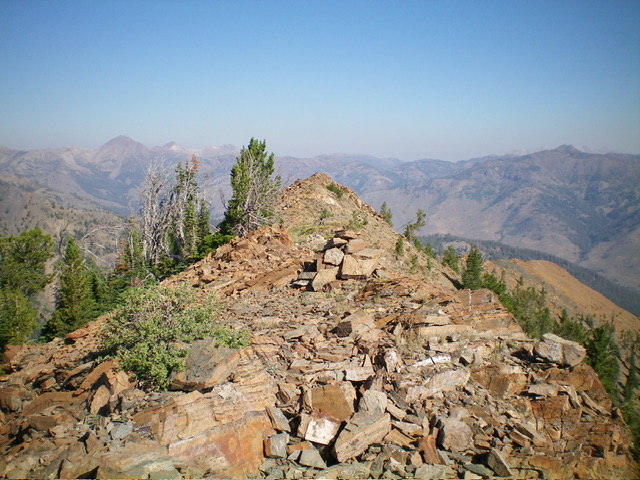
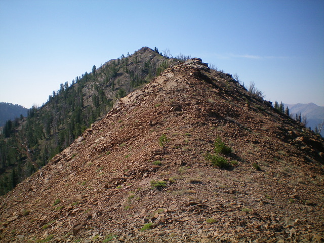
The summit cairn atop Peak 10102, looking northwest at the slightly-lower, northwest summit. Livingston Douglas Photo
North Ridge/West Face, Class 2
The Descent
From the summit, follow the narrow, rocky ridge crest northwest to the [lower] north summit. From there, descend north then northeast down steep-ish rock and loose scree/gravel (with some goat trails) to reach flatter terrain and a pine forest. Continue north-northeast then north down an enjoyable mix of scattered pines, minimal deadfall, tundra, pine duff, and gravel. Reach open, rocky Point 9413 and take some photos from here.
Continue another ½ mile north down the narrow, rocky (but easy) ridge crest to reach Point 9202. There are still many sections of easy tundra and gravel. This point is covered with tundra rather than rock. Leave the ridge here and descend northwest on a forested, rounded shoulder (more of a face) with an obvious drainage on its right/north side. This descent to Squib Creek is fast and easy, thanks to a thick (but easy) pine forest with steep duff/gravel and minimal deadfall.
As you approach the drainage, stay above it on its right/east side on a game trail that traverses the face. When the semi-open forest becomes not so steeply angled, descend to Squib Creek and cross the small stream. Once across the stream, search for the foot trail that leads back down to the trailhead in about ½ mile.
Additional Resources
Regions: Boulder Mountains->EASTERN IDAHO
Mountain Range: Boulder Mountains
Longitude: -114.29269 Latitude: 43.88709
