Elevation: 10,152 ft
Prominence: 412
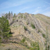
This peak is not in the book. Published November 2024
Peak 10152 sits at the head of Blind Creek on a ridgeline that is just north of the main Boulder Mountains ridge crest. The shortest route to the top is from the North Fork Big Lost River Road to its north. USGS Meridian Peak
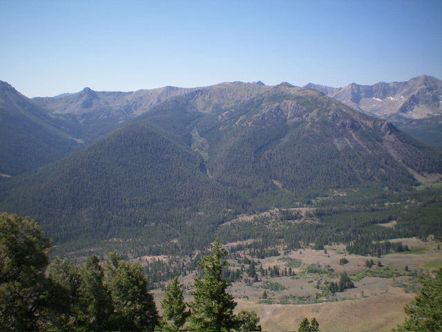
Peak 10152 (dead center in mid-ground) with Blind Creek just left of center. I ascended the ridge right of Blind Creek and descended the forested ridge left of Blind Creek. Livingston Douglas Photo
Access
North Fork Big Lost River Road/FSR-128 [(B)(2) on Page 242 of the Book]. From the signed road junction of Trail Creek Road and North Fork Big Lost River Road (the northeast of two such junctions), reset your odometer. Drive northwest then west up [maintained] FSR-128. At 11.2 miles, cross a bridge over a feeder creek. At 11.3 miles, reach a signed junction with FSR-601 (left). Go left onto FSR-601 and drive south for about 100 yards to a shallow fording of the North Fork Big Lost River. Park in a pullout just after this fording (as I did) or, better yet, drive another 0.1 miles on FSR-601 to an unsigned junction. Go right/southwest at this junction and drive 0.1 miles to an unsigned junction with a gated spur road heading right/west. Park here.
Map Errors
The USGS topo map is missing almost all of the side roads in the Blind Creek area. It shows FSR-128 as a jeep trail from Blind Creek westward. It is actually a rocky, narrow road but is not a jeep trail. I drove it all the way to its end at the North Fork Creek trailhead. The National Forest map fails to show the section of FSR-601 that intersects FSR-128 just west of the bridge crossing at the 11.2-mile point. The National Forest map fails to show the full extent of the spur road (now gated but still open to motorized vehicles) that traverses the north side of Peak 10152.
Northeast Spur/North Ridge, Class 2+
The Climb
From the junction at the base of the gated spur road, hike west up the spur road for about 0.2 miles to a culvert crossing of [small] Blind Creek. Leave the road here (at about 7,865 feet) and bushwhack south up the right/west side of Blind Creek in a thick pine forest with lots of deadfall. A ridge soon forms and follows the creek drainage. Use a game trail to get up through the thick forest and blowdown.
The ridge bends right-ish/southwest and gains definition. But there is little relief from the pines, ground firs, and blowdown until just above 9,100 feet. There is some ridge rock and talus to climb here (Class 2+) but the open terrain soon gives way to move pine forest. Finally, as the northeast spur is about to reach its junction with the north ridge (at about 9,800 feet), the terrain opens up and is mostly ridge rock with a few scattered pines and some ground firs.
Head left/south at the ridge juncture and scramble up rocky ridge outcrops (or skirt them on angled, loose scree) to move past Point 9974 and drop 25 vertical feet to a saddle. From the saddle, continue up to the very rocky northwest summit outcrop (Class 2+). Downclimb 75 feet off this very rocky, narrow hump (Class 2+) to a gentle saddle then scramble up more ridge outcrops (Class 2), heading southeast to the rocky summit perch. The summit has a modest cairn which I built up a bit.
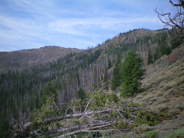
Peak 10152 (left of center) and its north ridge (right of center). This was my ascent route. Livingston Douglas Photo
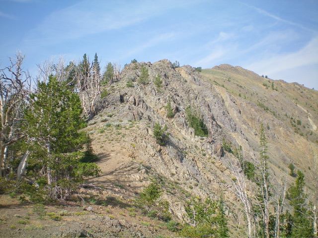
Peak 10152 (summit hump is right of center) and the rocky upper northeast ridge (left of center). This was my descent route. Livingston Douglas Photo
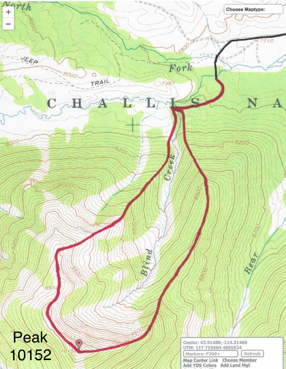
The black line is North Fork Road and the spur road. The red line is the ascent route (to the left) and the descent route (to the right).
Northeast Ridge/Northwest Spur, Class 2+
The Descent
This route is a more direct route from the spur road but it is more thickly forested than the north ridge route. From the summit, descend east on a narrow, rocky ridge crest in a mix of rocky ridge outcrops and loose scree/gravel. Reach a semi-forested ridge section where the ridge bends left-ish/northeast and has a few large ridge buttresses to downclimb (Class 2+). Enter a thick pine forest and work through (or around) ridge trees and blowdown, using an on-and-off game trail to help navigate through this mess.
Aim for a forested hump (which rises only 5-10 feet) and continue north-northeast then north on the narrow, thickly-forested ridge crest down to about 8,800 feet. Look for a northwest spur and descend northwest through a thick pine forest (with modest blowdown) to approach Blind Creek. Stay on a game trail that contours north on the right/east side of the creek drainage for as long as possible. The creek drainage becomes wider and flatter.
Leave the game trail and bushwhack along the flatter creek drainage to quickly reach the spur road at the culvert crossing of Blind Creek. Follow the road right/east down to the gated road closure and your parked vehicle. If you parked lower down, follow the 2-track road left/north down to an unsigned junction then continue another 0.1 miles left/northwest to the pullout at the fording of the North Fork Big Lost River. This descent route was brutal on my body. I had bleeding knees, a punctured left thigh, and an aching back after this bushwhack. Not a fun one.
Additional Resources
Regions: Boulder Mountains->EASTERN IDAHO
Mountain Range: Boulder Mountains
Longitude: -114.3402 Latitude: 43.8987