Elevation: 10,184 ft
Prominence: 324

This peak is not in the book. Below there are two routes described. Livingston Douglas report is first and Margo Mandella’s report which addresses Dan Robbins’ route is second. Livingston’s route avoids the fording of Wild Horse Creek of the Robbins’ Route, is slightly shorter, and includes a soft-ranked peak to the north of Little Kane Peak. Updated November 2024
North Ridge and East Ridge by Livingston Douglas
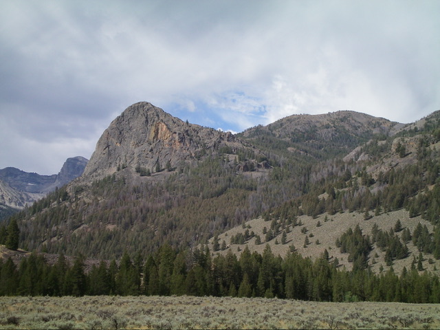
Little Kane Peak is the high point on a ridgeline that separates Little Kane Creek from Boulder Creek and Wildhorse Creek to the east. It can be climbed from the Boulder Creek Trail to its south or from Wildhorse Canyon Road to its northeast. The southeast face of Little Kane Peak is quite rugged and steep. Its east ridge has a magnificent rocky outcrop (Wildhorse Rock) that is worthy of climbing. USGS Standhope Peak

Little Kane Peak (right of center) and Wildhorse Rock (left of center) as viewed from the valley floor to the northeast. Livingston Douglas Photo
Access
Same as for Peak 10104. This is the second leg of a 3-peak adventure that includes Peak 10104, Little Kane Peak (10,184 feet), and Wildhorse Rock (8,972 feet). It covers 6.5 miles with 3,575 feet of elevation gain round trip.
North Ridge, Class 2
The Climb
From the 9,820-foot connecting saddle with Peak 10104, scramble up the easy, stable scree and broken rock of the north ridge to the open summit of Little Kane Peak. The summit has a decent cairn and offers magnificent views of the surrounding area.
East Ridge, Class 2
The Descent
From the summit, descend southeast then east on easy, broken rock and short grass/scrub to reach the well-defined east ridge and a forested, semi-open ridge crest. The terrain on the east ridge is a mix of ridge pines, deadfall, and loose scree. Nothing difficult. Work down through a thicker section of pine forest and cross the head of a dry gully. Continue east on open grass (and a gentler slope) down to a final, forested drop to a ridge notch at 8,740 feet. This open, grassy notch sits at the base of the Class 5 west face of Wildhorse Rock (8,972 feet). This concludes the second leg of today’s 3-peak journey. Wildhorse Rock is up next.

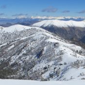
Little Kane Peak and its curving north ridge (right of center). This was my ascent route. Livingston Douglas Photo

Little Kane Peak and its east ridge (dead center, coming at the camera). This was my descent route. Livingston Douglas Photo
Dan Robbins Route by Margo Mandella
Little Kane Peak is located on the North End of the long ridge that divides Boulder and Wildhorse Creeks from Kane Creek in the Pioneer Mountains. USGS Standhope Peak
Little Kane Peak is located slightly more than 2 miles NE of Peak 10942/Purgatory Peak, which lies immediately NNE of Devils Bedstead East. The climb to Little Kane Peak begins from the Boulder Creek Trailhead, which is accessed from the Wildhorse Campground. The summits of both Little Kane Peak and Purgatory Peak provide outstanding views of Devils Bedstead East and the surrounding Pioneer Mountains.
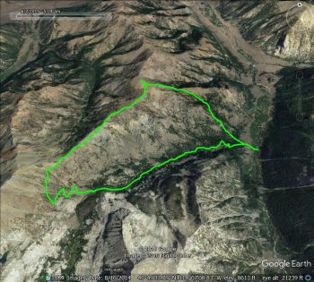
Dan Robbins’ trip report from the IdahoSummits 2016 Fall Outing provides additional information about the route and describes the picture-perfect weather conditions that his group encountered.

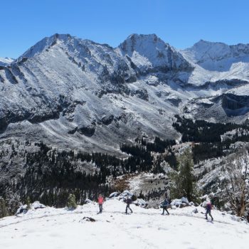
The view from near the ridge that accesses both Little Kane Peak and Purgatory Peak. Photo from the IdahoSummits 2016 Fall Outing. Steve Mandella Photo
Additional Resources
Regions: EASTERN IDAHO->Pioneer Mountains
Mountain Range: Pioneer Mountains
Longitude: -114.12329 Latitude: 43.83669
