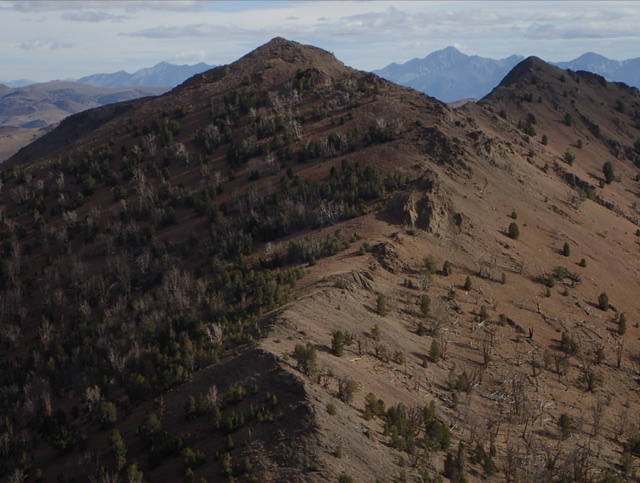
Elevation: 10,260 ft
Prominence: 480
This peak is not in the book. Updated November 2024
Far East Peak (a.k.a., Slide Peak) is located due east of Meridian Peak. Peak 10152 sits at the head of Slide Canyon on the lengthy northeast ridge of Meridian Peak (10,420 feet). It is most easily climbed via its south ridge from the mouth of Slide Canyon, just off the North Fork Big Lost River Road. USGS Meridian Peak
Southwest Ridge by Judi Steciak
Access
Drive about 9.0 miles up North Fork Big Lost River Road [B) (2) FS-128 on Page 242]. Turn north onto the short spur road that heads up Slide Canyon and park at the end of the road. From the end of the road on the right/east side of Slide Creek and you must cross Slide Creek and bushwhack up its WEST side.
Stay close to the edge and you should spot the waterfalls that gives the creek its name. Soon you will intersect an abandoned road that ends near the fork at 7,870 feet. Cross the creek and head up the nose between the forks. Continue up on intermittent game trails into a burn area until you can traverse west more-or-less horizontally to the saddle between the peaks. The footing is generally good everywhere on this hike.
Southwest Ridge, Class 2
The southwest ridge of Far East Peak has obvious bypasses for a few rock outcroppings and can be climbed without much difficulty.
South Ridge by Livingston Douglas
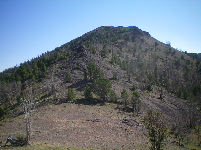
Far East Peak and its southwest ridge (just left of center, coming at the camera). This was my descent route. Livingston Douglas Photo
Access
Park at the top of the 0.1-mile spur road that ends at the mouth of Slide Canyon (7,610 feet and 43⁰55’45”N, 114⁰16’50”W).
Map Errors
No maps show the short spur road heading up to the mouth of Slide Canyon. There is a helpful mining road (or remnants thereof) that follows the right/east side of Slide Canyon and avoids a bushwhack along the left/west side of the creek. This mining road is not shown on maps.
South Ridge, Class 3
The Climb
This is probably the most direct route to the summit of Far East Peak. From the end of the spur road at the mouth of Slide Canyon, scramble northeast up an open scrub shoulder to intersect the remnants of an old mining road that heads left/northwest then north up into Slide Canyon. It descends about 20 vertical feet diagonally into Slide Canyon just below the critical fork in the canyon and the toe of the south ridge. This route avoids the initial forest bushwhack in the Slide Canyon drainage (Steciak route) which now has a fair amount of deadfall. The canyon fork is about ½ mile from the spur road at the mouth of Slide Canyon.
The south ridge sits between the two forks of the canyon. Leave the creek drainage and follow a good game trail (initially) up the forested ridge crest. The terrain soon opens up. Indeed, there is an open section of field grass early on. Continue north-northwest up the semi-open, steep-ish ridge in a mix of grass, scrub, and scattered pines. The south ridge has a few wiggles and is forested in a few short sections. Even in the semi-open areas, there is some large blowdown to work around. Higher up, move left-ish/west at about 9,000 feet to continue up through a burn area just below tree line.
Once above tree line, the final scramble up to the high ridge crest is steep, loose scree and gravel (Class 2+). Climb a solid, Class 3 rock rib to gain stability and advance faster. Once on the crest of the southwest ridge, it is an easy (albeit rocky), Class 2 scramble to the high point. The summit of Far East Peak sits on a ridgeline. It has a modest cairn which I built up a bit.
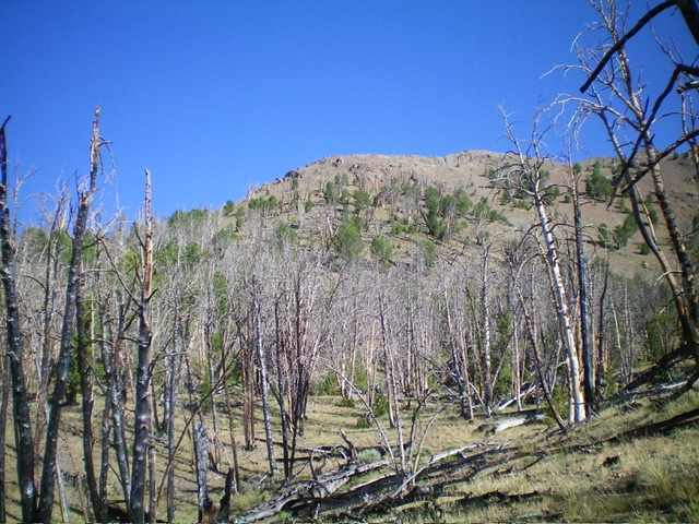
The southeast face of Far East Peak as viewed from high on the south ridge. Livingston Douglas Photo
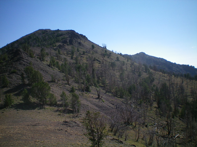
Far East Peak (summit is left of center) and its south ridge (skyline in mid-ground, right of center). This was my ascent route. Livingston Douglas Photo
Additional Resources
Regions: Boulder Mountains->EASTERN IDAHO
Mountain Range: Boulder Mountains
Longitude: -114.2955 Latitude: 43.9510
