Elevation: 10,263 ft
Prominence: 370

This peak is not in the book. Updated December 2019
Paramor Peak is located southeast of May Mountain on the main Lemhi Range Crest. The unofficial name for this peak was suggested by Rick Baugher. He climbed the peak in 2005. Livingston Douglas climbed the peak in 2019 and details the southeast ridge route below. USGS May Mountain

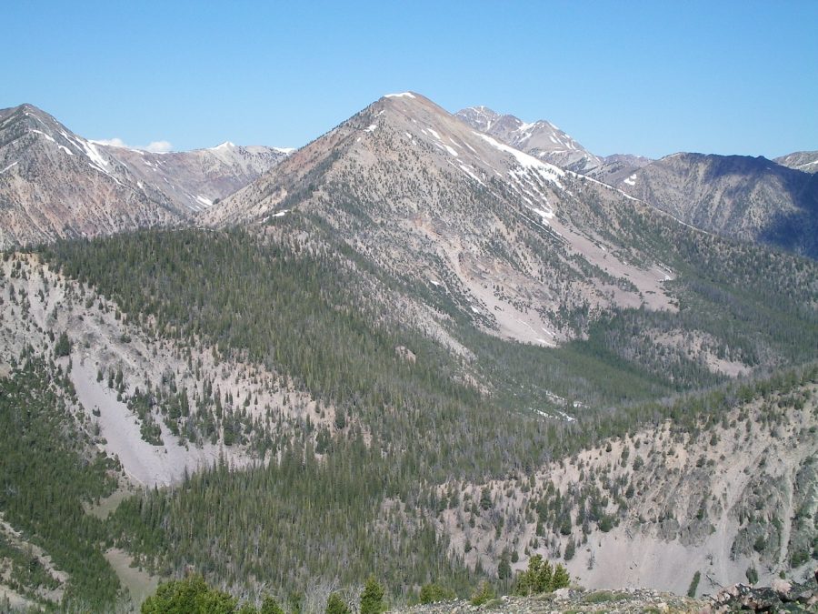
Peak 10263 (dead-center) as viewed from Peak 9523. The southeast ridge rises from a flat, forested section (left of center) to climb to the summit. Livingston Douglas Photo
Southeast Ridge, Class 2+ by Livingston Douglas
Access
Morse Creek Road/FSR-094 [(C)(2) page 317] is located exactly 10.2 miles south of US-93 on the [paved] Pahsimeroi Highway. From the signed turnoff on the east side of the highway, drive 4.3 miles to the Challis National Forest boundary. At 6.5 miles, reach the end of Morse Creek Road at a trailhead parking area (6,290 feet). This is the trailhead for the Morse Creek Trail/FST-4072.
The Climb
This climb (and subsequent descent) is the final leg of a ridge traverse from Peak 9785 to Peak 10263. Please refer to the Morse Creek Trifecta for a full trip report. From the 9,180-foot connecting saddle, scramble west-northwest up the ridge to the small summit of Peak 10263. The ridge terrain is forested initially, with lots of tedious blowdown. The upper part of the ridge has lots of rock bands/strata to circumvent or climb over (Class 2+).
Southwest Ridge, Class 2
Rick Baugher pioneered this route. Use the link below to read his route description.
Additional Resources
Regions: EASTERN IDAHO->Lemhi Range
Mountain Range: Lemhi Range
Longitude: -113.78459 Latitude: 44.67859
