Elevation: 10,273 ft
Prominence: 333
This peak is not in the book. Updated November 2024
The Rosencrance massif has two ranked summits: the southeast summit (Rosencrance Peak) and the northwest summit (West Rosencrance Peak). The southeast summit is just over 100 feet higher than the northwest summit. Due to very loose, steep gravel on their south sides, these peaks are most often climbed from the north from Copper Basin Road. USGS Standhope Peak
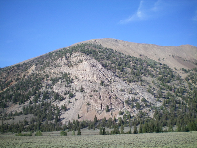
West Rosencrance Peak as viewed from the valley floor to its west. Stay away from the steep rock (left of center) when descending to the Fall Creek Trail. The steep gravel face right of center works best. Livingston Douglas Photo
Access
Same as for Rosencrance Peak. This is the second leg of a 2-peak adventure that includes Rosencrance Peak and West Rosencrance Peak (10,273 feet). It covers 6.5 miles with 3,725 feet of elevation gain round trip.
Southeast Ridge, Class 2
The Climb
From the 9,940-foot connecting saddle with Rosencrance Peak, follow the ridge crest west-northwest then northwest up over Point 10154. Drop 135 vertical feet to a ridge saddle at about 10,020 feet. From this saddle, scramble up the ridge in reasonably stable talus/scree with a few minor rocky outcrops to climb over or skirt. The summit of West Rosencrance Peak is a gentle, ridgeline hump. I built a nice cairn atop the high point.
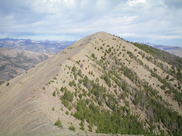
The summit hump of West Rosencrance Peak as viewed from the southeast ridge. This was my ascent route. Livingston Douglas Photo
South Face, Class 2
The Descent
From the summit, descend southeast on the ridge briefly to where the ridge cliffs end. From here, descend south-southwest down the face of steep-ish, loose talus. Reach a section of scree/gravel and boot-ski down the face. Look for gravelly areas as you descend to enhance your pleasure. Angle left-ish/south lower down to reach a talus/scree gully which is just left/east of a patch of pines. Boot-ski down this gully briefly then move onto a shoulder on the left/east side of the gully for a faster descent on smoother (less-chunky) gravel to reach the Fall Creek Trail in an open field below.
The south face is persistently steep but is not as gravelly and conducive to boot-skiing as it appears from a distance. Some sections of the face are hardened gravel and cannot be boot-skiied. It is critical to stay well left/east of the wicked rock (and thick forest) that is a direct line back to the Fall Creek Trailhead. Do not even consider that line as an option. Avoid it. Once on Fall Creek Trail, hike ½ mile west back to the trailhead.
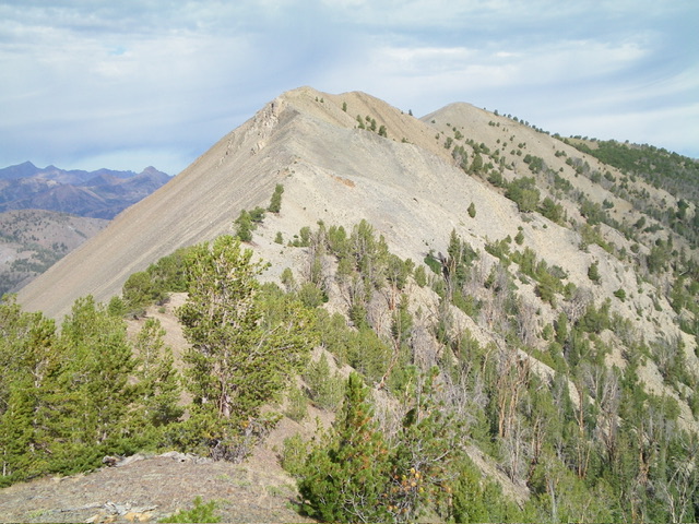
West Rosencrance Peak (summit hump is in the distance, right of center) and its up-and-down connecting ridge with Rosencrance Peak. Livingston Douglas Photo
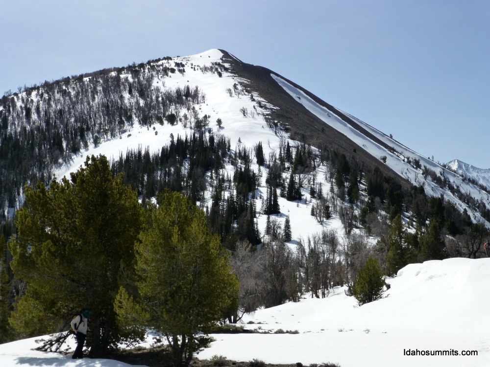
West Rosencrance Peak. Dan Robbins Photo
Additional Resources
Regions: EASTERN IDAHO->Pioneer Mountains
Mountain Range: Pioneer Mountains
Longitude: -114.0645 Latitude: 43.8659