Elevation: 10,284 ft
Prominence: 504
This peak is not in the book. Livingston Douglas, Judi Steciak, and Brett Sergenian all added routes and photos to this page. Updated November 2024
Ursa Peak is located above the scenic Trail Creek drainage. Its summit protrudes north into the relatively small Rear Creek drainage. Since this peak is located on the divide that separates the North Fork Big Lost River drainage from the Trail Creek drainage, it can be approached from either drainage. USGS Meridian Peak
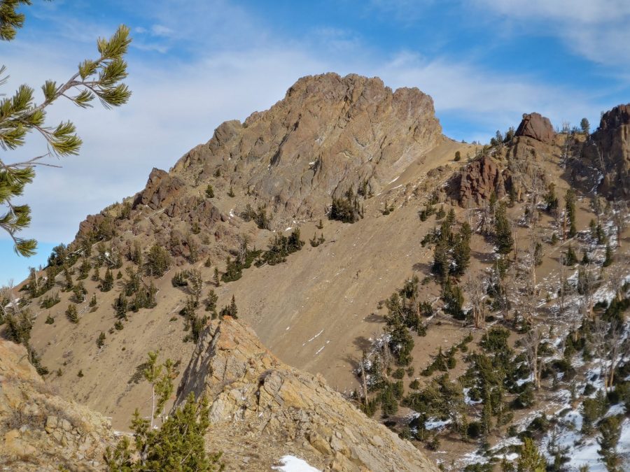
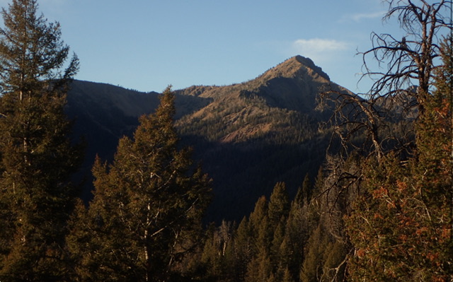
Ursa Peak. The south ridge is on the right. My route is not visible in this photo, which was taken from the ridgeline southwest of the peak. Brett Sergenian Photo
East Rib/Northeast Ridge and South Ridge/East Spur by Livingston Douglas
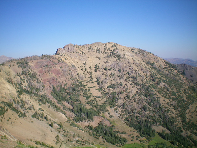
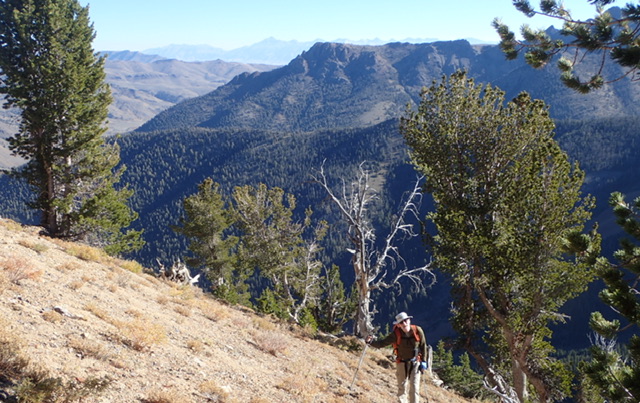
Ursa Peak as viewed from Point 9975 to its southeast. Livingston Douglas Photo
Access
From 8.9 miles up North Fork Big Lost River Road, turn left/south onto [signed] FSR-601. Reset your odometer here. At 0.1 miles, reach a signed junction with FSR-476/Miller Canyon Road. Go right/south to stay on FSR-601. Drive 1.2 miles to a signed junction with a spur road that leads left/south to the Squib Canyon trailhead. Park in a nice, shaded parking spot here (7,685 feet and 43⁰55’08”N, 114⁰17’57”W). This is the first leg of a 2-peak adventure that includes Ursa Peak and Peak 10102. It covers 8.5 miles with 3,650 feet of elevation gain round trip.
Map Errors and Other Corrections
The USGS map fails to show the full extent of the frontage road on the south side of the North Fork Big Lost River. This critical (and decent) 2-track leads to the Squib Canyon spur road. The USGS topo map fails to show the full extent of the Squib Canyon Trail. The National Forest map shows the Squib Canyon Trail heading south all the way up to an old mine at 9,200 feet. It ends long before that. The trail never even heads up that gully.
East Rib/Northeast Ridge, Class 2+
The Climb
From the [unsigned] Squib Canyon trailhead, hike south up the narrow, unmaintained trail (FST-052 on the National Forest Map) on the right/west side of small-ish Squib Creek and cross (or skirt) dozens of downed pines. The trail is faint in the grassy, open areas. The trail disappears about halfway up in a meadow, buried under an endless concoction of downed trees. Bushwhack a bit farther upstream past this mess and find the foot path again.
After about two miles (from the trailhead), the trail moves right-ish/southwest to stay above a marshy, blowdown-strewn area of multiple forks and thick veg in open terrain. The trail heads up into a thick forest and moves away from the center of Squib Canyon. The main (and only) stream heads right-ish/southwest here as well. I lost the foot path (perhaps it is only a use trail at this point) at about 8,600 feet.
Bushwhack right/west up a forested rib (one of three such ribs in this area). This is a STEEP bushwhack that does not relent, but it was not too bad because the deadfall was minimal and the understory was not too thick. Reach the top of the east rib at a minor bump on the [high] northeast ridge. Skirt this ridge bump to reach a ridge saddle to its southwest at about 9,700 feet. Follow the northeast ridge southwest then south to the summit. The ridge terrain is much less steep than the east rib. It is mostly open but rockier. It has some ridge outcrops to navigate (Class 2+).
The ridge merges into the north ridge at about 10,100 feet and bends left-ish/south. Head south up the ridge crest and climb over (or skirt) some more rocky ridge outcrops to reach the summit of Ursa Peak. The high point is at the north end of the rocky ridge crest area. It has a summit cairn, which I built up, and is slightly higher than the rocky south summit. The key to this route is to stay in the pine forest up the east rib. Avoid the “steep, soft gravel of almost 1,000 feet” referred to by Steciak. My route comes up onto the northeast ridge a short distance northeast of the gully/face of “steep, soft gravel” referred to by Steciak as set out down the page.
South Ridge/East Spur, Class 2
The Descent
From the summit, follow the rocky south ridge over some rocky ridge outcrops (or skirt them on their left/east side). Reach a massive, ugly ridge buttress. I climbed up it, hoping to descend its south side, but soon reached an impassable ridge gap. I backtracked and descended very loose Class 3 chutes of scree and gravel to then skirt underneath that buttress on its left/east side. If you skirt this buttress from above, staying well below the ridge crest, you can probably keep this ridge section at Class 2. You will have to contend with angled scree/gravel, of course.
Once past this massive buttress, the ridge is much easier and goes quickly. Head southeast then east to a ridge notch just west of Point 9975. Scramble east up easy tundra and broken rock to reach the cairned top of Point 9975. From Point 9975, head northeast then east in open tundra and broken rock to reach terrain that suddenly becomes steep and forested. The ridge gets rounded and difficult to follow. The saddle below is not visible.
Bushwhack east down through the pine forest to find the saddle. The forest gets thick (with more deadfall as well) lower down but that does not last for long. The grassy saddle suddenly appears. It is open, wide, and long. This is the 9,260-foot connecting saddle with Peak 10102. It concludes the first leg of today’s 2-peak journey. Peak 10102 is up next.
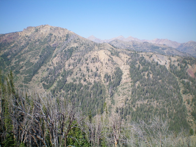
The massive east face of Ursa Peak. The summit is at far left. The east rib is forested and is just right of center. The northeast ridge is the skyline in mid-ground. This was my ascent route. Livingston Douglas Photo
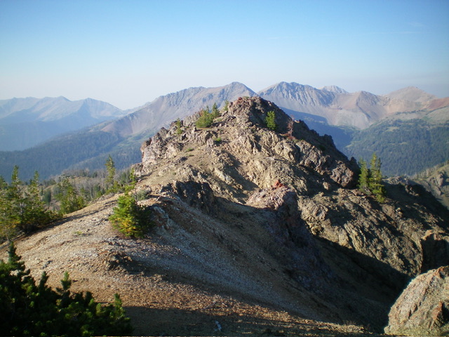
The summit area of Ursa Peak, looking south at the rocky false summit. Livingston Douglas Photo
North Ridge by Judi Steciak
Ursa Peak. Judi Steciak Photo
Access
Primary access is from the North Fork Big Lost River Road. Leave this road and turn onto the Miller Canyon access road [B)(2) FS–128 (B) on Page 242]. Continue on this road for 1.25 miles past the junction with the road up Miller Canyon. Park at the trailhead for FST-52/Squib Canyon Trail. Take advantage of a trail (albeit one long overdue for maintenance) to approach Ursa Peak from the north.
North Ridge, Class 2
Hike the trail south and into the west fork of the drainage until it ends. In Summer 2022, the trail could be followed despite over 60 downed trees (nearly all could be easily walked around or over). A blowout obliterated the trail near its end. Persevere and you’ll pick it up again. Continue cross-country up into the cirque. Around 9,300 feet, work west up a broad gully until you can trend north-northwest above cliffs/outcroppings to the broad eastern slopes. Head west to the peak’s north summit ridge and follow it to the top. Most of the 1,000 feet of elevation gain from the cirque to the summit is on steep, soft gravel which is tedious to ascend but pleasant to heel-plunge on the descent.
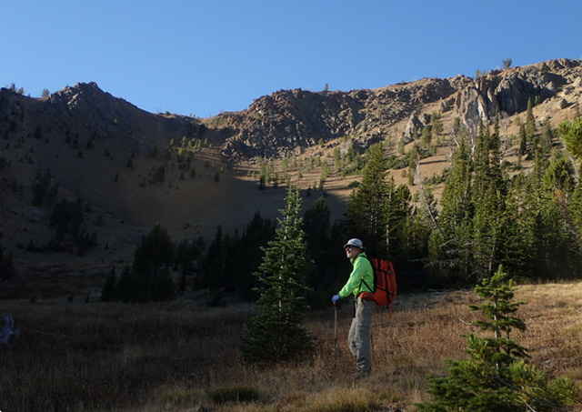
Looking toward the summit ridge. Judi Steciak Photos
Climbing out of Squib Canyon. Judi Steciak Photo
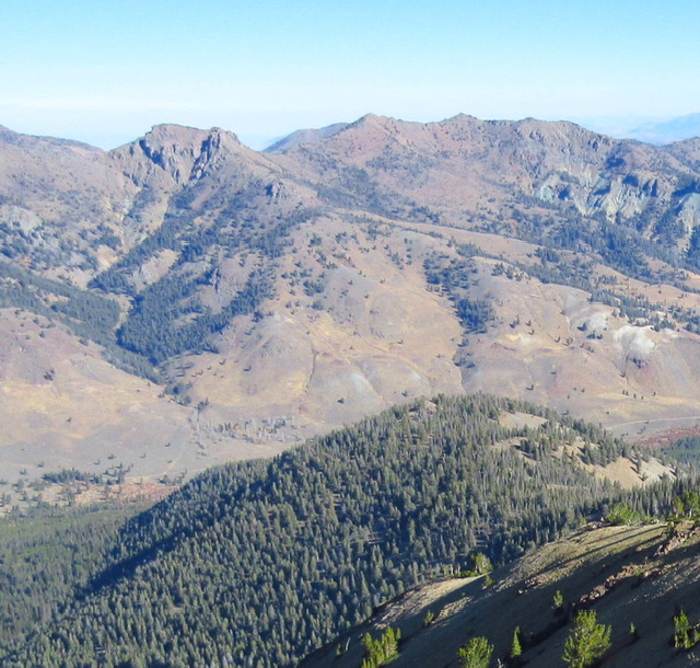
Meridian East and Meridian Far East (the next bump on the ridge to the right) as viewed from Ursa Peak. Carl Hamke Photo
South Ridge by Brett Sergenian
Access
Park Creek Road and the Trail Creek Loop Trail [(B)(1)(a) on Page 242]
South Ridge, Class 3
From the Trail Creek Trail at roughly 8,400 feet, climb to the ridgeline directly south of the summit. The South Ridge protrudes north from the crest and cliffs out. To avoid Class 5 climbing, traverse out onto the ridge’s East Face until you can find a safe line to move upward. Use the link below to read Brett Sergenian’s trip report.
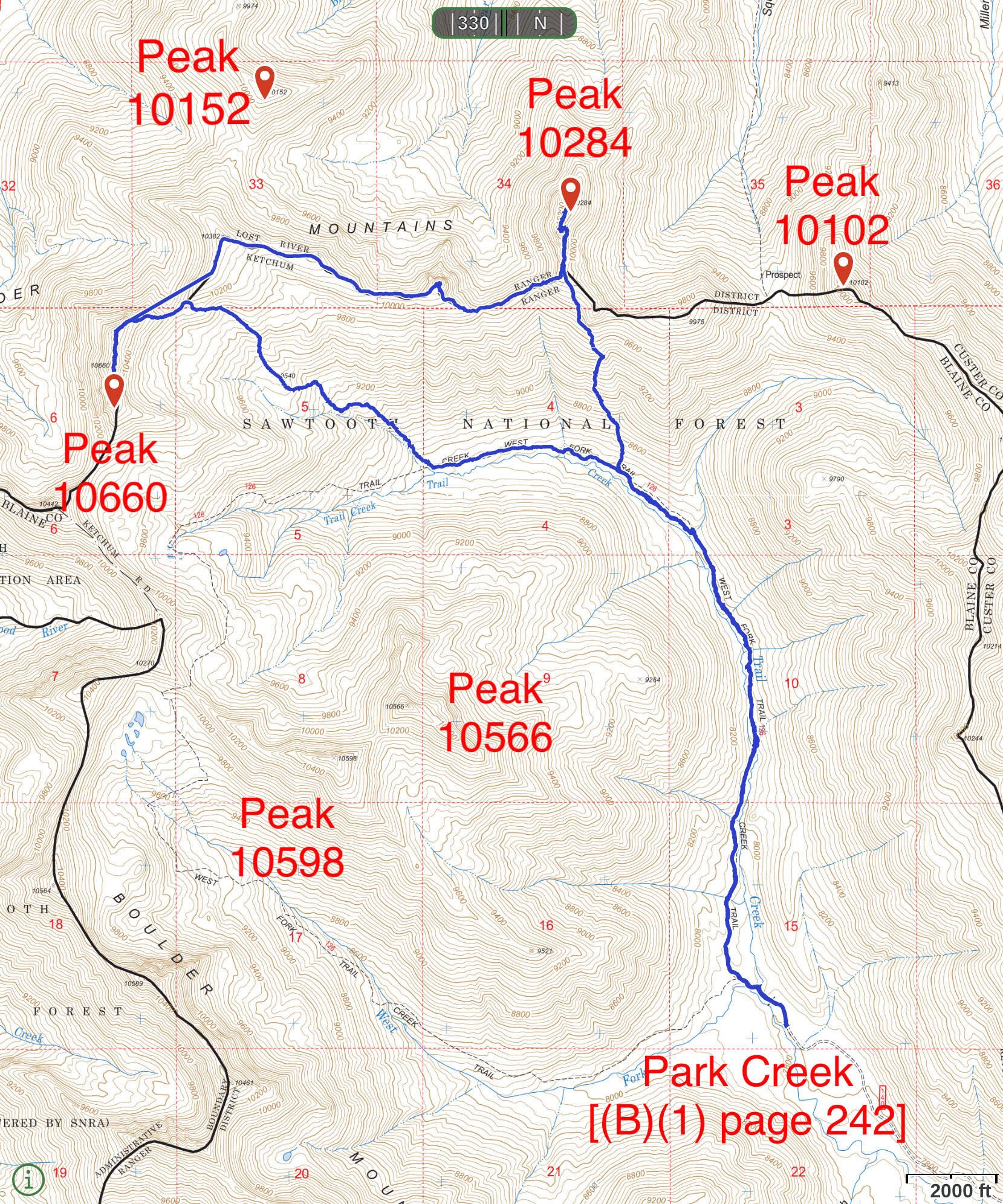
This map shows Brett Sergenian’s GPS track for Trail End Peak and Ursa Peak. His route covers 12.3 miles with 3,200 feet of elevation gain.
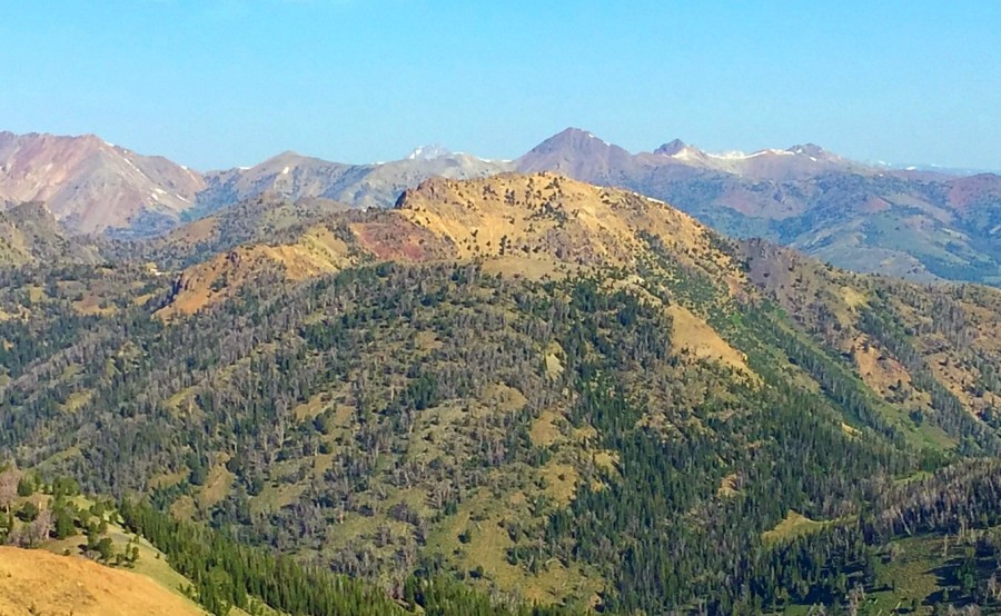
Peak 10284 as viewed from Peak 10340.
Additional Resources
Regions: Boulder Mountains->EASTERN IDAHO
Mountain Range: Boulder Mountains
Longitude: -114.3156 Latitude: 43.89219