Elevation: 10,289 ft
Prominence: 334
This peak is not in the book. The elevation and prominence figures are based on recent LiDAR updates. The USGS quad shows an elevation of 10,288 feet. Updated October 2025
Annies Peak is located east of the townsite of Patterson, Idaho. A Forest Service ATV trail leads up to the summit area. USGS Yellow Peak

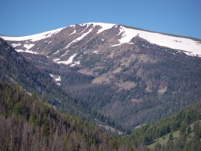
Annies Peak as viewed from the northeast. My ascent route climbs the ridgeline right of center. Livingston Douglas Photo
Access
Patterson Creek Trail/FST-185 [(A)(9.1)(a) on Page 315]. Access the trail from Patterson by driving up Patterson Creek. The road ends at the point where the East Fork Patterson Creek enters Patterson Creek. Follow the trail up East Fork Patterson Creek until it crosses the main Lemhi Range Crest, which is also the peak’s Northeast Ridge.
Map Errors
The USGS topo map fails to show FST-341/Eightmile Lake Trail. It also fails to show that FST-185 continues up the northeast ridge of Annies Peak to near the summit rocks. FST-185 heads southeast from the summit along the ridge crest to reach the head of Big Eightmile Canyon. The USGS topo map shows no trail on the ridge crest.
Northeast Ridge, Class 1
The Ascent
Hike up the Patterson Creek Trail/FST-185 all the way up past a signed junction with FST-341/Eightmile Lake Trail and to a signed trail junction on the crossing of the northeast ridge. FST-4074 heads west down the East Fork Patterson Creek from this crossing. Go left/south to stay on FST-185 as it heads up the northeast ridge to reach the summit area. A short, off-trail scramble puts you on the rocky high point of Annies Peak.
As FST-185 heads up the northeast ridge, it moves away from the ridge crest near tree line and follows the right/west side of the ridge a ways below it. The 2-track trail turns left/east high up to return to the ridge crest just below the summit then heads right/south to skirt the rocky high point. I built a cairn atop the highest ground boulder near the edge of the cliffed east face of the summit. The northeast ridge offers a nice view of EightmileLake to the north.
FST-185 requires multiple crossings of the West Fork of Big Eightmile Creek with no foot bridges to help. The trail has a series of minor ups and downs and requires a 30-foot descent to the trail junction on the crossing of the northeast ridge.
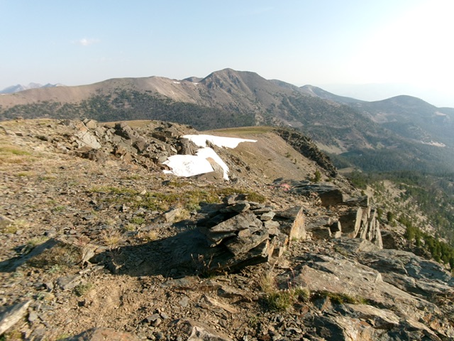
The summit of Annies Peak, looking north. Livingston Douglas Photo
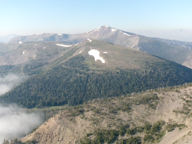
Annies Peak (in mid-ground) as viewed from high on Patterson Peak to its north. Livingston Douglas Photo
Additional Resources
Regions: EASTERN IDAHO->Lemhi Range
Mountain Range: Lemhi Range
Longitude: -113.61459 Latitude: 44.57201