Elevation: 10,300 ft
Prominence: 320
This peak is not in the book. Livingston Douglas added revisions to this page, a more detailed route description, and new photos. Updated December 2024
Peak 10350 is one of four ranked Boulder Mountains peaks surrounding Little Fall Creek. The other three peaks are Peak 10340, Peak 10356 and Peak 10350. Peak 10300 is a rugged peak with vicious north and east aspects. The connecting ridge with Peak 10350 is narrow, rocky, and challenging. Do not take this peak lightly. USGS Rock Roll Canyon

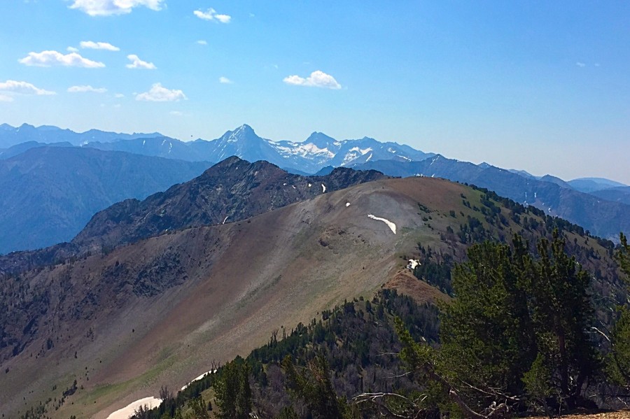
Peak 10300 as viewed from Peak 10350. This photo shows the long ridge that narrows down as you approach the summit. The summit is NOT the gentle hump in center. It is the rugged, rocky peak left of center in the distance.
Access
Access is from Little Fall Creek via a mining road that climbs up to 9,200 feet. See the access section for Peak 10340 for the details. This is the fourth leg of a 4-peak adventure that includes Peak 10340, Peak 10356, Peak 10350, and Peak 10300. From my starting point, it covers 9.0 miles with 3,875 feet of elevation gain round trip.
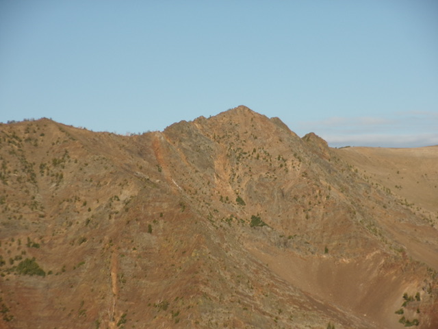
Peak 10300 (right of center) and its rugged northeast face. Livingston Douglas Photo
Northwest Ridge, Class 3
The Climb
From the 9,980-foot connecting saddle with Peak 10350,scramble southeast up the easy ridge of gravel and broken rock to the gentle, elongated, ridgeline summit of Point 10271. From a distance, you might think that this is the summit of Peak 10300, but it is not. The ridge work from here to the top of Peak 10300, though only 29 feet higher, is significant and should not be taken lightly. Just the look of rugged Peak 10300 and the ugly, narrow, rocky connecting ridge from here will give you pause.
From Point 10271, head southeast across some easy ridge humps to reach the “west ridge” section of the northwest ridge of Peak 10300. This ridge section is a complex series of ridge towers and outcrops. The ridge is very narrow, in total contrast to the rounded ridge crest up to Point 10271. The sides of the ridge from here to the summit are brutal—steep, loose, angled scree with dangerous side gullies and aretes. Be very careful on this ridge traverse to the summit of Peak 10300. Navigate east through the ridge towers and rocky ridge outcrops. It is generally best to scramble over them rather than try to skirt them, given the dangerous prospects of side-hilling here.
Finally reach two ridge humps that are rocky but are easier to tackle. They are wider and more gradual in slope. The first ridge hump (the west summit) is 20 feet lower than the true/east summit. Do a final drop to a ridge notch then climb east up the ridge crest to the east ridge hump, which is the true summit of Peak 10300. It sits at the very east end of the rocky ridge crest on a ridge corner. I built the small summit cairn up substantially, given the hard work that it took to get here.
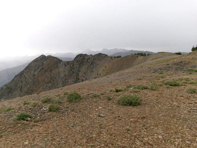
Peak 10300 (at far left) and the choppy, narrow ridgeline leading to its summit. This was my ascent route. Livingston Douglas Photo
South Face, Class 2+
The Descent
From the summit, descend directly southwest down the steep south face on loose scree (initially). Quickly find a rocky shoulder (with ridge pines in areas) that heads directly down to the valley floor. This shoulder is steep and has loose scree. Spend very little time on it. The better descent option from here is the wide gully of scree/gravel to the right/west of this shoulder. It is easier to boot-ski it or downclimb it than the scree on the shoulder. In descending the gully, move to the right or left side of it to descend face rock that is more stable than the center of the gully in certain sections. Lower down, avoid a steep-ish drop in the gully by moving onto a right/west shoulder. Farther down, skirt a dry waterfall in the gully by moving onto a shoulder on the left/east side of the gully.
The gully ends as you approach the valley floor and becomes a nice scree/gravel shoulder (of sorts) then a face. It allows for a fast boot-ski to the valley floor and Little Fall Creek Jeep Road. The terrain on the south face is completely open rock so visuals are excellent. The USGS topo map makes the south face look rather hideous and problematic, but it is not. When you approach the road, you must cross willow-shrouded Little Fall Creek. Aim to cross the creek at a willow-free gap to the right/west of the gully spillout. You can then quickly reach and jump the small stream and bushwhack up through a patch of pines and scrub to reach the road. Follow the road south for about 0.8 miles to the sharp bend and the parking pullout.
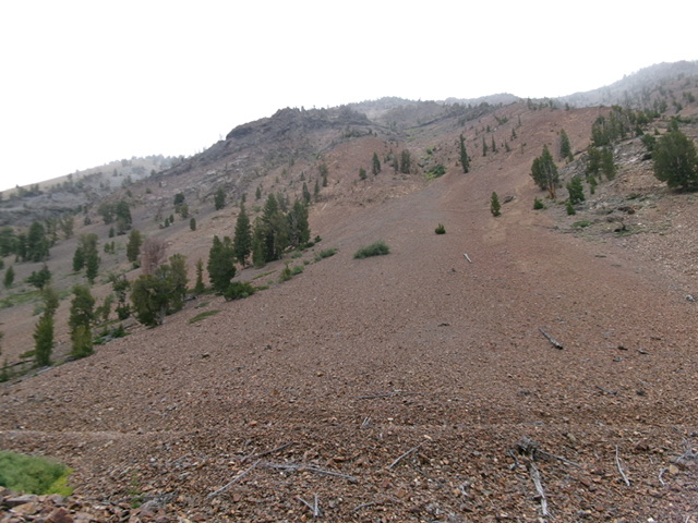
Looking back up the descent gully on the south face from Little Fall Creek Road. Livingston Douglas Photo
Additional Resources
Regions: Boulder Mountains->EASTERN IDAHO
Mountain Range: Boulder Mountains
Longitude: -114.25209 Latitude: 43.86909