Elevation: 10,420 ft
Prominence: 760
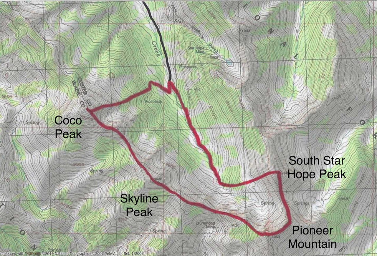
This peak is not in the book. John Platt and Dan Robbins climbed South Star Hope Peak, Skyline Peak, Pioneer Peak/Drummond Peak and Skyline Peak in one day. Use the links below to access their trip reports. Livingston Douglas climbed these four peaks in reverse order to the Robbins/Platt route. His route set out below started at a higher point on Star Hope Canyon Road, so it is a shorter, far more efficient way to climb this foursome. It also descends the loose gravel of South Star Hope Peak, a better option than ascending that peak from the north as Robbins/Platt did. Updated November 2024
Coco Peak is one of seven summits that surround Star Hope Creek. Coco Peak is the highest of four ranked summits that sit on a ridgeline on the west side of Star Hope Creek in the Pioneer Mountains. The other peaks are Glide Mountain (10,256 feet), Peak 10096, and Skyline Peak (10,248 feet). It is most easily climbed from rugged Star Hope Creek Road/FSR-508 to its northeast. USGS Star Hope Mine
Access
From the signed junction of FSR-135/Copper Basin Road and FSR-138/Copper Basin Loop Road, drive south on FSR-138. At 9.1 miles, reach the Star Hope Campground. At 9.3 miles, after the road crosses Star Hope Creek on a bridge, turn right/south onto [unsigned] FSR-508/Star Hope Creek Road. You will need a 4WD vehicle with good tires to navigate this narrow 2-track road. Reset your odometer at the junction of FSR-138 and FSR-508. Pass through a dispersed camping area near the base of the road. At 3.1 miles, reach a signed junction with a side road that heads left/east up Star Hope Gulch to the Star Hope Mine.
Go straight/south here to stay on FSR-508. At 3.6 miles, reach an unsigned junction with an old mining road (shown on maps) that heads right-ish/south. Drive about 100 feet on this side road and park in a pullout just before the road crosses Star Hope Creek [8,490 feet and 43⁰41’35”N, 113⁰55’49”W). This is the first leg of a 4-peak adventure that includes Coco Peak, Skyline Peak (10,248 feet), Drummond Peak (10,525 feet), and South Star Hope Peak (10,493 feet). It covers 7.0 miles with 3,850 feet of elevation gain round trip.
Map Errors
Maps fail to show the full extent of Star Hope Creek Road. It becomes a Jeep/ATV Road then a rugged ATV Trail soon after the old mining road where I parked. The rugged, narrow 2-track goes all the way to a high basin at about 9,600 feet. It makes for a good hiking trail and is used by ATVs up to about 8,900 feet. Beyond that, it is not even drivable by ATVs.
East Ridge, Class 2
The Climb
From the roadside pullout, follow the old mining road across [shallow] Star Hope Creek. The road heads briefly south then turns sharply right/northwest and climbs up into a pine forest. The road soon bends left/south and soon emerges from the forest into an open area. Leave the road here and bushwhack southwest up to tree line in a thick-ish pine forest with a few game trails to help. Stay on the left/south edge of the forest in open scrub higher up. Overall, this bushwhack is not bad and has some semi-open areas and not much blowdown. The ridge gains definition as you gain altitude.
At tree line, the terrain becomes much steeper, looser, and rockier. Stay on the ridge crest and switchback a little to use minor goat trails. Higher up, the final push to the summit is on solid, dark brown ground rock with some loose scree to deal with. The ridge goes directly to the high summit ridge. Once on the summit ridge, follow the easy, rocky ridge crest right/northwest for 50 yards or so to the high point. The summit of Coco Peak had a torn-down cairn so I rebuilt it.
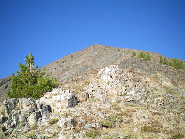
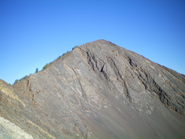
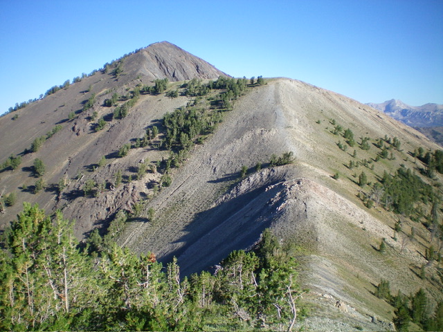
The summit hump of Coco Peak as viewed from high on the east ridge. This was my ascent route. Livingston Douglas Photo
Southeast Ridge, Class 2
The Descent
From the summit, follow the easy, broken-rock ridge crest southeast then east to a gentle finger. Ascent about 10 feet to cross it then descend right-ish/southeast on easy, broken rock to the 9,740-foot connecting saddle with Skyline Peak (10,248 feet). This concludes the first leg of today’s 4-peak journey. Skyline Peak is up next.
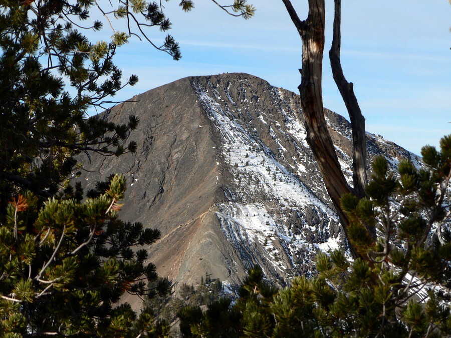
Coco Peak. Dan Robbins Photo
Additional Resources
Regions: EASTERN IDAHO->Pioneer Mountains
Mountain Range: Pioneer Mountains
Longitude: -113.94589 Latitude: 43.68919
