Elevation: 10,450 ft
Prominence: 310
Peak 10450 is located in the Boulder Mountains between South Glassford Peak and Peak 10446. USGS Ryan Peak
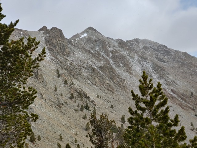
Peak 10450. Brett Sergenian Photo
Access
From the North Fork of the Wood River trailhead [(A)(9)(a) on Pages 241-242], follow the North Fork Big Wood River Trail to the West Pass Trail. Follow West Pass Trail north for a couple of miles before turning west on the trail you take as if you were heading to Glassford Peak or Culmination Peak.
West Ridge, Class 2
After a couple of miles, leave the trail at roughly 7,800 feet and gain the West Ridge of Peak 10450 at 10,150 feet. Turn east and follow the Class 2 West Ridge to the summit. Either descend via the same route or continue east to Peak 10446. The ridge between these two peaks is Class 3.
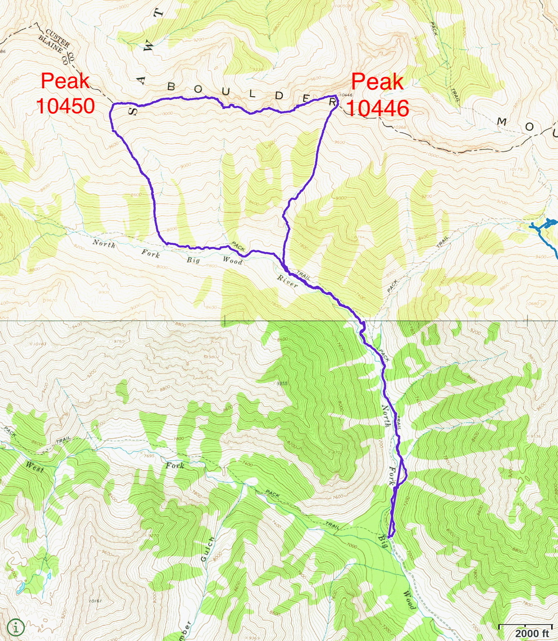
Brett’s GPS track for the traverse from Peak 10450 to Peak 10446. Round-trip stats: 9.89 miles with 4,100 feet of elevation gain.
Additional Resources
Regions: Boulder Mountains->EASTERN IDAHO
Mountain Range: Boulder Mountains
Longitude: -114.46519 Latitude: 43.89701