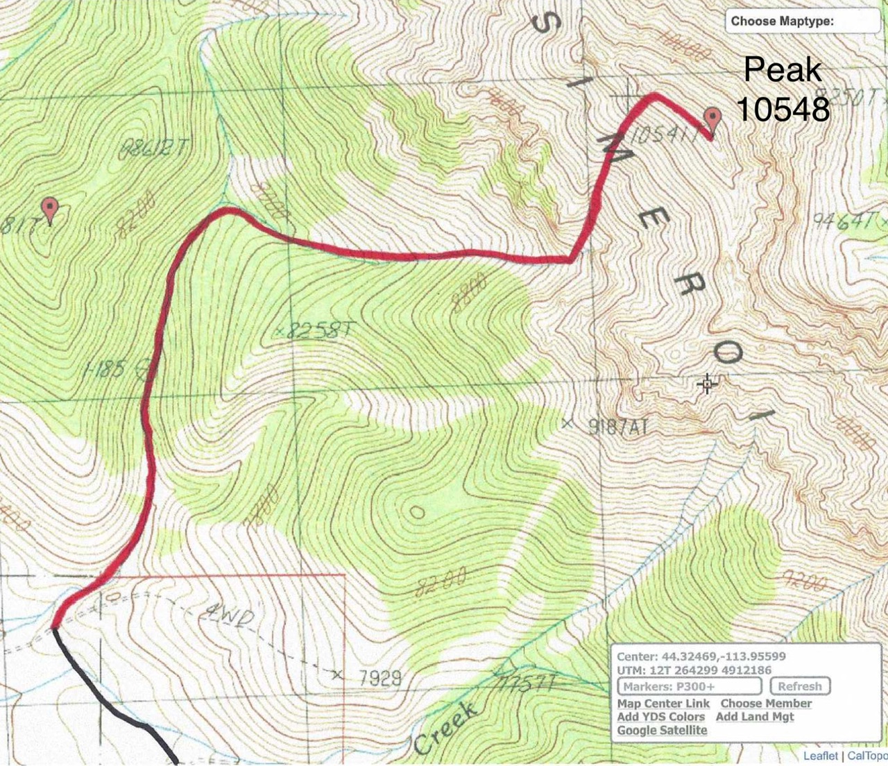
Elevation: 10,548 ft
Prominence: 334
This peak is not in the book. Published November 2024
LiDAR measurements identified Peak 10548 as a ranked summit and not simply a ridge point. It is rocky, ridgeline summit that sits on the Pahsimeroi Crest between Mount Darcy and McGowan Benchmark. Peak 10548 is most easily climbed from a steep, rocky gully on its west side. USGS Grouse Creek Mountain
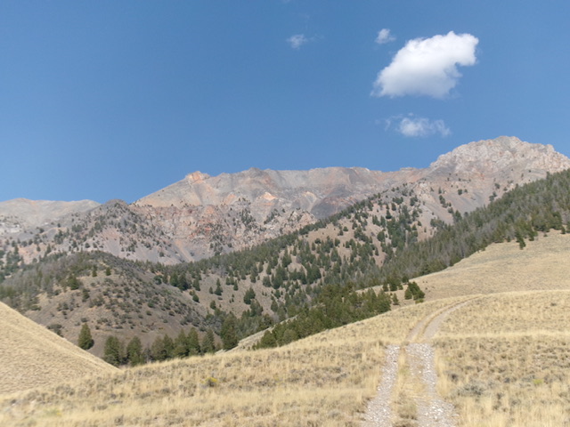
Peak 10548 (on high ridge in dead center) as viewed from the southwest (start of climb). Livingston Douglas Photo
Access
From US-93 south of Challis at virtual MM145.95, turn southeast onto [signed] Gooseberry Creek Road/BLM-228. At 2.1 miles, reach an unsigned junction (44⁰18’01”N, 114⁰00’52”W). Go left/northeast here. At 4.2 miles, reach an unsigned junction (44⁰18’49”N, 113⁰58’41”W). Go left/northwest here. At 4.5 miles, park at an unsigned junction on a bench just south of the ascent gully (7,280 feet and 44⁰19’03”N, 113⁰59’00”W).
Map Errors
The USGS map fails to show the road segment between Gooseberry Creek Road and the 2-track road that heads northeast to the mouth of Gooseberry Creek Canyon. It also fails to show the old road in the ascent gulch. This old road continues west down the gulch to the valley floor. None of it is shown on the USGS topo map.
West Gully/Northwest Ridge, Class 3
The Climb
From the unsigned junction, descend north into the dry gulch on a weak cattle trail. Cross to the left/north side of the gulch and find an old, grassy road bed. Follow the old road northeast then north past a grassy meadow with the remnants of an old cabin. Continue to follow the grassy road bed as it crosses to the left/west side of the dry creek drainage and enters a pine forest. The old road bed soon ends. Follow a weak game trail as it heads up the right/east side of the drainage all the way to a major fork in the gulch.
The left fork of the gulch is open and very rocky. The right fork of the gulch is thickly forested, at least initially. The right fork is the base of the west gully of Peak 10548. There is a decent game trail on its right/south side through the initial area of forest. The forest gives way to open, rocky terrain and a wicked patch of avalanche debris (downed trees). Once past the avalanche debris, scramble east up a wide, rocky gully in a mix of minor gullies and lateral moraines. The moraines are narrow on top but are a good ascent option.
Higher up, the terrain steepens and the moraines disappear. Slog up the talus/scree slope to reach a rocky headwall and a sharp left/northeast turn in the gully. Do not climb all the way to the headwall. Instead, continue up the middle of the gully as it now heads northeast, directly at the summit area of Peak 10548. Stay in the center of the gully for the best footing. Scramble up steep, endless talus and scree. Stay just to the right/east of a prominent ridge/shoulder that is steep, rocky, and choppy. The shoulder does NOT make for a better ascent option. The steep, angled face rock to the right/east of the gully is also a BAD idea—steeply-sloped slab rock with loose scree/gravel on top mixed in with cliff bands.
Higher up in the gully, the slope steepens and requires some Class 3 scrambling on all fours. Find a weak rib in the middle of the gully to find embedded rock for better footing. The rib soon disappears and the scramble to the crest of the northwest ridge is now a face rather than a gully. The slope is steep and loose. Search for any talus instead of the looser scree and gravel to continue your advance. Once on the crest of the northwest ridge, follow it right/southeast across several ridge outcrops. This Class 3 ridge is very rocky and choppy. There are a few minor ups and downs required before reaching the cairned summit of Peak 10548. The summit sits on a high ridge crest.
When descending into the west gully, be sure to stay well right/west of the steep slab rock. Keep the shoulder/ridge just to your right/west as you slowly downclimb the center of the rocky gully. There are only a few patches of scree/gravel that you can boot-ski. This is just a tedious downclimb. Retrace the ascent route back to the mouth of the initial gulch then follow a cattle trail diagonally back up onto the bench and the unsigned junction where you are parked.
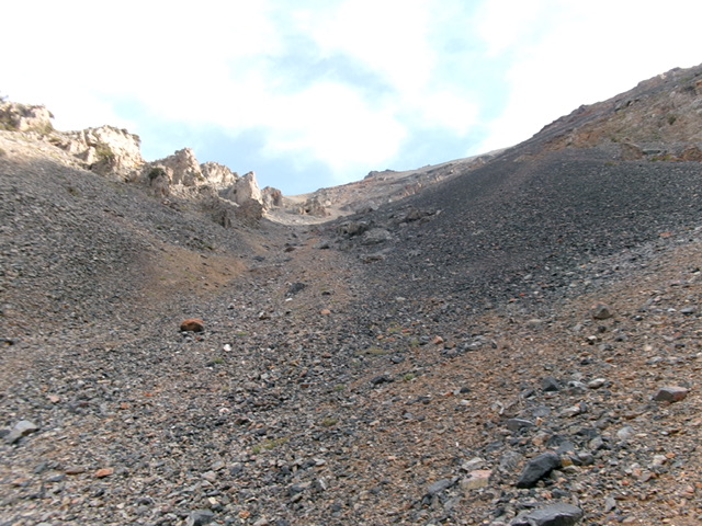
Looking up the steep northeast fork of the west gully. This is the crux of the climb. It leads to the high summit ridge. Livingston Douglas Photo
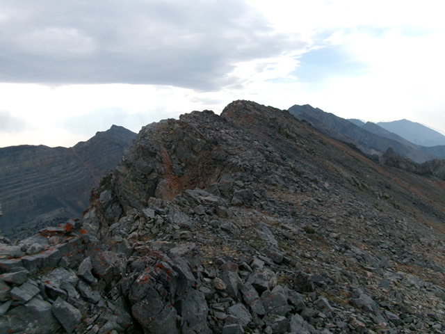
The rocky summit ridge of Peak 10548. This was the final leg of my ascent route. Livingston Douglas Photo
Additional Resources
Regions: EASTERN IDAHO->Lost River Range->Pahsimeroi Range
Mountain Range: Lost River Range
Longitude: -113.95573 Latitude: 44.33202
