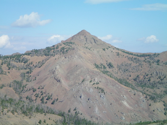
Elevation: 10,522 ft
Prominence: 1,102
Climbing and access information for this peak is on Page 233 of the book. The book states the elevation of Red Meridian at 10,552 feet when the actual elevation is 10,522 feet. It refers to Red Meridian as Peak 10552. Published November 2024
Red Meridian is located on a high ridgeline between Meridian Peak (10,420 feet) to its south and Meridian Benchmark (10,370 feet) to its northeast. It is most easily climbed from the Hunter Creek Trail to its south-southwest. The ridge traverse from Red Meridian to Meridian Peak is magnificent. I highly recommend it. USGS Meridian Peak
Access
North Fork Big Lost River Road/FSR-128 [(B)(2) on Page 242 of the Book]. From the signed road junction of Trail Creek Road and North Fork Big Lost River Road (the northeast of two such junctions), reset your odometer. Drive northwest then west up [maintained] FSR-128. At 11.2 miles, the road crosses a bridge over a feeder creek. Just before this bridge crossing, there is an unsigned 2-track road that heads right/north. Drive 0.2 miles up this 2-track to a signed junction with the Hunter Creek 4WD road.
Park in a pullout just left/west of this junction at 7,765 feet and 43⁰55’24”N, 114⁰19’31”W. The road is considerably rougher after this point with ruts and dips that you may or may not be able to navigate. The road ends in another 1.2 miles at about 8,100 feet on the east side of the Hunter Creek drainage. You can also reach Hunter Creek Road from the North Fork Big Lost River Road at the 11.1-mile point at a signed junction. The 2-track road from that junction to the subsequent junction (where I parked) is rougher than the 2-track road coming up from the bridge crossing.
This is the first leg of a 2-peak adventure that includes Red Meridian and Meridian Peak (10,420 feet). It covers 9.5 miles with 3,800 feet of elevation gain round trip.
Southwest Ridge, Class 2
The Climb
From the pullout at the road junction, hike about 1.2 miles west then northwest up Hunter Creek Road to its end at a parking area and the signed trailhead for the Hunter Creek Trail/FST-050. Bear left at an early, unsigned road junction. Hike north up the Hunter Creek Trail for about 1.7 miles to a fork in the canyon. The trail drops about 50 vertical feet early on to descend to Hunter Creek. The trail crosses Hunter Creek several times with no footbridges or logs. The trail is well maintained.
At the fork in the canyon (8,520 feet), Hunter Creek Trail crosses to the left/west side of Hunter Creek to climb up a dry fork to the northwest. Leave the trail here and bushwhack up the wet fork that initially heads northeast. Stay on the left/west side of Hunter Creek (initially) in reasonable pine forest with some blowdown to skirt. Hunter Creek soon moves to the far left/west side of the drainage. Cross to the right/east side of the creek and bushwhack up the center of the drainage. A ridge emerges at a second fork in the canyon (at 8,700 feet).
Hunter Creek heads up the left/northwest fork here. The northeast fork is bone dry. Scramble up the southwest ridge (which separates the two forks) here. The ridge crest is open and grassy. The ridge terrain becomes a mix of scattered pines and grass/scrub. Higher up, the ridge has rocky outcrops and bends right-ish/northeast at about 9,650 feet. The pines are much thicker up here but are not a problem. There is much more ridge rock now, but nothing difficult. The pines become scattered but never want to end. They hang around until at least 10,100 feet.
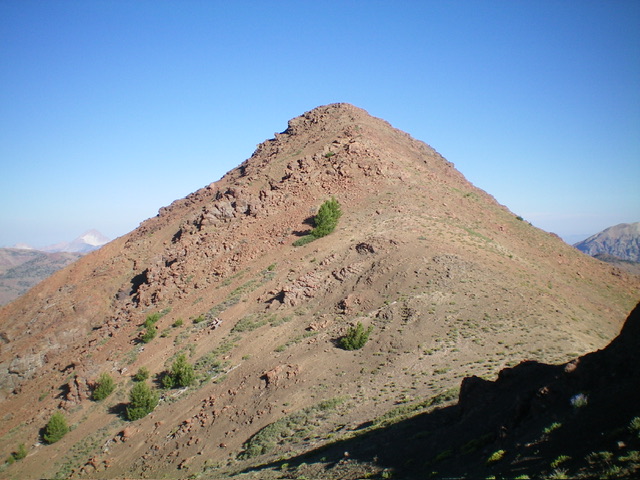
Above tree line, the ridge is open rock, loose scree/gravel, and short grass/scrub. The ridge bends right-ish/east and heads directly to the ridge-crest summit of Red Meridian. The final 300 vertical feet of climbing is a steep mix of loose scree/gravel, easy tundra, and two large ridge buttresses that can be easily skirted on their left/north sides. The summit of Red Meridian has a modest cairn, which I built up considerably.
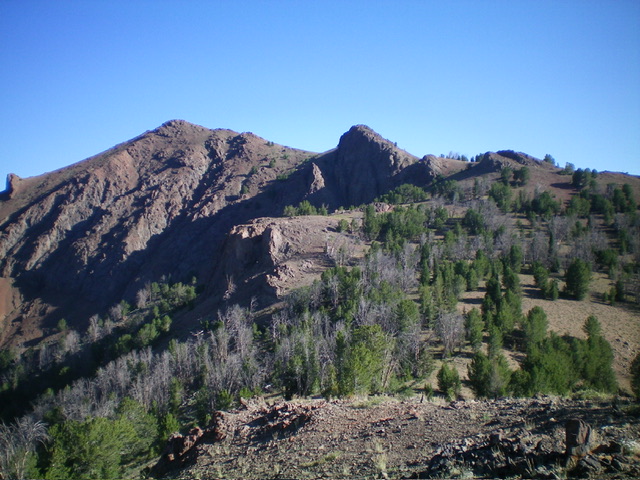
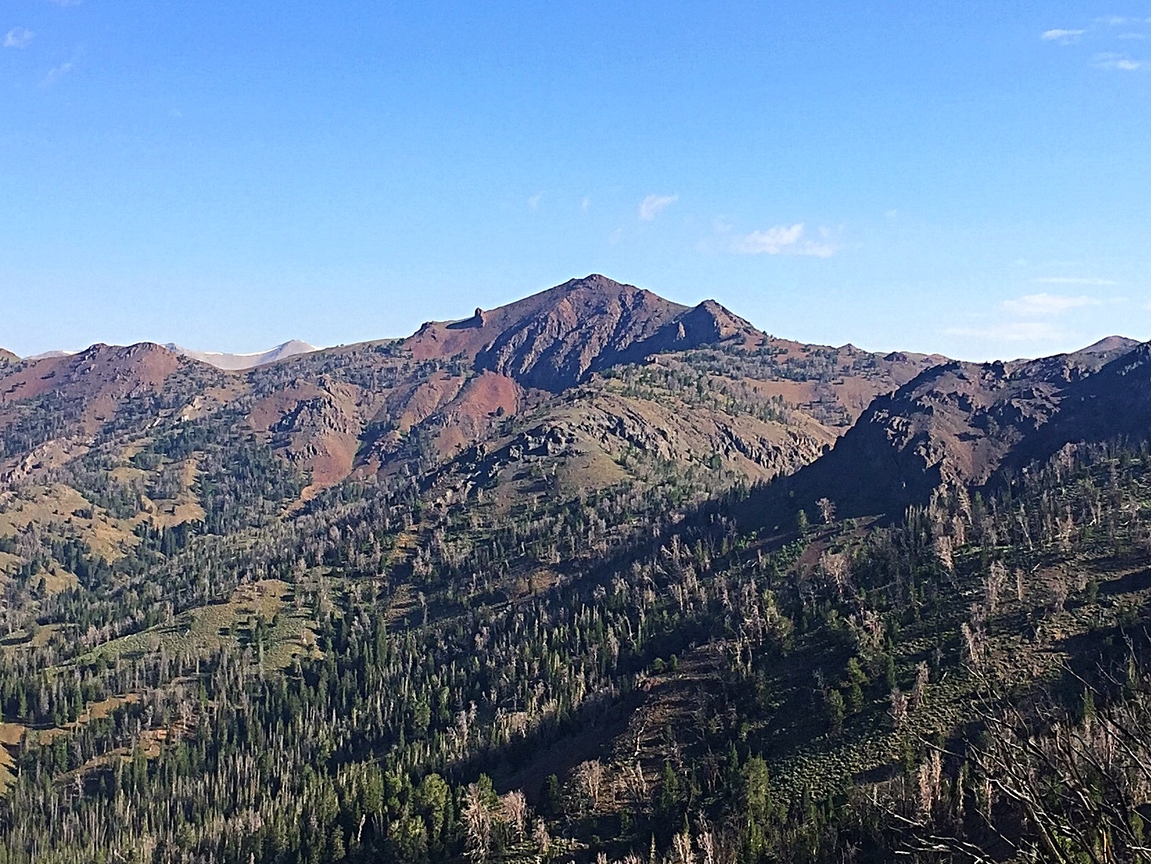
Red Meridian (summit is left of center) and its weaving south ridge (in center and right of center). This was my descent route. Livingston Douglas Photo
South Ridge, Class 2+
The Descent
From the summit, descend southeast on the rocky, narrow ridge to reach an ominous-looking ridge outcrop (narrow and steep-sided). Surprisingly, it is only a Class 2+ effort to scramble up over it and descend its south side on the ridge crest. Below this rocky outcrop, skirt another buttress and descend easy tundra to a ridge saddle underneath Point 10022. Scramble up 60 vertical feet in easy, open grass/scrub with a few scattered pines and some blowdown to reach the rocky top of Point 10022.
Continue south along a flattish, easy ridge section of tundra and gravel (with some ridge trees to skirt) to reach a rocky ridge section with a few ridge buttresses to downclimb and reach the 9,620-foot connecting saddle with Meridian Peak. This downclimb is on loose grave/sand and in chutes of crumbly scree, so be careful. The final descent to the saddle heads left/southeast to reach the small saddle. This connecting saddle concludes the first leg of today’s 2-peak journey. Meridian Peak (10,420 feet) is up next.
Additional Resources
Regions: Boulder Mountains->EASTERN IDAHO
Mountain Range: Boulder Mountains
Longitude: -114.3298 Latitude: 43.9685
