Elevation: 10,589 ft
Prominence: 489

This peak is not in the book. Rick Baugher proposed the name. In his trip report linked below Rick explained: “I left a note with the intent to honor Martyn Mallory (1880-1936) the pioneer outdoor photographer from Hailey.” Updated December 2024
Mallory Peak is the southernmost of a trio of high peaks on the high ridgeline west of the West Fork Trail Creek. It is the most difficult of the three peaks to climb. Mallory Peak has a wicked north face as well as a very steep, challenging northeast ridge. USGS Rock Roll Canyon
Access
Park Creek Road and the Trail Creek Loop Trail [(B)(1)(a) on Page 242].
See the Hemingway Peak page for additional details. This is the third leg of a 3-peak adventure that includes Hemingway Peak (10,540 feet), Murdock Peak (10,564 feet), and Mallory Peak. It covers 10.5 miles with 3,800 feet of elevation gain round trip.

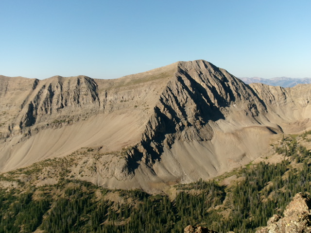
Mallory Peak as viewed from the northeast. My descent route follows the skyline left of center. Livingston Douglas Photo
Northwest Ridge, Class 2+
The Climb
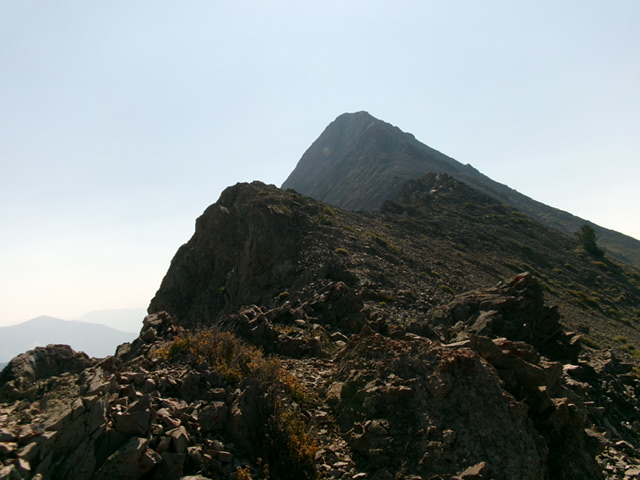
From the 10,180-foot connecting saddle with Murdock Peak, the northwest ridge of Mallory Peak looks intimidating. Surprisingly, the narrow, rocky ridge goes quite easily at Class 2+. Goat trails really help on this ridge. Just don’t fall off the left/northeast (then north) side of the ridge. The rocky summit hump has a modest cairn.

Looking up the rocky northwest ridge of Mallory Peak. This was my ascent route. Livingston Douglas Photo
Southeast Ridge/East Spur, Class 2+
The Descent
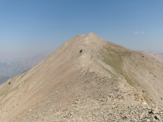
From the summit, follow the southeast ridge to Point 10461. Do not be tempted to descend the east face from the first high saddle (at 10,340 feet) because there is a hidden cliff band about 200 vertical feet below the saddle that will block you. The ridge terrain to Point 10461 is easy Class 2 work on mostly broken rock with a few ups and downs. The net uphill to Point 10461 is about 120 vertical feet from the high saddle. The ridge traverse from Mallory Peak to Point 10461 is much easier than the USGS topo map suggests. The descent from Point 10461 down to the valley floor won’t be so easy.
From the top of cairned Point 10461, descend the east spur. This spur is a mix of forest and rock (high up), then pure rock (rocky outcrops plus a massive ridge buttress to downclimb), then thick forest lower down. There is a lot of steep, loose scree on this descent and a few false ridges to avoid, particularly the first one that heads left/northeast to the valley floor. Stay on the ridge crest, which becomes rounded and more of a face midway down. It also becomes thickly forested, which makes following it difficult. Keep the massive gully that separates Point 10461 from Point 10226 on your right/south as you descend.
That gully is an optional descent route since it is open. It is rocky and has some veg to wrestle with, but it leads down to the West Fork Trail Creek drainage without any difficulties. If the east spur becomes too onerous, you can descend to the gully and follow it down to the West Fork drainage. But let’s stay on the east spur and finish it off. Lower down, there are multiple forested ridges and dry gullies. There are gaps an game trails to assist in the descent.
There are also easy sections of pine forest with minimal deadfall. Stay on the right/east-most ridge crest. As the ridge approaches the valley floor, it opens up. Descend to the valley floor on open scrub/grass to the mouth of the aforementioned gully. Cross the West Fork Trail Creek at an easy, willow-free spot then scramble up 25 vertical feet to find the West Fork Trail in open grass/scrub. Follow the foot trail for about 1-1/2 miles back to the West Fork Trailhead.

Mallory Peak and the upper southeast ridge. This was the first leg of my descent route. Livingston Douglas Photo
Additional Resources
Regions: Boulder Mountains->EASTERN IDAHO
Mountain Range: Boulder Mountains
Longitude: -114.34989 Latitude: 43.84669
