Elevation: 10,598 ft
Prominence: 538
Climbing and access information for this peak is on Page 239 of the book. Livingston Douglas added more detailed access information, new routes and photos. Updated December 2024
Peak 10598 is located in the upper reaches of the Trail Creek drainage. The drainage is surrounded by eleven 10,000-foot peaks. This peak and Peak 10566 sit in the middle of this group. Peak 10598 is one of two high peaks that sit atop a ridge that separates Trail Creek from West Fork Trail Creek in the Boulder Mountains. Peak 10566 is located a short distance to the northeast. Both peaks are most easily climbed from the West Fork Trailhead. USGS Rock Roll Canyon
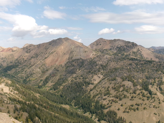
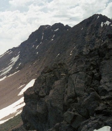
Peak 10598 viewed from Hemingway Peak
Access
Park Creek Road, FS-140 and the Trail Creek Loop Trail, FST-126 [(B)(1)(a) Page 242]. The Trail Creek Loop Trail, FST-126 has not been maintained in many years. Furthermore, trail is not in the location shown on the FS topographic map. See the map below. The tread is easy to follow until roughly 9,000 feet. After that point, there are cairns marking the route until tree line. After you reach tree line, make your way to the saddle on the peak’s northwest ridge. Expert route finding skills are recommended.
Northwest Ridge, Class 2-3
See the route description in the book.
Southeast Ridge and Northeast Ridge by Livingston Douglas
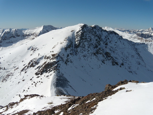
Peak 10598 as viewed from the northeast. Livingston Douglas Photo
Access
Park Creek Road/FSR-140 and the West Fork Trail (also known as the Trail Creek Loop Trail/FST-126) [(B)(1)(a) on Page 242 of the Book]. Park at a campsite near the West Fork Trailhead in the road loop. This parking spot is at 7,820 feet and 43⁰50’44”N, 114⁰17’54”W. This is the first leg of a 2-peak adventure that includes Peak 10598 and Peak 10566. It covers 6.5 miles with 3,250 feet of elevation gain round trip.
Southeast Ridge, Class 2
The Climb
From the [signed] West Fork Trailhead, follow the trail briefly to a fording of Trail Creek. Walk upstream on a use trail for about 100 feet to a footbridge/log crossing of the creek. Once across the creek, follow a use trail downstream to rejoin the West Fork Trail. Continue west on the trail for about 100 yards to a fork in the trail and a trail sign for “Loop Trail #126.” Go left/west here for the West Fork of this loop. Follow the trail for a few minutes to reach the edge of the forest. Leave the trail here to climb up the steep southeast face of the southeast ridge of Peak 10598 in open (or semi-open) terrain.
Scramble west up the right/north of two obvious shoulders with a gully in between. These two shoulders merge high up when they join the east section of the southeast ridge at about 9,100 feet. The right/north shoulder is probably the better choice as it seems to be a bit less steep early on. The right shoulder is a mix of open scrub/gravel and pine forest and is fairly steep. Higher up, cross the narrow, dry gully onto the left/south shoulder since it is heading more directly at the southeast ridge.
The left shoulder has open scrub on its left/south edge high up. The slope finally relents at about 9,000 feet and soon joins the crest of the southeast ridge. The southeast ridge is mostly forested with some deadfall to skirt. Once above tree line, scramble northwest up reasonable scree with a few large, rocky ridge outcrops. The summit of Peak 10598 is on a ridge corner. It had no summit cairn so I built a decent one atop the small high point. There is a rocky point to the west that is clearly a bit lower.
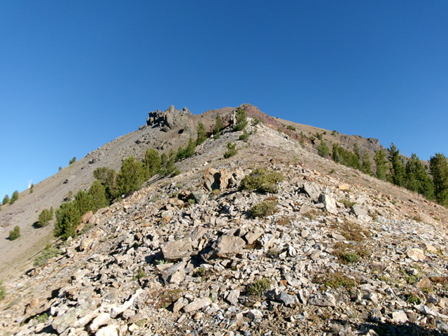
Looking up the upper section of the southeast ridge of Peak 10598. This was my ascent route. Livingston Douglas Photo
Northeast Ridge, Class 3
The Descent
From the summit, descend east briefly then northeast down steep gravel (good for boot-skiing) with fierce exposure to the left/northwest. Lower down, the gravel slope ends and crumbly hoodoos and ridge buttresses begin. The final buttress requires a testy, Class 3 downclimb on narrow ledges, angled ramps, and chutes. Perhaps it can be skirted on its right/southeast side but, even there, you must downclimb off the ridge rock. Reach the gentle, gravelly saddle that sits between Peak 10598 and Peak 10566. This is the 10,164-foot connecting saddle between the two peaks. It concludes the first leg of today’s 2-peak journey. Peak 10566 is up next.
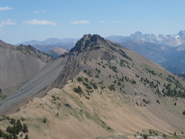
Peak 10598 (left) and Peak 10566 (right) as viewed from Peak 9986 to the south. My ascent route on Peak 10598 climbs the ridge in mid-ground from right of center all the way leftward up to the bare, rocky summit. Livingston Douglas Photo
Peak 10598 as viewed from the pass on its northwest side.
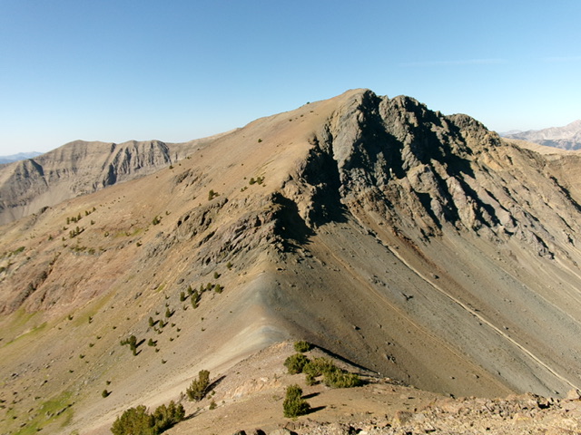
Peak 10598 as viewed from Peak 10566. John Platt Photo
Additional Resources