Elevation: 10,698 ft
Prominence: 390
This peak is not in the book. Livingston Douglas provided a detailed route description of Larry Prescott’s last climb. Additionally, you will John Platt’s GPS track and photos below. LiDAR measurements have increased the elevation of this peak by five feet.
So why two unofficial names? The original Mount Perspiration name was given to the peak by Rick Baugher, a long-time contributor to this website, when he climbed the peak in 1991. Generally speaking, mountaineers accept that the person(s) making the first ascent of a peak have the naming rights to the peak. Rick made the first known ascent and his proposed name predates the Prescott name by 26 years.
On October 19, 2016, Larry Prescott, also a contributor to this website, died from a heart attack just short of the peak’s summit. John Platt (another contributor to this website) and several friends climbed the peak one week later in a tribute to Larry. The group unofficially decided to rename the peak after Larry. The government has established a legal process for naming geographical features. I discuss this process in depth on Pages 32-33 of the book. One requirement is that a feature cannot be officially named after a person until 5 years after their death.
Rick’s proposed name was used on the Climbing Idaho website (see link below) well before the proposed Prescott Peak name. Larry was a very popular resident and educator in Eastern Idaho and he was a good friend of mine. Rick and John are also good friends. Thus, I am not taking a position on which name should be used. Updated November 2024
Peak 10639 is located on the main Lemhi Range Crest between Mount Inspiration and Medusa. The peak has an impressive 1,700-foot North Face that towersand towers over Davis Canyon to its north. The shortest route to the top is via Coal Kiln Canyon to its east. Livingston Douglas advises “Be very careful when climbing the east ridge or northwest ridge of this peak. Don’t wander too close to the north edge of either of these ridges. A fall here would most certainly be fatal.” USGS Coal Kiln Canyon
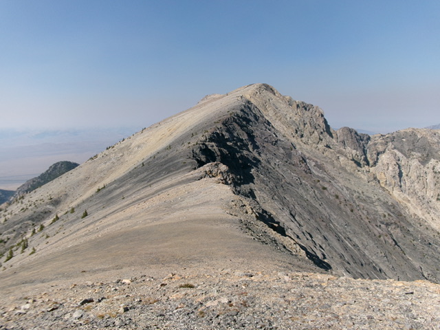
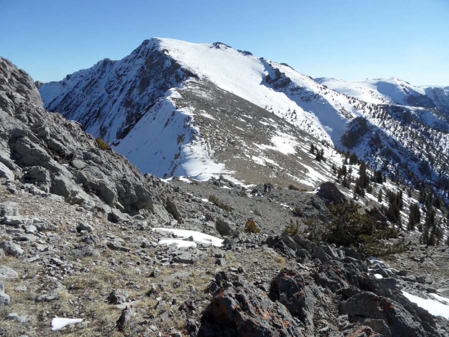
Mount Perspiration and its east ridge (dead center). This was the final leg of my ascent route. Livingston Douglas Photo
East Face/East Ridge and Northwest Ridge by Livingston Douglas
Access
From ID-28, drive west on Coal Kiln Road/FSR-188 (signed for the Coal Kilns) for 5.1 miles to reach the parking/picnic area and bathroom for the Coal Kilns. The road junction is at MM61 on ID-28 and is 3.4 miles north of [signed] Nicholia Road. Park at the Coal Kilns parking area (7,365 feet; 44⁰18’37”N, 113⁰10’48”W). The road gets much rockier, overgrown, and primitive past this point. This is the first leg of a 2-peak adventure that includes Mount Perspiration and Mount Inspiration (10,729 feet). It covers 10.0 miles with 4,950 feet of elevation gain round trip.
East Face/East Ridge, Class 2+
The Climb
From the Coal Kilns parking area, hike about 75 yards west up an unsigned jeep road to a signed junction with FSR-840. Go left/southwest onto FSR-840 and follow it to about 7,615 feet and a sharp left turn uphill. This bend is also just before reaching an unsigned junction (shown on the USGS topo map). Leave the jeep road and bushwhack northwest through thick sagebrush to reach an obvious north-south ridge that sits above, and on the east side of, Coal Kiln Canyon. Cross a wide sagebrush gully to reach the ridge.
Cross the ridge and descend about 120 vertical feet through easy pine forest to reach Coal Kiln Canyon. Follow a jeep road in Coal Kiln Canyon southwest then west to its end at a major left/south turn in Coal Kiln Canyon. The jeep road turns into a signed ATV/MC trail along the way. Bushwhack west then southwest in a pine forest to find a prominent shoulder that heads directly at Point 10546. This bushwhack is not difficult. Head west-southwest up this shoulder and emerge from the pine forest. The shoulder opens up and has only short, scattered firs on it. Point 10546 is clearly visible to the southwest.
Reaching the top of Point 10546 is the crux of this climb. Scramble up the shoulder then cross to the left/southeast side of a prominent gully on the northeast face. Once across the gully, scramble southwest at tree line (just above the final pine trees) to reach the east ridge. This climb to the east ridge is very steep and loose (Class 2+). Once on the east ridge, scramble up the steep ridge on talus, angled ground rock and, higher up, steep face rock (Class 2+/3) that offers better traction. The final push to the top of Point 10546 requires a scramble up another steep, loose section of talus and scree. Stay on the edge of the ridge in minor rocky outcrops to avoid the loosest scree.
Once atop Point 10546, Mount Perspiration is not far away and the ridge traverse from here is rather easy. Descend southwest on stable scree and gravel to a 10,380-foot saddle. From this saddle, follow the ridge west-southwest up ridge rock and reasonable talus and scree to the summit. The summit of Mount Perspiration is on a ridge corner and is shaped like a triangle. There is no summit cairn. The high point seems to be at its rocky northeast corner (as per the USGS topo map). I built a decent summit cairn there with the few pieces of talus that I could find.
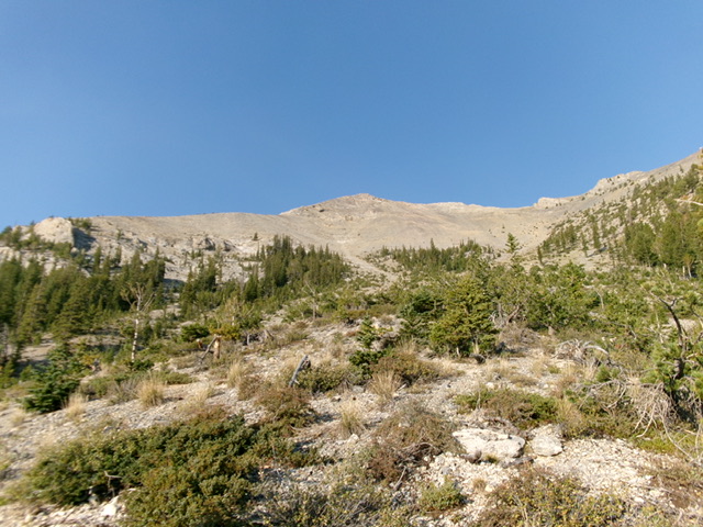
Looking up the steep east face of Mount Perspiration. Point 10546 is in dead center. The summit hump is not yet visible. This was my ascent route and is the crux of the ascent. The Platt routes climb the ridgelines to the left and to the right of center. Livingston Douglas Photo
Northwest Ridge, Class 2
The Descent
From the summit, descend west-northwest then northwest down the exposed ridge crest using goat trails to help. Stay close to the edge of the ridge for the best footing. Lower down, scramble up over two rocky ridge humps on the way to the 10,300-foot connecting saddle at the base of the south ridge of Mount Inspiration (10,729 feet). This connecting ridge concludes the first leg of today’s 2-peak journey. Mount Inspiration is up next.

Mount Perspiration (left of center) and its choppy northwest ridge (skyline in center). This was my descent (then ascent) route. Livingston Douglas Photo
John Platt GPS Track and Photo
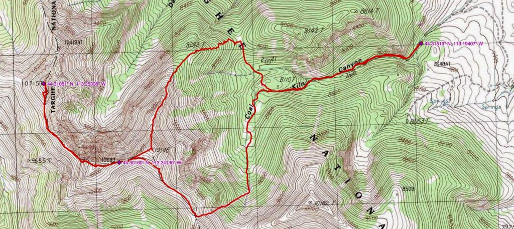
The map below shows the Platt crew’s route. USGS Coal Kiln Canyon
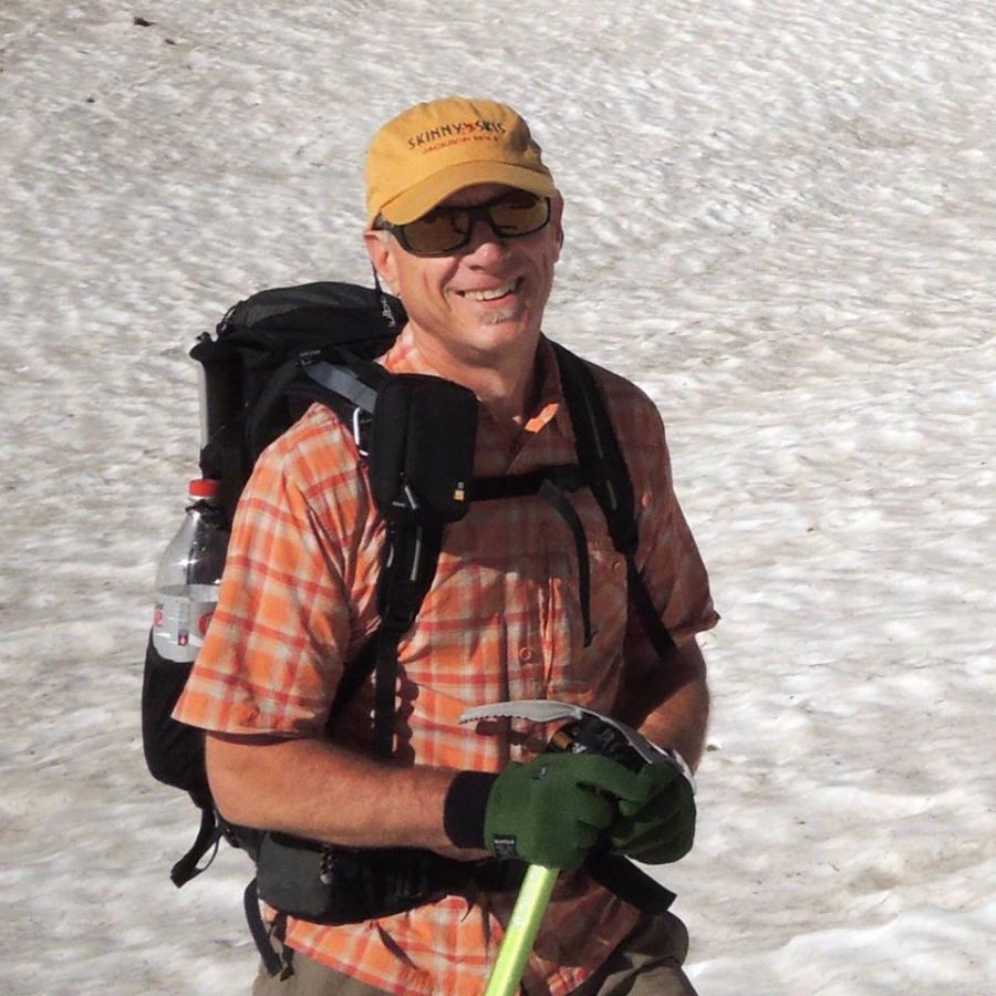
Larry Prescott
Additional Resources
Regions: EASTERN IDAHO->Lemhi Range
Mountain Range: Lemhi Range
Longitude: -113.24489 Latitude: 44.30119
