Elevation: 10,724 ft
Prominence: 351

Climbing and access information for this peak is on Page 304 of the book. Based on LiDAR measurements, the elevation of this peak has increased by a foot. Livingston Douglas has completely revised this page. Updated November 2024
Peak 10724 is located northwest of Meadow Lake and south-southwest of Portland Mountain. It is a ranked hump on the elongated southwest spur of the south ridge of Portland Mountain (10,824 feet). It sits above the headwaters of both Meadow Creek and Deer Creek in the Lemhi Range. Peak 10724 is most easily climbed via its south ridge from an unmapped trail that comes up from Meadow Lake. USGS Gilmore

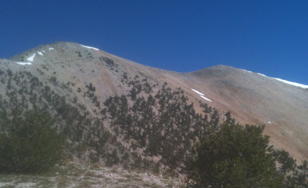
Peak 10724 as viewed from the pass above Meadow Lake
Access
Meadow Lake Trail [(A)(6)(a) on Page 314 of the Book]. If you are not camped at the Meadow Lake Campground, park in one of the “day use” parking areas in the campground. This is the first leg of a 4-peak adventure that includes Peak 10723, Gilmore Peak (10,735 feet), Gilmore East (10,744 feet), and Liberty Mountain (10,216 feet). It covers 7.5 miles with 3,025feet of elevation gain round trip.
South Ridge, Class 2
The Climb
From the southwest corner of the Meadow Lake Campground, find a well-beaten, unsigned foot trail that heads west up the north side of the inlet stream in a forested area. This is the Meadow Lake Trail. The trail soon emerges from the pine forest and skirts the right/north side of a tarn (shown on the USGS topo map). The trail then bends left/southwest to switchback up through a talus slope. There are lots of large trail cairns in this section of the trail.
The trail does several switchbacks and seems to be heading too far left/south to reach the critical ridge saddle. But it makes one final turn right/northwest and heads directly to the saddle (diagonally upward) with no more switchbacks. Whew. The trail crosses a few shoulders and dry shoulders on the way to the narrow ridge saddle at 10,140 feet. The saddle has a Forest Service Trail sign (“Lemhi Crest; 10,200 feet; No Maintained Trails Beyond This Point”). This is the connecting saddle between Peak 10724 and Gilmore Peak (10,735 feet). It sits at the base of the south ridge of Peak 10724.
From the saddle, scramble northwest then north up the open, rocky ridge and quickly find a goat/use trail. This trail comes and goes, but is useful at times. The ridge still requires a Class 2 scramble up ridge rock to reach the summit. The measured/official southwest summit is at a ridge corner. It had no summit cairn. But there is a ridge hump to the right/northeast that has a nice cairn atop it. The northeast summit is the official high point, according to LOJ. Descend 65 vertical feet to a ridge notch then climb up onto the cairned northeast summit. My altimeter finds the two summits of equal height. Visually, however, it seems like the northeast summit IS slightly higher. Stand atop both summit humps “just to be sure.”
The south ridge of Peak 10724 is a curved ridge crest. It is hardly a straight line. It just keeps bending right until you reach the northeast summit. From the northeast summit, return to the southwest summit. From there, descend south then southeast down to the narrow, 10,140-foot connecting saddle with Gilmore Peak. Get a good look at the rocky, imposing, northwest ridge of Gilmore Peak because that is what is up next in this 4-peak journey.

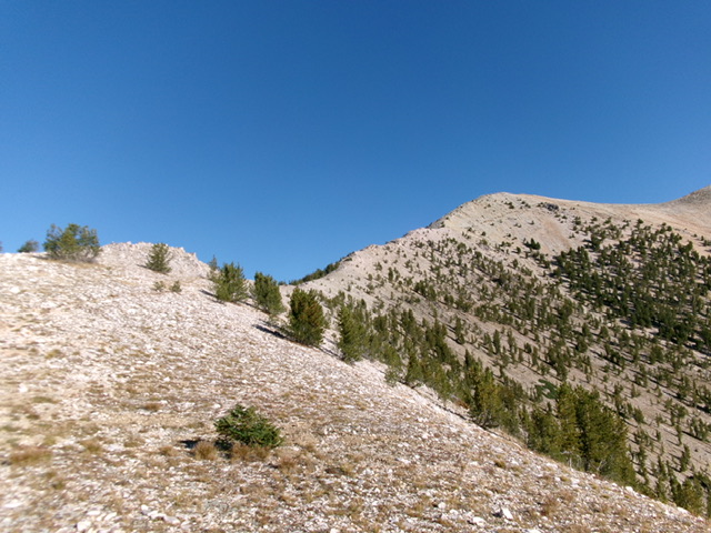
Looking up the south ridge of Peak 10724 from the saddle. The ridge is left of center and heads diagonally up and right. The summit hump is not visible in this photo. This was my ascent route. Livingston Douglas Photo

The cairned, northeast summit hump (dead center) as viewed from the official, measured southwest summit. Livingston Douglas Photo

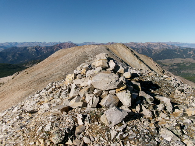
The large cairn atop the northeast summit, with the official/measured summit hump in the background. Livingston Douglas Photo
Additional Resources
Regions: EASTERN IDAHO->Lemhi Range
Mountain Range: Lemhi Range
Year Climbed: 2013
Longitude: -113.3368 Latitude: 44.4382