Elevation: 11,243 ft
Prominence: 453

This peak is not in the book. Based on LiDAR measurements, the elevation of Apex Peak is now 11,243 feet and the prominence is now 453 feet. The website still uses the older data. Livingston Douglas added his take on the North Ridge Route as well as new photos. Updated November 2024
Apex Peak is the 82nd-highest peak in Idaho. It is located north of Cleft Peak and east of Mount Corruption. Rick Baugher describes this peak as follows: “This peak, part of the long Breitenbach Spur, is the apex of a triangle formed by Dry Creek, Burnt Creek, and the Donkey Hills. On July 4, 1999, I found no sign of a prior summit visitation. The 1,000-foot snow tongue shown in the accompanying photo lasts well into Summer and offers good skiing. The peak’s limestone face contains abundant fossils of the Mississippian age like horn corrals and productids.” USGS Leatherman Peak
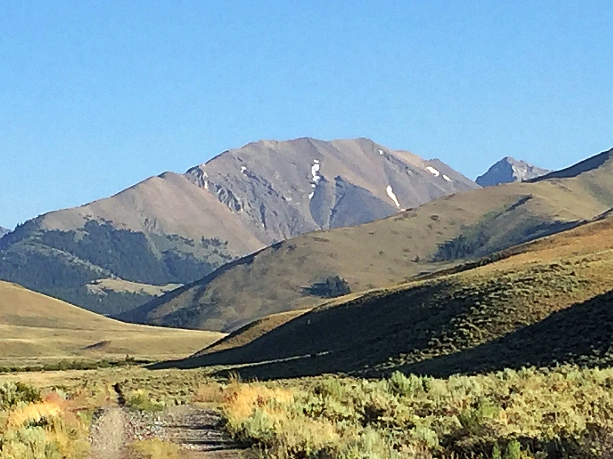
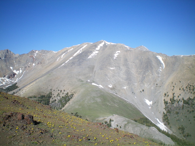
Apex Peak as viewed from the entrance to East Fork Burnt Creek. The north ridge is on the left skyline.
Access
Access the peak from the Burnt Creek Canyon Roads [(A)(6.2) on Page 290]. Follow the road into the drainage until the road drops down off a high point to East Fork Burnt Creek.
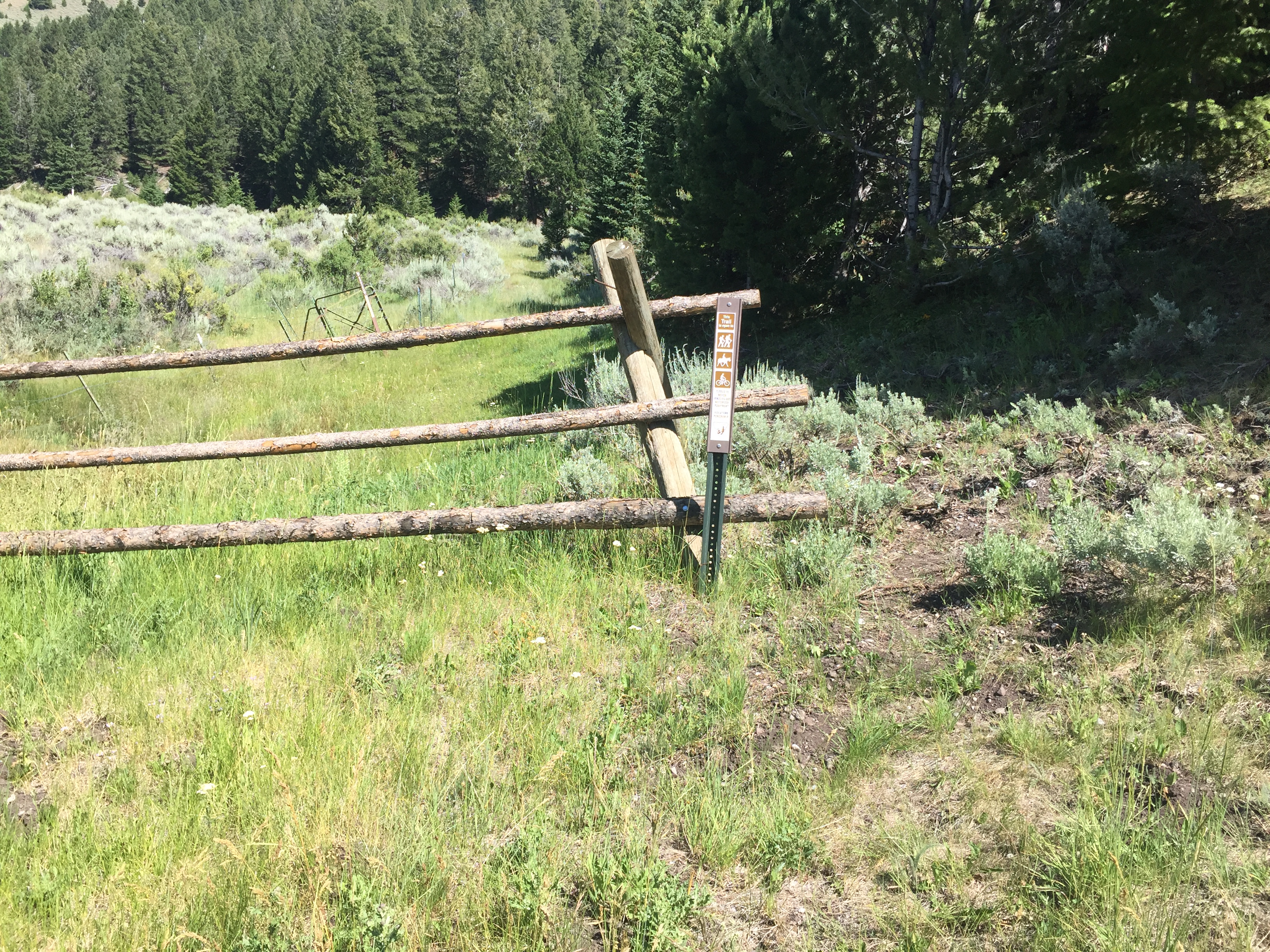
The trail starts behind this fence
North (Never Ending) Ridge, Class 2
From the end of the road, walk past the fence and follow the trail up East Fork Burnt Creek until you reach Burnt Creek Lake. This unofficial trail was in good shape in July 2017. The trail passes the lake on its East Side and disappears in the meadow at the south end of the lake. From here, climb due south up to the first saddle on the peak’s north ridge to approximately 10,200 feet. From this point, the route climbs the ridge to the summit in roughly 3.7 miles with 3,200 feet of elevation gain.
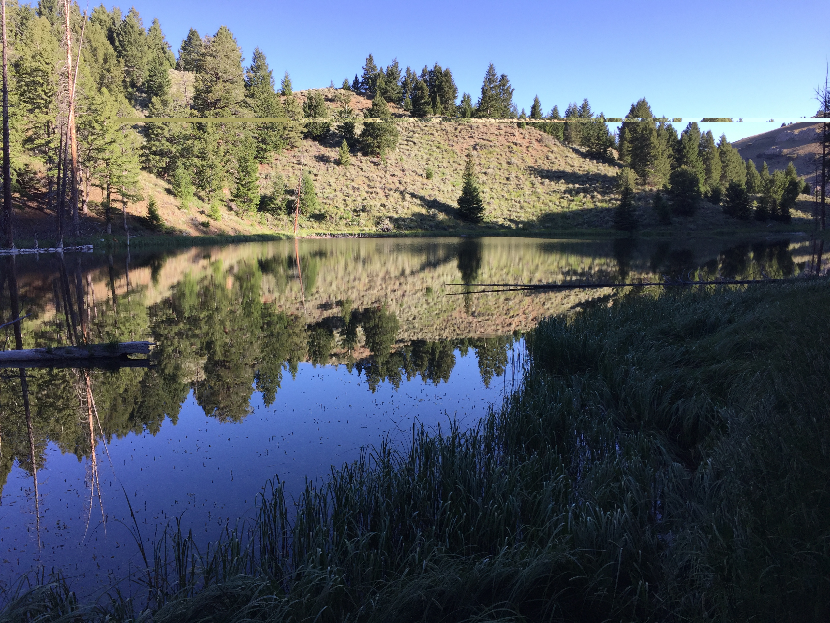
Burnt Creek Lake. The lake is picturesque, but the water is foul-looking.
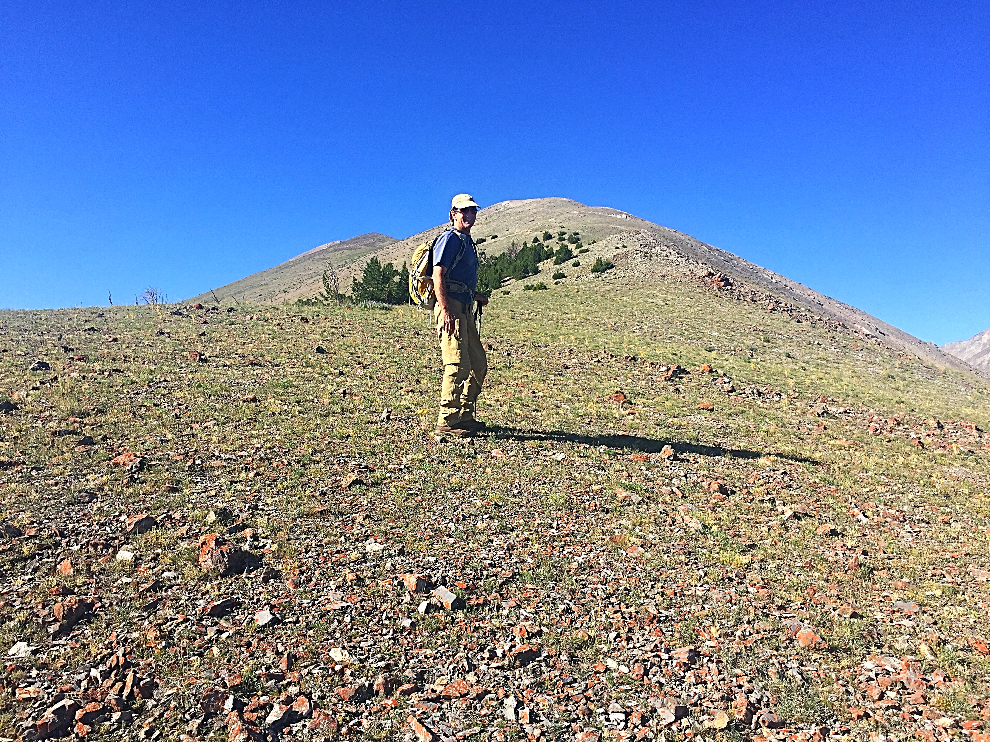
Pat McGrane on the lower section of the Never-Ending Ridge.
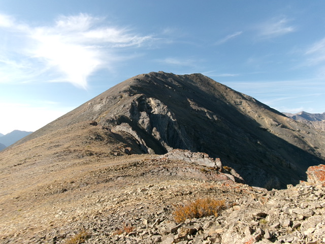
The ridge finally reaches its “apex” after many false summits.
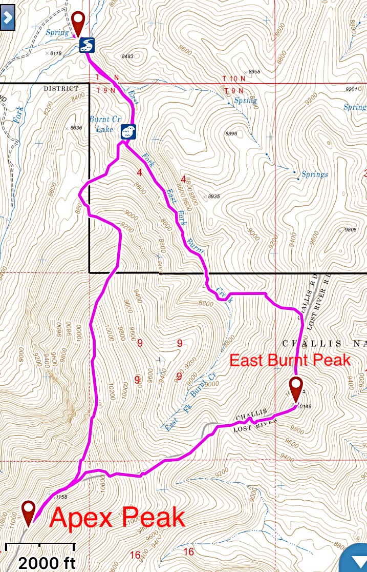
This is my GPS track for Apex Peak and East Burnt Peak. The route off Apex Peak is a Class 2 walk down steep, loose talus.
North Ridge by Livingston Douglas
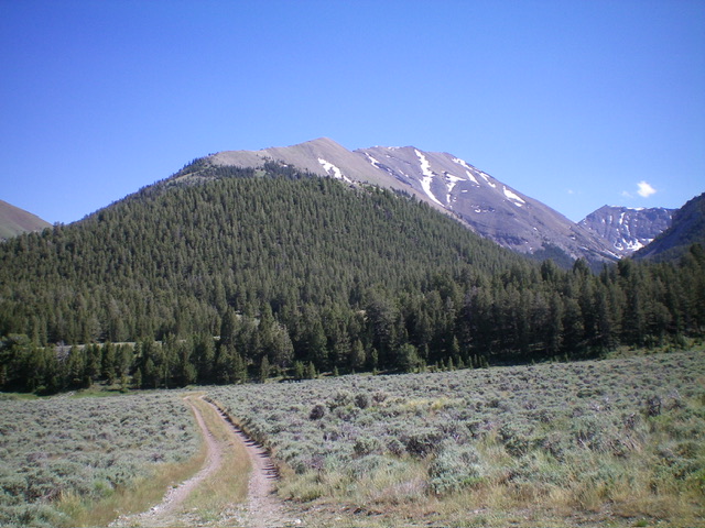
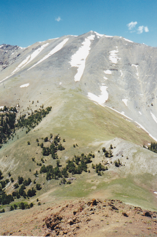
Apex Peak as viewed from Burnt Creek Road to its north. Livingston Douglas Photo
North Ridge, Class 2+/3
The Climb
From the parking area at the end of the East Fork Burnt Creek Road, follow a use trail southeast then south up to Burnt Creek Lake. Continue past the lake and up the East Fork Burnt Creek for about ¼ mile on a cattle trail until passing the steep cliffs on the right/west side of the drainage. Leave the drainage and bushwhack west up through a STEEP pine forest to reach the rounded crest of the north ridge. Go left/south onto the ridge and scramble up through easy, semi-open pine forest. The forest soon thins out and you reach open tundra with a few scattered pines.
As you gain elevation, the underlying terrain becomes rockier but is still easy scree. Sometimes the ridge is steep and somewhat loose. At other times, the ridge is flatter and more stable. At about 10,400 feet, reach a section of ugly, rocky ridge outcrops that persist for at least 200 vertical feet. Stay on or just left/east of the ridge crest in this area. Skirt the worst of the rocky outcrops on ledges, angled talus, or easy scree chutes on the left/east side. I found that the better stability of the rock on the ridge outcrops outweighed their slightly higher climbing grade (Class 3 versus Class 2+).
Looking up the rough, rocky mid-section of the north ridge. This is the crux of the climb. Livingston Douglas Photo
Once past this rocky section, head up the easier, open ridge on decent ground rock/scree and climb over (or around) a few ridge cliff bands. High up, reach Point 11158. From that point, it is a tedious, up-and-down ridge traverse in choppy ridge rock to reach the ridgeline summit of Apex Peak. The summit has a modest cairn, which I built up a bit. The cairn is atop a hump that is equal to (or slightly lower than) another hump about 15 feet to the south. Stand atop both humps “just to be sure.” Tom Lopez is correct that this ridge seems to go on forever. When you pass East Burnt Peak (10,149 feet) to the left/east, you might think that you’re almost there. But, unfortunately, you’re not. You still have a lot of work left to reach the summit of Apex Peak.
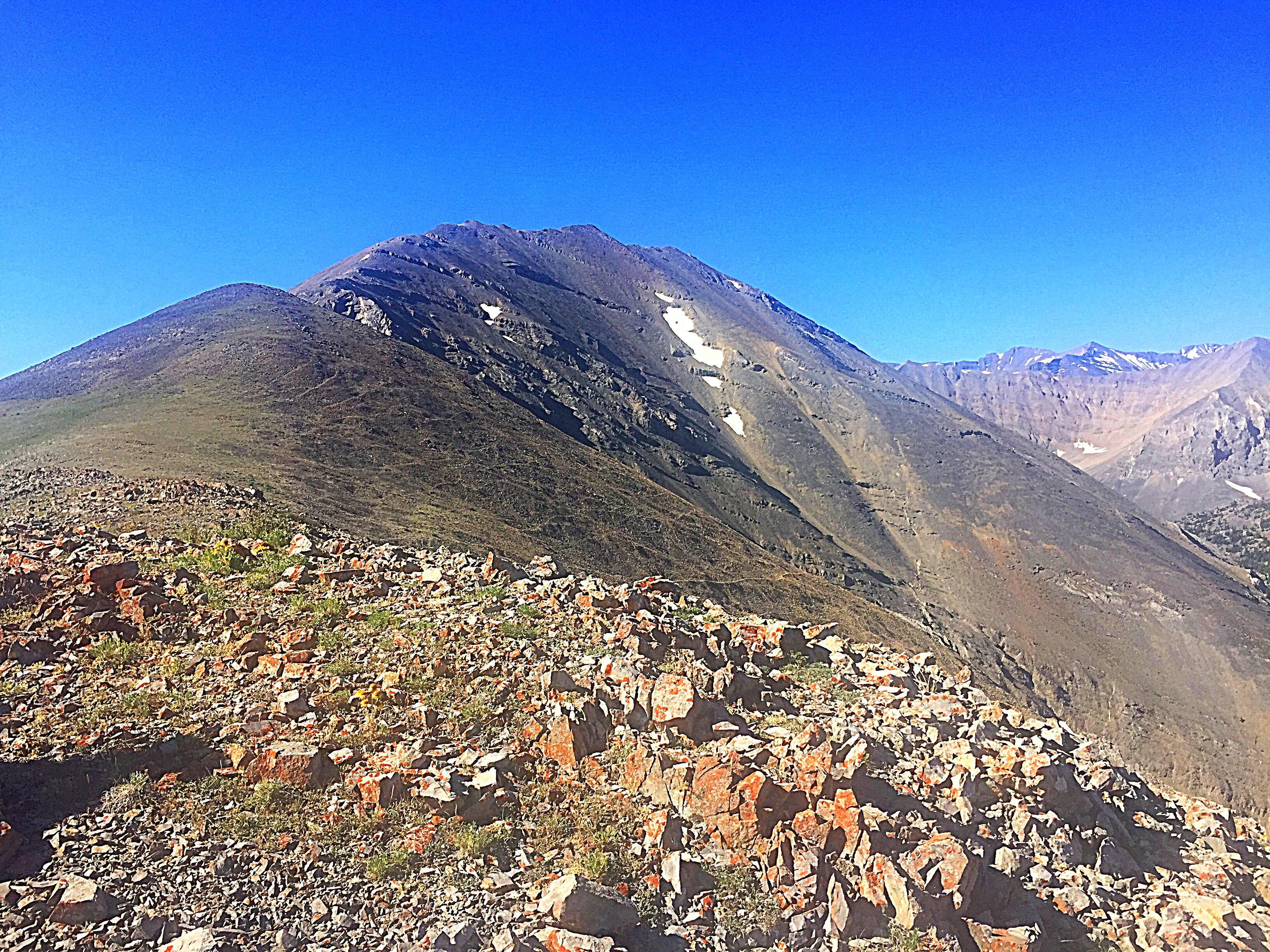
Apex Peak as viewed from East Burnt Peak to its northeast. The summit is in dead center. The lengthy north ridge is the skyline right of center. Livingston Douglas Photo
Apex Peak as viewed from East Burnt Peak, where an ancient cairn was found. East Burnt Peak is the second highest volcanic summit in the Lost River Range. Rick Baugher Photo and Commentary.
Additional Resources
Regions: EASTERN IDAHO->Lost River Range
Mountain Range: Lost River Range
Year Climbed: 2017
First Ascent Information:
- First Ascent Year: 1999
- Season: Summer
- Route: Via the face shown in the photo.
- Party: Rick Baugher
Longitude: -113.63929 Latitude: 44.11219
Pingback: boulder in id – Welcome