Elevation: 10,340 ft
Prominence: 360
This peak is not in the book. Livingston Douglas added the East Face/Northeast Ridge and North Ridge Routes and additional commentary on the Little Fall Creek access conditions. Updated December 2024
Peak 10340 sits on a high north-south ridgeline that separates Trail Creek from Little Fall Creek in the Boulder Mountains. It is one of four Boulder Mountain peaks with 300+ feet of prominence that surround Little Fall Creek. This peak can be climbed from all of the drainages that surround it. You should be able to find a Class 2 route no matter which way you approach the peak. while it is most easily climbed from the Little Fall Creek Jeep Road to its east. Its east face is very loose, steep gravel and would make for a difficult ascent. USGS Rock Roll Canyon
Access
Little Fall Creek provides good access via a mining road that climbs up to 9,200 feet. As of June 2015, the road was blocked by two large fallen trees just above the second creek crossing. Most high-clearance vehicles (driven carefully) can make it to the first creek crossing. A 4WD will be necessary above the creek crossing, and many 4WDs will have difficulty crossing a large step on the talus slope above the first creek crossing. The road makes an excellent hiking trail.
Northeast Ridge, Class 2
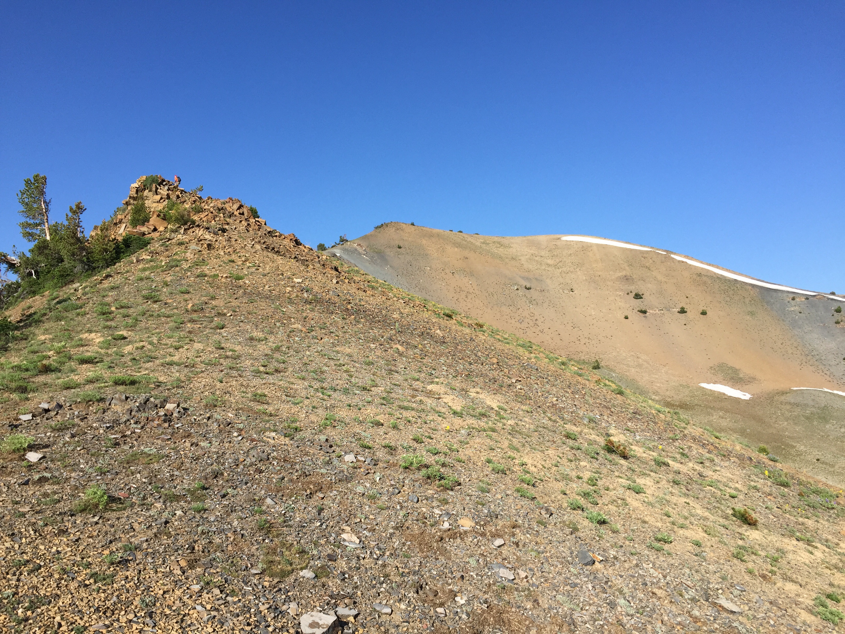
Access the northeast ridge from the end of the road at 9,200 feet and follow it to the summit. The ridge rises steeply through forest terrain and then moderates above treeline. It has no major obstacles.
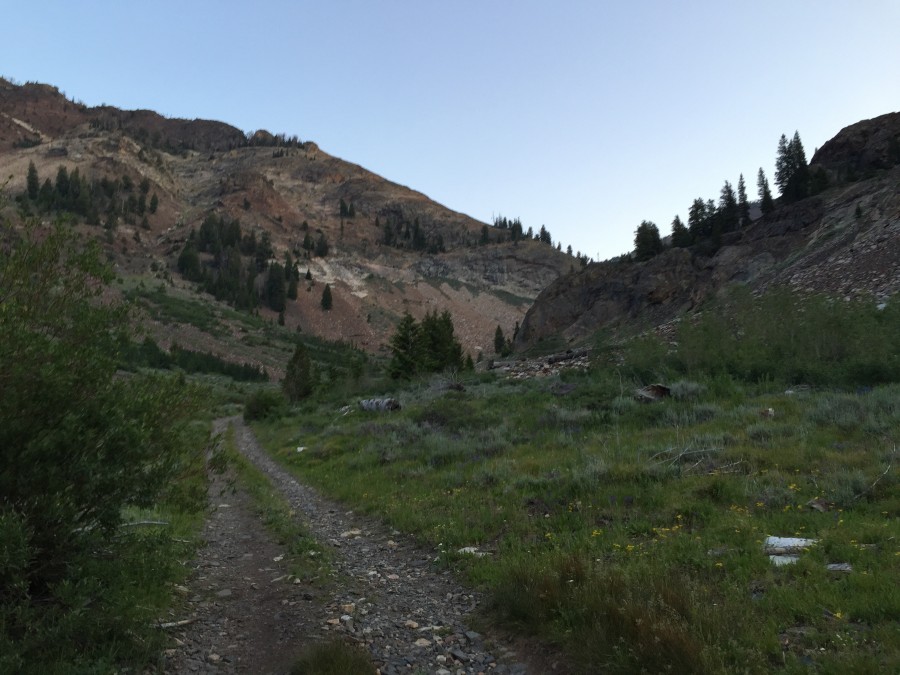
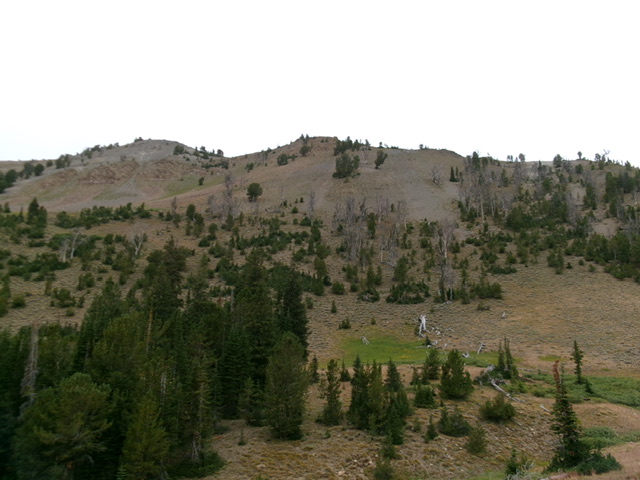
The Little Fall Creek approach
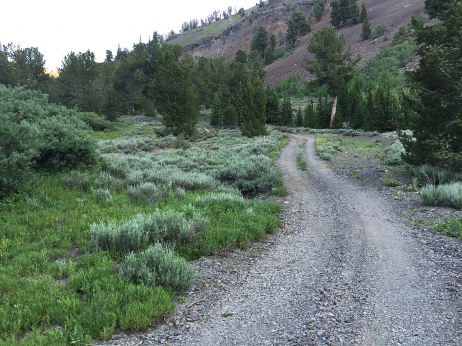
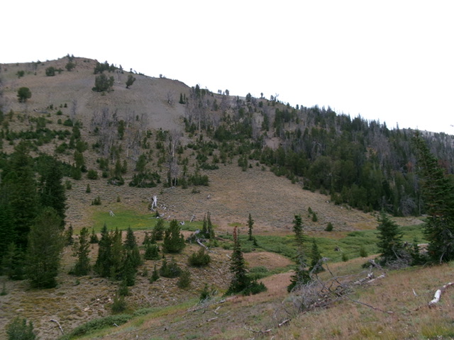
Higher up Little Fall Creek approach
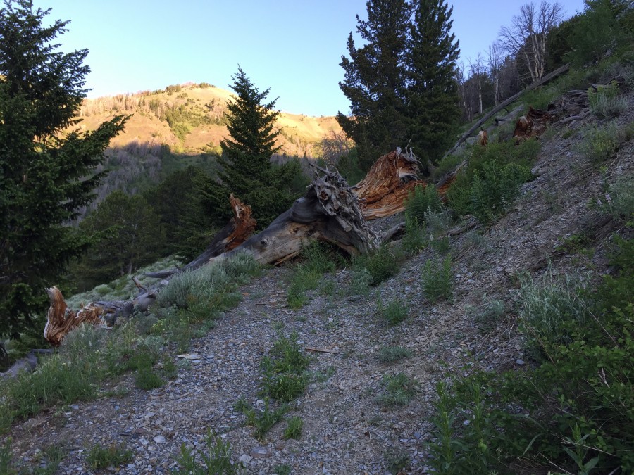
The blockage above the Falcons Creek crossing on the Little Fall Creek approach. These huge trees will not be easy to move.
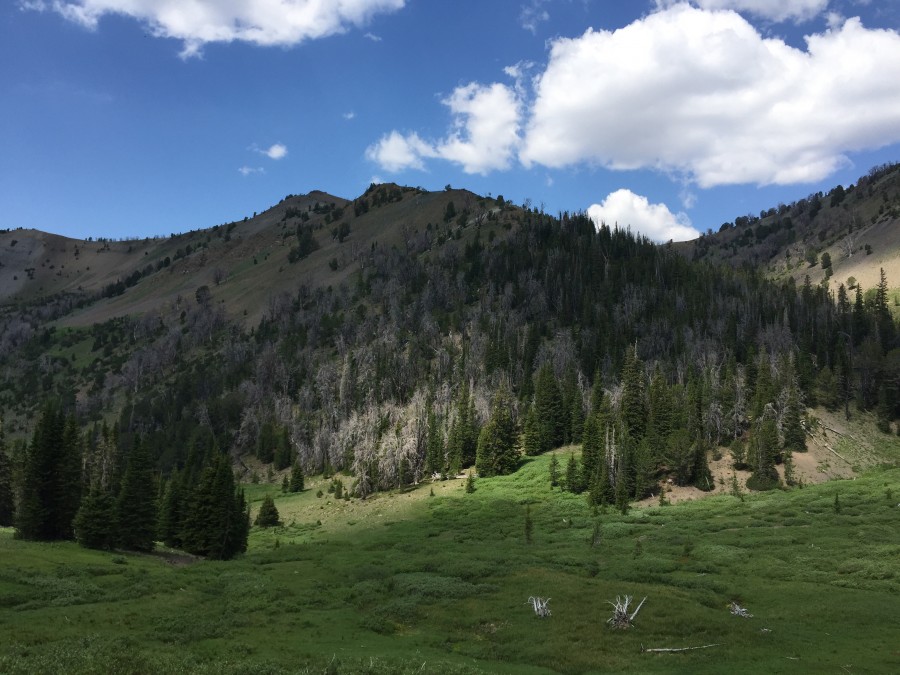
The lower section of the northeast ridge is forested. Once you break out of the trees, you will have clear going.
Almost to the summit
East Face/Northeast Ridge and North Ridge by Livingston Douglas
Peak 10340 as viewed from the east. The summit hump is left of center. Livingston Douglas Photo
This peak is the first leg of a 4-peak adventure that includes Peak 10340, Peak 10356, Peak 10350, and Peak 10300. From my starting point, it covers 9.0 miles with 3,875 feet of elevation gain round trip.
Access
Little Fall Creek Road/FSR-502 is poorly signed at its junction with Trail Creek Road. This junction is located 1.5 miles up from the [signed] Phi Kappa Campground and 1.0 miles down from the [signed] Park Creek Campground along Trail Creek Road. Drive a mile up the rocky, narrow road to a sharp right/north bend and a parking pullout at 8,000 feet. The road fords Little Fall Creek shortly before reaching this sharp bend. The road gets considerably steeper, rockier and rougher after this point.
East Face/Northeast Ridge, Class 2
The Climb
Hike (or drive) up FSR-502 from the pullout to just below a cabin near the end of the road. There is an unsigned road junction at 8,652 feet (map) where you must go right/east. Leave the road at 9,160 feet, a short distance before it reaches the old cabin. Bushwhack northwest down through grass and scrub to cross Little Fall Creek just below a large area of creeksidewillows. Once across the creek, scramble northwest directly up the east face in a mix of scattered pines, scrub, and loose scree/gravel. This section is quite steep in areas.
Focus on climbing a gully initially then a shoulder on its right/east side higher up. Reach the crest of the northeast ridge and much easier terrain. Follow the ridge left/southwest up a moderate grade in a mix of ridge pines, minor rocky outcrops, and endless scree/gravel. There is a decent goat/elk trail on the right/northwest side of the ridge crest to help get through the loose scree. The summit of Peak 10340 is a gentle gravel/broken-rock hump with no cairn (and no rocks with which to build one).
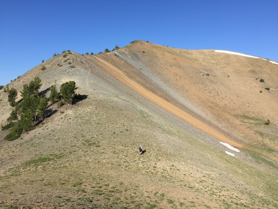
The northeast ridge of Peak 10340. My ascent line goes up the center to intercept the ridge. The summit is at far left and is not in the photo. Livingston Douglas Photo
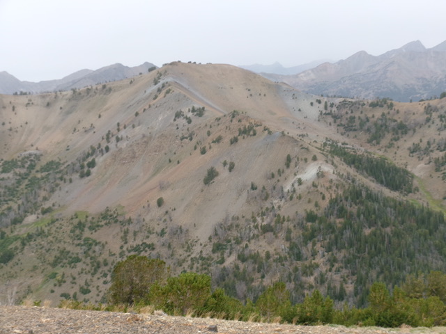
Peak 10340 (left of center) and its northeast ridge (heading diagonally left in center). This was my ascent route. Livingston Douglas Photo
North Ridge, Class 2
The Descent
From the summit, head northwest briefly on easy, broken rock then north down an easy gravel slope to the 9,980-foot connecting saddle with Peak 10356. This concludes the first leg of today’s 4-peak journey. Peak 10356 is up next.
Additional Resources
Regions: Boulder Mountains->EASTERN IDAHO
Mountain Range: Boulder Mountains
Year Climbed: 2015
Longitude: -114.28179 Latitude: 43.87089