Elevation: 5,780 ft
Prominence: 280
This peak is not in the book. Erik Pohlmann has provided five route variations for reaching this peak which are set out below. For additional access information see the following website page: Danskin Mountains OHV Trails. Published May 2018
Livingston Douglas climbed the peak via the most direct route, the peak’s south ridge. Find his route at this link: South Ridge by Livingston Douglas
Additionally, this peak can be climbed as part of a three-peak ridge traverse that includes Peak 5913 (Cayuse Peak), Peak 5780 (Mennecke Peak), and Peak 6021 (Teetors Peak) found at this link: Cayuse-Mennecke–Teetors Traverse by Livingston Douglas
Mennecke Peak is located southeast of Danskin Peak on the main Danskin Mountains Crest. Mennecke Peak is difficult to access and therefore provides fantastic and adventurous solitude. Although not very high compared to some of its neighbors, it provides exceptional views into the southern portion of the range, of the Boise River Canyon, Smith Prairie, and the mighty Trinity Mountains. One should also highly consider climbing nearby Peak 5913 (Cayuse Peak) and Peak 6021 (Teetors Peak) during this trip. USGS Long Tom Reservoir
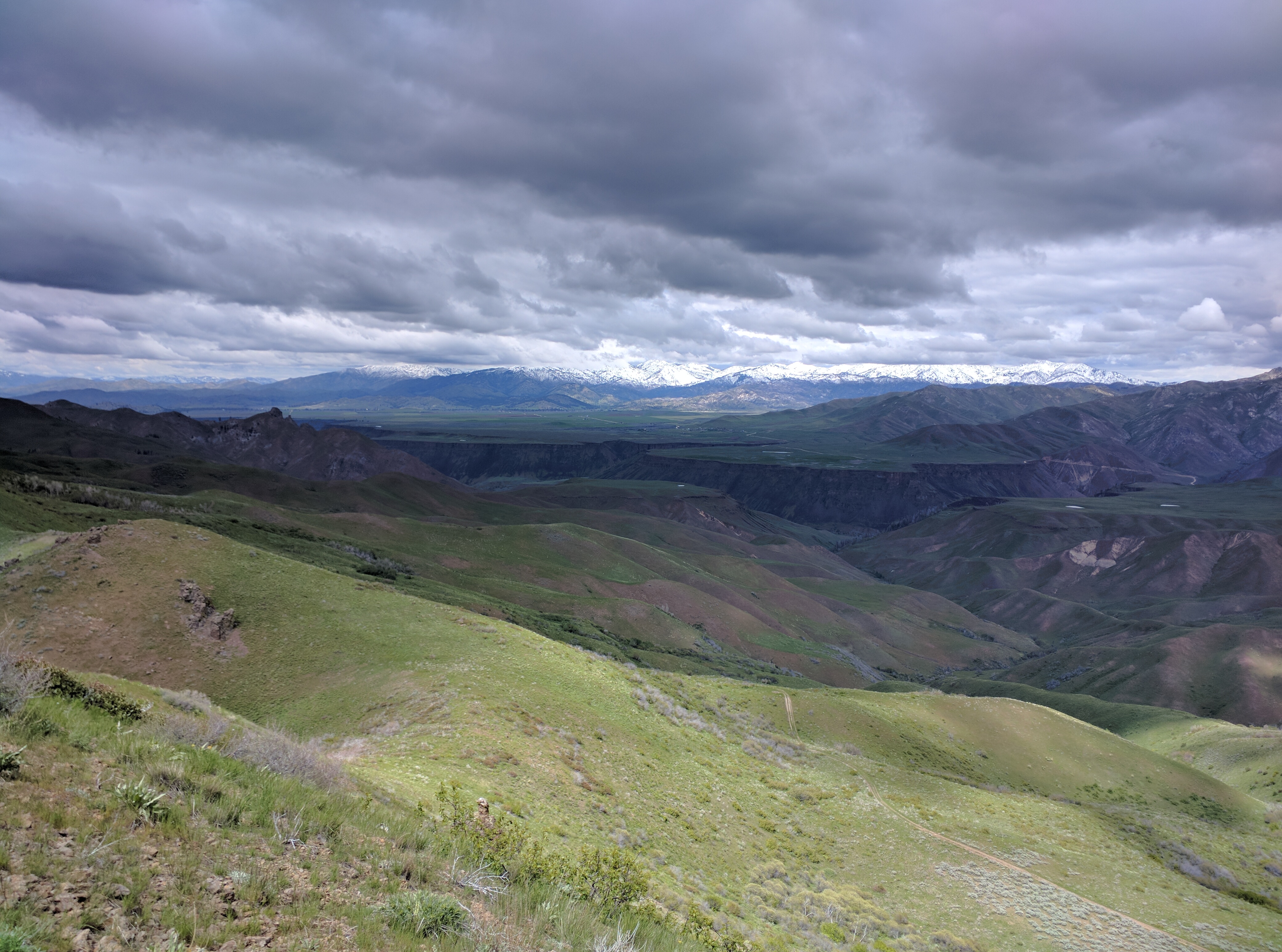
Northerly summit view towards the impressive South Fork Boise River Canyon, Smith Prairie, and the snow capped Trinity Mountains. Notice the Danskin Southeast Ridge Trail (FST-143A01) in the lower right of the photo.
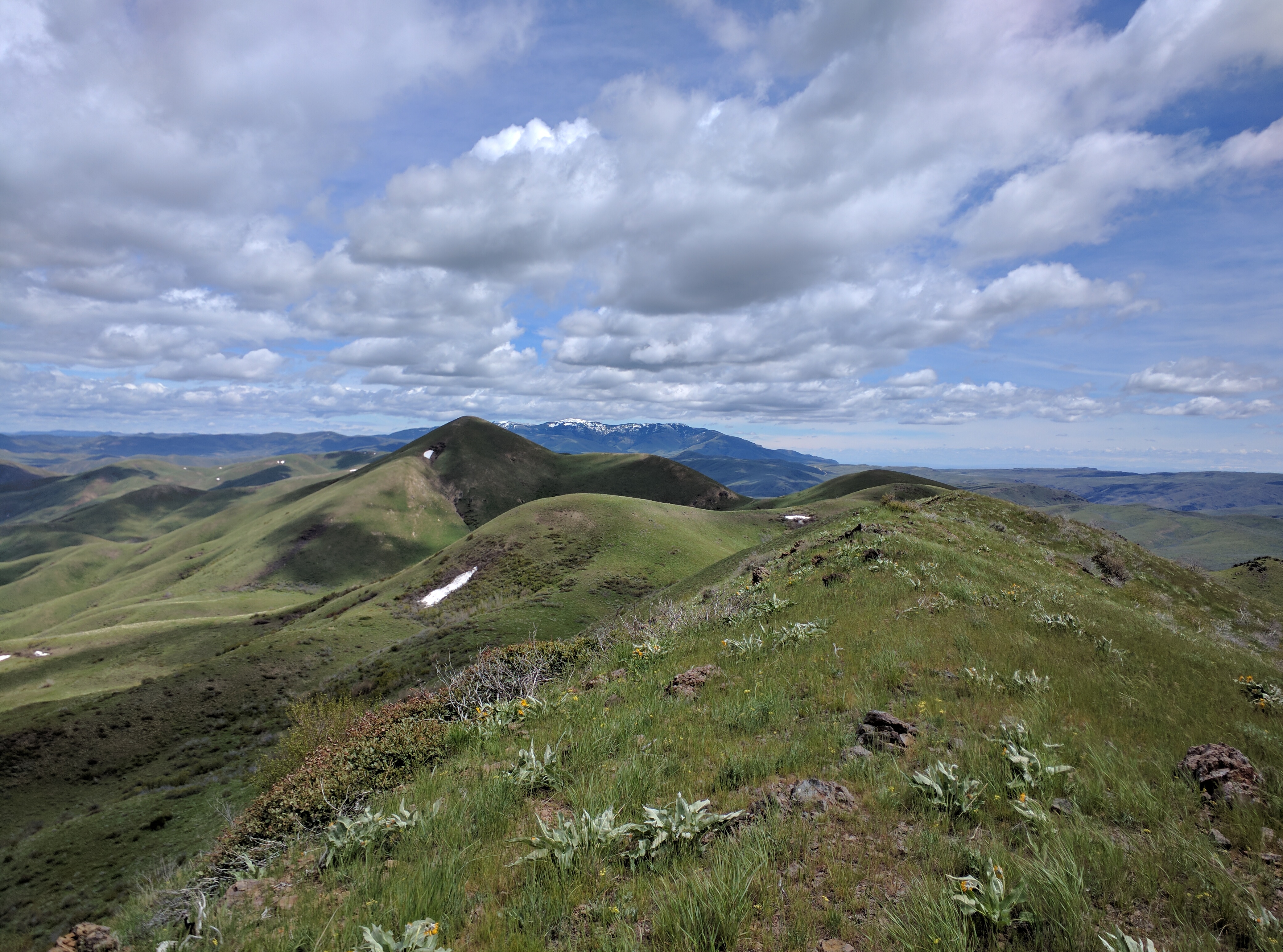
Southerly summit view towards snow-capped Bennett Mountain in the background. Notice Peak 5913 (Cayuse Peak) just left of center.
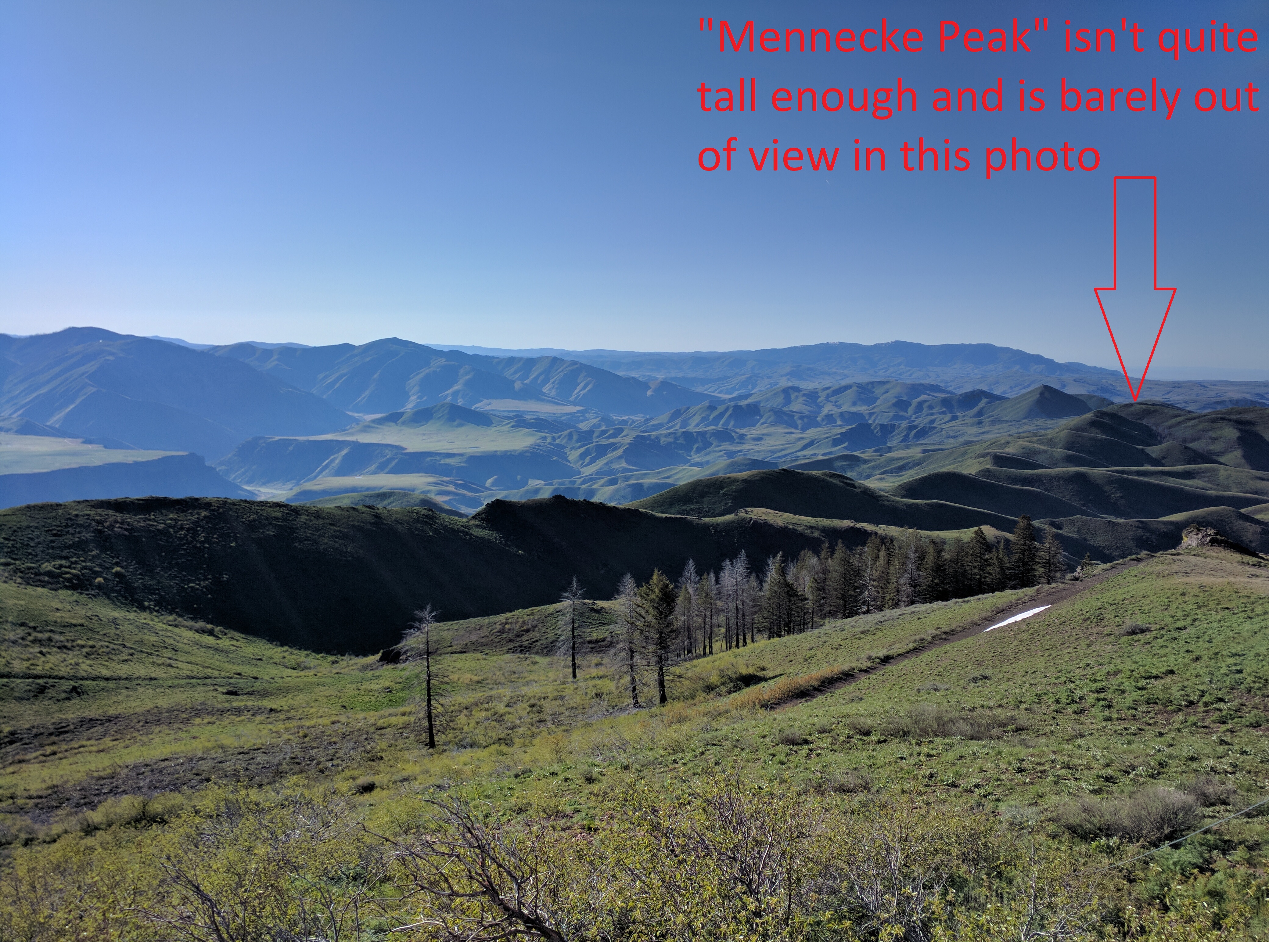
Mennecke Peak as seen from Danskin Peak to the north. The obvious ridge beginning at the left of the photo and spanning all the way to Mennecke Peak on the right is the beautiful Danskin Southeast Ridge and, in my opinion, makes for one of the best treks in the southern portion of the Danskins.
Routes
East Ridge, Class 2
Thoughts: Can bag Peak 5913 (Cayuse Peak) along the way; views are fantastic.
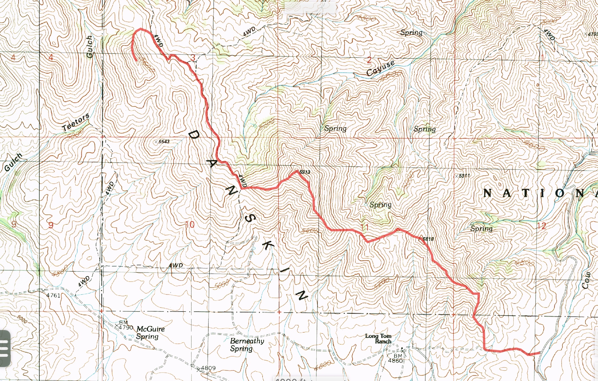
East ridge GPS track
Danskin Southeast Ridge/Trail FST-143A01, Class 2
Thoughts: my favorite backcountry route in the southern portion of the range; views are stunning; route finding is an adventurous blast; solitude is magnificent.
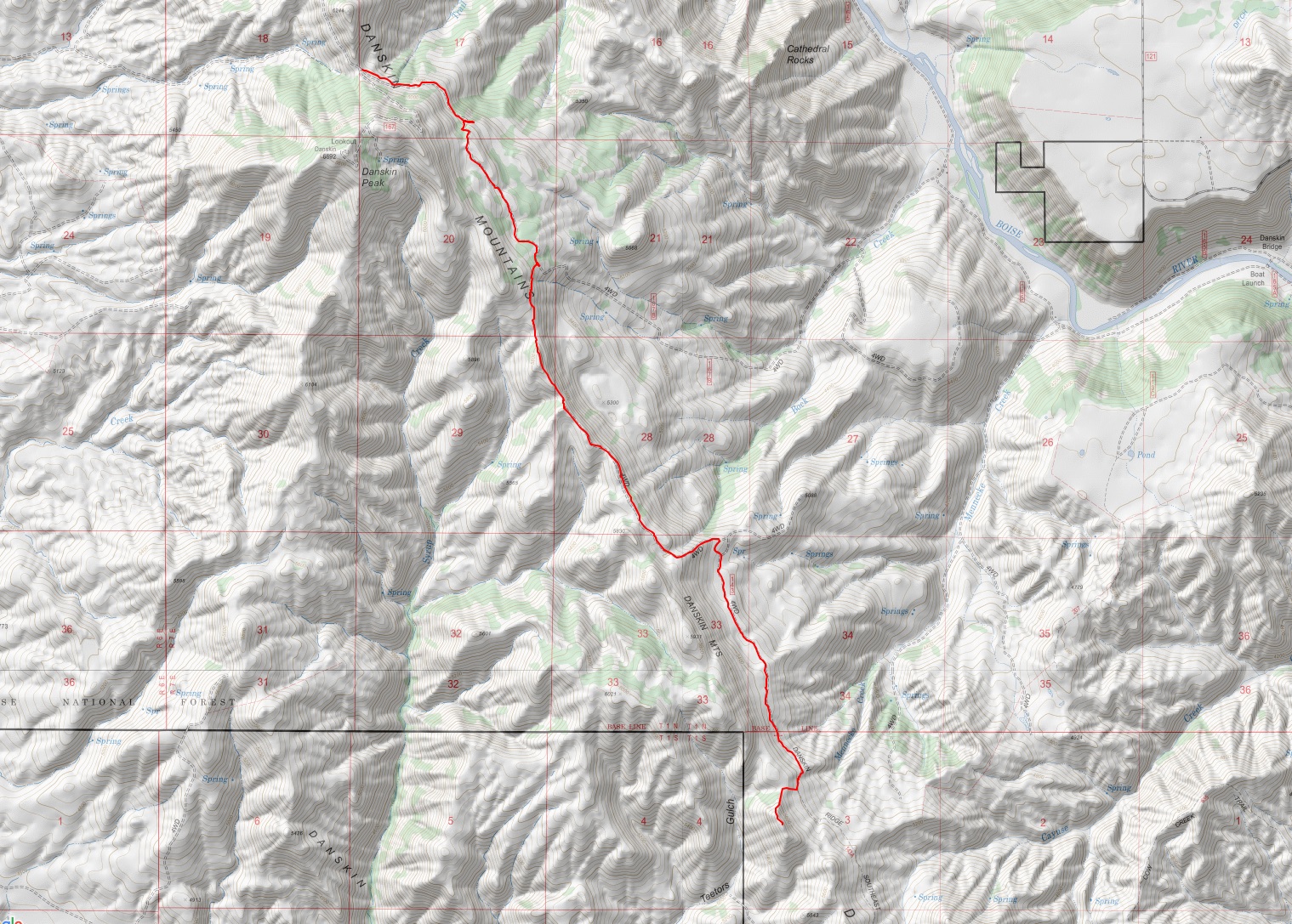
Danskin Southeast Ridge Trail#143A01 GPS track
Jeffery-Goodale Cuttoff Oregon Trail/143A, Class 1
Thoughts: following this old Indian path and wagon trail will leave a historical impression; it’s incredible what our ancestors endured; rarely visited; rugged desertscape is unique.
Jeffrey-Goodale Cutoff Oregon Trail #143A GPS track
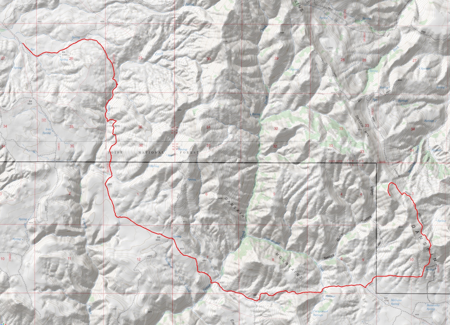
Full Monty, Class 1
Thoughts: adventure loops don’t get much better; lots of variety.
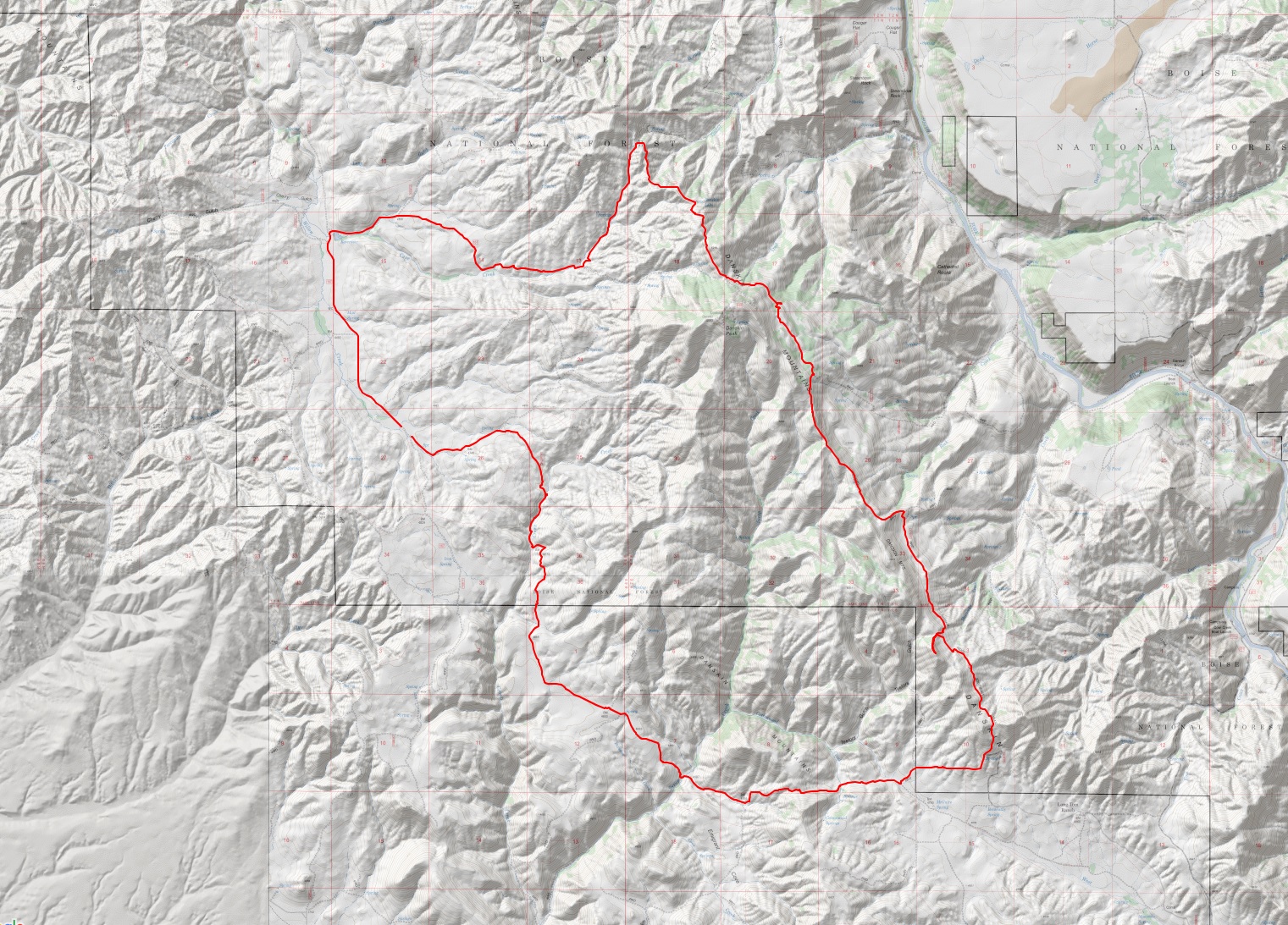
Full Monty GPS track
Teetors Gulch Loop, Class 1+
Thoughts: the drive will be more adventurous than the peak; this would by far be the easiest route if private property didn’t block the better roads.
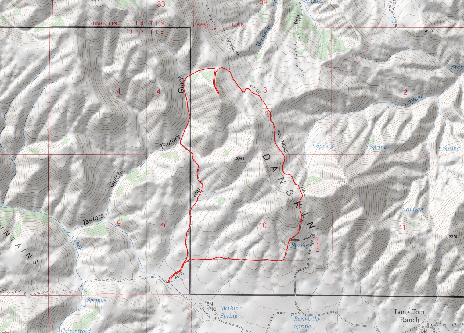
Teetors Gulch Loop GPS track
Additional Resources
Regions: Boise Mountains->Danskin Mountains->WESTERN IDAHO
Mountain Range: Boise Mountains
Longitude: -115.61509 Latitude: 43.36379