Elevation: 6,405 ft
Prominence: 305
This peak is not in the book. Published November 2024
Peak 6405 is the first of two ranked summits along Swenson Valley Road in the Soda Springs Hills. It is a scrub hill that is most easily climbed from Swenson Valley Road to its south. This area is a mix of private and public land, so be careful. This climb is entirely on BLM land. USGS Alexander
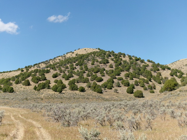
Peak 6405 as viewed from the south (start of climb). Livingston Douglas Photo
Access
From US-30 about two miles west of the US-30/ID-34 junction, turn north onto [signed] Ivins Road. Drive north on Ivins Road for about 3.5 miles to a signed junction with Cornelison Road. Cornelison Road is a maintained county road that heads east to the mouth of Swenson Valley/Canyon. Turn right/east onto Cornelison Road and drive 0.4 miles to a signed “T” junction with Swenson Valley Road. Reset your odometer here. At 0.9 miles, reach the BLM boundary. The county road now becomes BLM-12 and is not as well maintained. At 1.4 miles, reach an unsigned junction with a 2-track road heading left/north up a drainage. Park in a large, grassy area at this junction (5,730 feet and 42⁰42’26”N, 111⁰43’33”W).
Map Errors
The USGS topo map shows a 4WD road heading north then northeast to skirt the right/east side of Peak 6405. This 2-track actually heads briefly north then bends northwest to climb up to a saddle southwest of Peak 6405. I saw no evidence of a 2-track on the east side of Peak 6405.
South Ridge, Class 2
The Climb
From the grassy parking area, hike briefly north up the grassy 2-track road. It soon bends left/northwest. Leave the road here and bushwhack through thick scrub to cross a dry, wide drainage to reach the base of the south ridge/face of Peak 6405. Cross a cattle fence and scramble north up through grass/scrub, ground rock, and scattered junipers (not difficult) to reach a false summit hump. Continue north to the open high point of Peak 6405. There was no summit cairn so I built one.
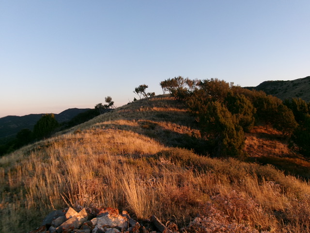
The elusive summit hump of Peak 6405. Livingston Douglas Photo
Additional Resources
Regions: Blackfoot Mountains->Soda Springs Hills->SOUTHERN IDAHO
Mountain Range: Blackfoot Mountains
Longitude: -111.7287 Latitude: 42.7164